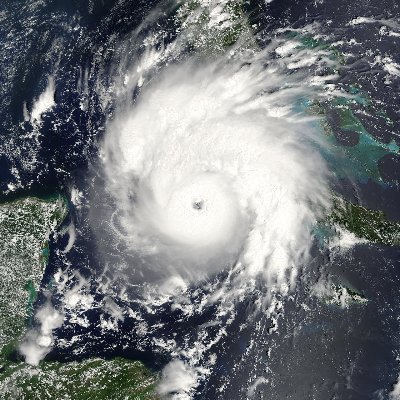
Danny Morris Profile
Danny Morris

@dmorris9661

Followers
1,999
Following
89
Media
1,853
Statuses
6,904

CPA with interest in tropical meteorology.

North Miami Florida
Joined October 2020
Don't wanna be here? Send us removal request.
Explore trending content on Musk Viewer
@dmorris9661
Danny Morris
3 years
@SteveKornacki Shit like this is why fraud arguments will continue. Every county should report mail ins/EV first, then election day vote. It's one thing to double count but how was this not verified/corrected prior to posting results?
27
39
499
@dmorris9661
Danny Morris
4 years
@JoshShapiroPA Get ready for an avalanche of lawsuits. Voter fraud will not be tolerated.
1
9
129
@dmorris9661
Danny Morris
2 years
Hyperactive hurricane season confirmed. Classic +AMO look is clearly depicted. Buckle up folks. Pay no attention to the date...
Tweet media one
13
21
147
@dmorris9661
Danny Morris
2 years
Besides the monster Caribbean hurricane in the Gulf on the ECMWF, what I found interesting is another 3 MDR disturbances on Sep 29th. Would be a record turnaround were we to get this amount of late season activity. We'll see whether the ECMWF is crying wolf or is onto something.
Tweet media one
11
12
142
@dmorris9661
Danny Morris
2 years
This is not normal. Even for a strong El Nino, you would likely not see this. This is Sep 12th. Not Dec 12th. Plenty of work will be done in the offseason trying to investigate the causes for the AWB. Sorta reminds me of 2004 only in the complete opposite direction.
Tweet media one
16
23
142
@dmorris9661
Danny Morris
2 years
A WNW track beginning in the SE Caribbean, followed by a bend back due west before curving NW and N does have precedent.... #Charley 2004.
Tweet media one
Tweet media two
12
24
133
@dmorris9661
Danny Morris
28 days
Despite getting hammered with westerly shear up to 30 knots, Beryl has refused to weaken considerably and appears to have completed an EWRC in a hostile environment. Jamaica, please take this storm seriously. There is no indication of rapid weakening yet despite what models show.
@WxTca
Deelan Jariwala
28 days
This is the most confused I've been by a recon pass in a long time? Taken at face value, this would suggest that #Beryl is still 140-145kt despite the obvious degradation on satellite. Not really sure what's going on here...
Tweet media one
Tweet media two
11
31
291
6
27
132
@dmorris9661
Danny Morris
1 month
🧵This persistent pattern that help spawn our gyre could in fact lead to another one! Models seem to be hinting at a 2nd gyre also moving NW into the SW Gulf and trying to spin up. Westerlies near Central America and easterlies to the north favor convergence (i.e another gyre).
Tweet media one
3
18
123
@dmorris9661
Danny Morris
2 years
1/ New May CanSIPS forecast (issues fixed!). Not sure how accurate this forecast is but looks like the Atlantic could be favored for much of hurricane season with the sinking cell squarely over the Pacific Ocean.
9
26
122
@dmorris9661
Danny Morris
2 years
Something I find interesting for the medium range track of 98L is the WNW/W bend shown on the GEFS/GEPS. On the EPS, we see more of a continued W/WNW motion, resulting in the EPS being on the SW side of the model envelope. GEFS is furthest NE and GEPS is right down the middle.
Tweet media one
Tweet media two
Tweet media three
12
19
122
@dmorris9661
Danny Morris
2 years
1/The Atlantic basin looks unusually dry, especially in the mid levels, as we head into the 1st week of Aug. While SAL has been going strong, the issues that are plaguing the basin run much deeper than SAL. Despite a warming MDR, why has the basin looked so hostile?
Tweet media one
12
21
121
@dmorris9661
Danny Morris
11 months
I guess in 10+ days, we could be doing this all over again.....
Tweet media one
Tweet media two
10
11
114
@dmorris9661
Danny Morris
1 year
Quite an active looking Eastern Tropical Atlantic for the 3rd week of June. 92L looks to be on the cusp of TCG and should trends continue, will be classified as a TD/TS later today. The wave behind it also appears to be gradually organizing. And a 3rd wave behind it over Africa.
1
23
109
@dmorris9661
Danny Morris
1 year
17/18 runs the GFS has a tropical cyclone forming in the Western Caribbean. The GFS has been consistent. Probably will be consistently wrong but I appreciate the consistency. I'm more curious on the strong AEWs it shows in the day 8-12 range as other models show an active ITCZ.
8
10
106
@dmorris9661
Danny Morris
5 months
1/ The latest CanSIPS is quite revealing, now trending even more pronounced with the +AMM horseshoe. Note warmer anomalies in the deep tropics and Canary Current regions and cooler anomalies off the East Coast. As classic of a setup you can ask for regarding the ATL SST pattern.
4
25
105
@dmorris9661
Danny Morris
2 years
We'll see whether this type of warming can be maintained going into May but the MDR is slowly warming up. 14 day change regarding SSTs.
Tweet media one
7
13
104
@dmorris9661
Danny Morris
1 year
1/ While our eyes are on Bret and 93L (both organizing throughout the day), I'm still in awe of the wave train over Africa beyond our 2 systems. CCKW is certainly helping but the +AMO and startup of the WAM will leave us with plenty of contenders and we are 6 weeks until August!
2
9
105
@dmorris9661
Danny Morris
22 days
🧵What's next after Beryl? Well, the ATL most likely will go quiet for at least 10 days as tropical forcing moves east and favors the WPAC/EPAC. However, there is a small hint at another low latitude AEW moving off Africa in the medium to long range (8-10 days).
2
7
102
@dmorris9661
Danny Morris
3 months
The long range GEFS and EPS show a favorable window for the ATL basin around the 2nd week of June. The favorable window looks to have gotten pushed back ~1 week due to timing of the MJO/CCKW. The W Caribbean starts perking up around the 2nd week of June, with a weak EPAC signal.
6
22
100
@dmorris9661
Danny Morris
26 days
With VHTs rotating around the eye of Hurricane Beryl, the storm is likely in the stages of reintensifying or at the very least plateauing in its weakening phase, as its central pressure has risen to the 970s. The Yucatan should prepare for at least a category 2 hurricane.
3
11
102
@dmorris9661
Danny Morris
4 months
OTS tracks are the most common for Cabo Verde storms and we will see several in 2024. Should we see a stronger Azores High and less East Coast troughing, which one of the 4 tracks do you think is most likely during the 2024 hurricane season? Explain your reasoning if possible.
Tweet media one
25
13
100
@dmorris9661
Danny Morris
1 month
A recent trend on the GFS has been for a weaker PVS in the SW ATL. The PVS will impart westerly shear and in conjunction with the fast trade winds, could really disrupt Beryl. Assuming Beryl is a hurricane at this point and avoids Hispanola, the chance it survives could increase.
2
9
100
@dmorris9661
Danny Morris
2 years
As we get closer to June, the Atlantic SST pattern looks a bit different than prior years with a less pronounced Subtropical warm pool. In fact, it looks like a blend of 2008 and 2017, with the East Atlantic not as warm.
Tweet media one
Tweet media two
Tweet media three
Tweet media four
4
13
95
@dmorris9661
Danny Morris
1 year
The 2023 Atlantic Hurricane Season begins tomorrow June 1st and while there is strong consensus one a moderate to strong El Nino event suppressing activity, seasonal models such as the ECMWF/UKMET, despite depicting the strong +ENSO, have overly bullish numbers in the ATL basin.
Tweet media one
9
21
93
@dmorris9661
Danny Morris
2 years
1/ July NMME forecast is out and it shows a hyperactive ATL hurricane season, with a classic +AMO setup (horseshoe). Although the strength of +MDR SST anomalies is weak, the overall configuration of a warm North Atl, cold Subtropics, and warm MDR is conducive for hyperactivity.
Tweet media one
Tweet media two
6
13
91
@dmorris9661
Danny Morris
6 months
The February 2024 UKMET seasonal forecast continues to trend with a warmer Tropical ATL/Canary Current region and a cooler ENSO as we approach Summer 2024. The forecasted look for the ATL is the warmest I have ever seen the UKMET show, with the closest comparable being 2010.
Tweet media one
4
16
94
@dmorris9661
Danny Morris
19 days
A trend I've noticed in recent days is for less favorable tropical forcing over the EPAC, which has resulted in models becoming more bearish on strong TC development in that basin. The trend is for a more favorable ATL basin around the last 10 days of July.
Tweet media one
5
14
93
@dmorris9661
Danny Morris
20 days
The ATL basin should remain quiet over the next 2 weeks as the current/future pattern favors a significant amount of dry air intrusion into the deep tropics, with cutoff low activity in the NE ATL. However, this pattern is favorable for warming of the MDR and the Canary Current.
Tweet media one
Tweet media two
3
16
94
@dmorris9661
Danny Morris
4 months
All signs point to an active hurricane season per the NMME. Looking at the trend analysis, a few things stand out: 1) +IOD (note cool water off Indonesia) 2) More -PDO (note cool water off Baja CA) 3) ATL Nino holding on (warmer water in the equatorial ATL/south of the equator).
7
26
91
@dmorris9661
Danny Morris
1 month
A tropical wave currently embedded in the ITCZ near 30W is producing some thunderstorm activity as it tracks westward. This wave will bring rainfall to the Windward Islands/Northern South America and may need to be watched for possible TCG in the Western Caribbean.
5
14
91
@dmorris9661
Danny Morris
1 year
Closer to Africa, another large TW is about to come off and has support from the CMC/GEPS and the ICON on developing as it comes further west. It'll deal with a dry air to its north but I'd still watch it as it nears the Antilles given the uncertainty of conditions 7+days out.
2
9
90
@dmorris9661
Danny Morris
5 months
1/ March 2024 ECMWF seasonal forecast has trended cooler with the -ENSO and less warmth in the EPAC MDR. ATL MDR looks about the same (classic +AMM), with less warmth off the East Coast and no Newfoundland warm blob. A perfect SST setup for a hyperactive year essentially.
Tweet media one
Tweet media two
2
11
90
@dmorris9661
Danny Morris
15 days
Updated EPS weeklies suggest an African Standing Wave setting up over Africa/IO by end of July. This should help spawn amplified TWs. Also, with sinking expanding over the Pacific, the ATL will be primed for activity. My best guess (EPS weeklies concur) is the 2nd week of August.
Tweet media one
Tweet media two
4
24
90
@dmorris9661
Danny Morris
1 month
The most impressive wave of the 2024 hurricane season as the sun rises is getting enhanced by favorable tropical forcing (CCKW) as it tracks westward. Development is possible as the wave passes north of South America and south of Jamaica when it reaches the Western Caribbean.
@MichaelIgbino10
Michael Igbinoba
1 month
In the North Atlantic, a pretty high-amplitude African Easterly Wave ~50W is moving in-phase with an upper-level anticyclone, providing upper-level divergence. It’s also in front of a Convectively-Coupled Kelvin Wave, which forces anomalous low-level convergence ahead of itself.
2
6
44
2
11
89
@dmorris9661
Danny Morris
2 months
In terms of actual TC output, the EPS has now locked in (GEFS as well) on the 2nd half of June for a favorable window to appear. The 3rd week of June could favor the W Caribbean/Gulf as a CCKW/MJO traverse eastward. As the forcing moves over Africa, the MDR may become favorable.
Tweet media one
@dmorris9661
Danny Morris
2 months
By the 2nd week of June, I'd watch the ITCZ to see whether we get an amplified TW. There are hints we may see a wave try to amplify near the Caribbean in the medium to long range. These type of waves can be seedlings for Western Caribbean/Gulf development should they survive.
2
9
69
4
17
87
@dmorris9661
Danny Morris
1 year
To put into context just how positive the AMO has been since the early spring, compare to previous years with a +AMO since 1995. 2023, 2022, 2020, and 2017 for context.
Tweet media one
Tweet media two
Tweet media three
Tweet media four
4
17
86
@dmorris9661
Danny Morris
2 years
1/ New EPS weeklies suggest the ATL *should be* primed to take off around Aug 20th and last at least into mid Sep before favorable forcing tries to push eastward toward the MC and WPAC. I would think this tropical forcing would be enough to reverse the persistent WB pattern.
Tweet media one
3
9
84
@dmorris9661
Danny Morris
4 months
1/ The 2023-2024 El Nino event is holding onto dear life as upwelling near SA/EPAC erodes the +anomalies centered on/near the equator. The El Nino is likely a weak event and will likely fully decay by April.
2
14
86
@dmorris9661
Danny Morris
5 months
The ECMWF will be part of tomorrow's C3S seasonal forecast. Note how the ECMWF is gradual with the La Nina development (weak Nina by ASO) and has a neutral PMM. Also, +anomalies in the MDR weaken (still +AMM look) by Summer. Perhaps alluding to a stronger Azores Bermuda High?
Tweet media one
Tweet media two
Tweet media three
Tweet media four
2
15
82
@dmorris9661
Danny Morris
2 years
1/ May UKMET forecast is out and there are some noticeable changes. Stronger La Nina signal in the pacific. A bit more warmth in the Eastern MDR. Two warm pools, one in the Western Subtropical Atlantic and one in the North Atlantic. Pretty unique look.
Tweet media one
Tweet media two
Tweet media three
8
9
79
@dmorris9661
Danny Morris
2 years
Looking toward the future beyond Ian, pretty unusual to see TC activity occur in the MDR in Oct but there is decent support for some strong TWs in the next 10 days, with some ensemble support for development beyond day 10. Very weird season.
Tweet media one
Tweet media two
Tweet media three
12
8
81
@dmorris9661
Danny Morris
11 months
After looking awfully dim the last few days, Africa has lightened up. Per models, wave 6 has strong support and will move off in ~6 days. Wave 4/5 do not have much model support though some (GFS/ECMWF) favor the southern half of wave 4 while others (ICON/CMC) favor wave 5.
Tweet media one
10
9
81
@dmorris9661
Danny Morris
3 years
6/ Just because you see a graphic such as this one posted, do not presume the system is guaranteed to go OTS. I've learned my lesson years ago, especially when dealing with so many moving parts. The wave has yet to move off Africa and there are still many unknowns at this time.
Tweet media one
5
5
79
@dmorris9661
Danny Morris
2 years
1/ July 2022 C3S forecast is out and continues to show an above normal hurricane season. It's trended toward a slightly more dry MDR, with a wetter Gulf. Subtropics look a lot drier, a combination of the cooler Subtropics and steering pattern. Overall, quite similar to 2020.
Tweet media one
Tweet media two
5
6
78
@dmorris9661
Danny Morris
1 year
1/ Impressive +anomalies in the Canary Current region and the far North Atlantic in 2023. How much of this warmth, especially in the MDR, holds in July will be key once we get into Aug. SAL normally peaks in July so you'd think this would dampen those warm anomalies.
Tweet media one
1
12
80
@dmorris9661
Danny Morris
2 years
The Eastern half of the MDR has warmed appreciably over the past week and should continue as westerlies prevail over this region in the next 10 days or so. Noticeable cooler Subtropics than recent years. Hard to get a more favorable SST configuration for the Atlantic.
Tweet media one
Tweet media two
6
11
78
@dmorris9661
Danny Morris
17 days
🧵Over the African continent are two impressive AEWs that will traverse the continent westward over the next 4-7 days. Although the Tropical ATL will likely be dust-ridden over these next 2 weeks, one or both of these waves bare watching for possible development down the road.
Tweet media one
2
12
80
@dmorris9661
Danny Morris
25 days
Microwave imagery and visible satellite depicts Beryl's inner core has remained largely intact after making landfall in the Yucatan as a cat 2 hurricane. Although down to a TS, the mid level vortex appears robust and the center will be emerging over water sooner than expected.
2
12
78
@dmorris9661
Danny Morris
5 months
This looks familiar with the MJO propagating eastward and than slowing over Africa and the Indian Ocean. Pretty sure I saw this pattern from 2020-2022... I wonder what those years had in common?🥶
Tweet media one
5
8
77
@dmorris9661
Danny Morris
2 years
The normally bearish CMC model is trying to bring some excitement back into the season with a pretty interesting setup during the 2nd week of Sep.
Tweet media one
9
5
77
@dmorris9661
Danny Morris
1 year
Regardless of what happens to the current wave off Africa, there are signs that near the start of Aug, environmental conditions in the ATL basin (both wind shear and improved thermodynamics via less stability and more available moisture) will become more conducive for TC genesis.
Tweet media one
Tweet media two
Tweet media three
Tweet media four
8
17
77
@dmorris9661
Danny Morris
1 month
After shedding nearly all of its convection yesterday afternoon/evening, our vigorous TW has refired new convection as it moves into the SE Caribbean. Strong trade winds will prevent development but as the wave passes Jamaica's longitude and slows, some development is possible.
2
10
74
@dmorris9661
Danny Morris
5 months
Despite producing an impressive 30/14/7 stat line, the 2020 hurricane season had stability issues associated with Hadley Cell stretching. Note while the ATL was warmth, the +anomalies are more widespread, with no concentrated tropical warmth. Hence, the lack of quality CV storms.
Tweet media one
4
7
77
@dmorris9661
Danny Morris
6 months
1/ The February 2024 seasonal ECMWF run shows a cool neutral look in the early Summer, with a robust +AMM look, the strongest +anomalies focused in the deep tropics. Note the precip plume extending from the MDR into the Caribbean.
Tweet media one
Tweet media two
4
12
73
@dmorris9661
Danny Morris
1 year
What month is this? Despite the tropical storm nonchalantly moving through the Central Antilles, a few more interesting waves right behind the lead one.
2
6
73
@dmorris9661
Danny Morris
5 months
Given the amount of TC activity expected, I looked at all Cat 2+ hurricanes that passed within 200 NM of Barbados. Interestingly, only 3 such storms during an El Nino, with 2 of them in 1963. La Nina had more storms, with a W Gulf cluster. Neutral was by far the busiest.
Tweet media one
Tweet media two
Tweet media three
7
14
76
@dmorris9661
Danny Morris
2 years
1/ I'm amazed at the persistence of the extratropical pattern. On Sep 1, the GFS predicts continuing high lat ridge with troughing cutting off underneath in the NE ATL. This is wavebreaking essentially. Notice the tongue of mid lat dry air extending as far south as the ITCZ!
Tweet media one
Tweet media two
11
5
75
@dmorris9661
Danny Morris
2 years
1/ Our tropical wave of interest has fared well since moving off the coast of Africa, with persistent convection. Soon, it will be interacting with a MCS to its NE. This interaction will in all likelihood enhance the vorticity of our wave and promote further organization.
3
7
73
@dmorris9661
Danny Morris
3 years
Keep an eye on this tropical wave near 50W. There's growing model support that this wave will interact with some monsoonal entity in the W.Caribbean and will try to develop and move into the GOMEX in about 6-7 days, as a CCKW will be passing by next week. Next name is #Ida .
6
10
72
@dmorris9661
Danny Morris
4 years
@Nate_Cohn Will be a Midwestern sweep this time once he wins MN as well. At least 2, if not all of PA,MI,WI, and MN are going Trump.
5
1
56
@dmorris9661
Danny Morris
1 month
96L continues to organize and may become a TD/TS within the next 2 days or so. It will follow a track similar to that of Beryl, bringing rain/wind to the Lesser Antilles. Antilles should prep for a strong TS though the environment won't be as conducive as it was for Beryl.
4
3
73
@dmorris9661
Danny Morris
2 years
1/ The Atlantic continues to remain quiet as July comes to an end. While there are certain rumblings that the season will underachieve significantly, I remain cautiously optimistic that we'll see an uptick in activity beginning the 3rd week of August (Aug 15th).
Tweet media one
7
10
72
@dmorris9661
Danny Morris
11 months
What's quite remarkable is that despite a strong El Nino, Sep 2023 will likely be one of the more active Septembers in recent history. Despite the abundance of activity, the Antilles and CONUS most likely caught a big break with the weak Azores/Bermuda High and # of cut off lows.
Tweet media one
Tweet media two
6
5
71
@dmorris9661
Danny Morris
2 years
Not sure what to make of the 12z EPS. Such favorable tropical forcing in the 3rd and 4th week of Aug, with peak climatology near, in a supposedly "favorable" year should produce more than this. Either a model bust or a seasonal bust. No cutting corners.
Tweet media one
Tweet media two
12
4
71
@dmorris9661
Danny Morris
7 months
🧵🤯
Tweet media one
12
6
69
@dmorris9661
Danny Morris
1 month
Some rotation to the Central America gyre, which is bringing heavy rain to Central America and the Yucatan Peninsula. It'll have 2 or so days over water to tighten up. Perhaps the curvature of the BOC coastline can help a vortex deepen to acquire a name prior to a MX landfall.
1
11
68
@dmorris9661
Danny Morris
8 months
🧵The December 2023 CanSIPs forecast for July 2024 shows a classic +AMM coupled with a developing La Nina. +AMM is common after a strong +ENSO given the expected -NAO event in the Winter/Spring 2024. Hard to get a better look for a busy ATL hurricane season.
Tweet media one
4
12
70
@dmorris9661
Danny Morris
2 months
🧵A Central America gyre will likely get drawn to the north as southerly flow pushes moisture into the GOM. Depending on where the gyre exits, it could have some time over the Western Gulf to organize and become a TD or TS. Primary concern will be heavy rain.
Tweet media one
1
15
69
@dmorris9661
Danny Morris
1 year
🌭alert run per the 12z ECMWF. 90L avoids a quick exit and looks to get closer to the East Coast, an EPAC crossover develops in the NW Caribbean, and the ATL ridge returns with vengeance to send wave 4 further west and avoid immediate recurvature. Notice the bowling ball cutoff.
5
9
66
@dmorris9661
Danny Morris
4 months
The ECMWF Standardized Tropical Density forecast is not the most accurate but this is the first one I've seen that has the entire U.S Coastline in enhanced values. Besides the one aggressive June 2022 run, these forecasts have been pretty bearish. Curious if this holds next run.
Tweet media one
Tweet media two
Tweet media three
7
12
69
@dmorris9661
Danny Morris
4 months
We are likely seeing El Nino's last stand as the equatorial Pacific warms, as well as waters to the north (-PDO weakening). As the MJO finishes propagating the Pacific, we will likely see a La Nina base state setup, with rising over Africa/IO. ENSO neutral is likely by May.
Tweet media one
Tweet media two
Tweet media three
4
15
68
@dmorris9661
Danny Morris
2 months
By the 2nd week of June, I'd watch the ITCZ to see whether we get an amplified TW. There are hints we may see a wave try to amplify near the Caribbean in the medium to long range. These type of waves can be seedlings for Western Caribbean/Gulf development should they survive.
2
9
69
@dmorris9661
Danny Morris
2 years
1/ UKMET June 2022 seasonal forecast is out and it shows something similar to its May 2022 forecast for a very active season. The ensemble mean is trying to depict a positive AMO, which looks similar to the active ECMWF forecast but not as robust as say 2017.
Tweet media one
Tweet media two
Tweet media three
2
10
67
@dmorris9661
Danny Morris
3 months
Pretty interesting look on the EPS looking at the Zonal Wind Anomalies. Large batch of easterlies in the equatorial Pacific (small WWB in the EPAC) and enhanced westerlies in the equatorial ATL and West Indian Ocean. ATL Nino looks to persist and a +IOD appears to be developing.
Tweet media one
4
17
69
@dmorris9661
Danny Morris
5 months
1/ Our El Nino is beginning to thin as a period of strong easterlies cools the equatorial Pacific. The El Nino is now a borderline weak/moderate event and will continue to decay in the coming weeks. How fast La Nina develops remains to be seen.
Tweet media one
Tweet media two
Tweet media three
Tweet media four
3
15
66
@dmorris9661
Danny Morris
10 months
🧵A busy 2023 Atlantic hurricane season will try to push for hyperactive over the next 2 months. Not surprisingly, tracks have been mostly quick recurves with some storms just NE of the Antilles. Quite a void in the Caribbean and Southern Gulf, minus Idalia, common for El Ninos.
Tweet media one
5
10
66
@dmorris9661
Danny Morris
11 months
Interesting trends on the GEFS. Good news for the Northern Islands, where there's a good chance 95L misses them. However, note the lower heights in the SE US (cutoff trough) and higher heights over SE Canada (more ridging). Could be a close call for the NE US as 95L turns north.
0
8
68
@dmorris9661
Danny Morris
2 months
Pretty decent model support for a Central America gyre to try to spin up in the Western Gulf. The system should be quite broad so anything more than a TS is unlikely. Regardless, heavy rains will be coming down over Central America, Mexico, and Texas. Possible we get Alberto.
Tweet media one
Tweet media two
Tweet media three
2
8
67
@dmorris9661
Danny Morris
1 year
June 9, 2023 and the Atlantic MDR beginning at 25W already has 26C+ SSTs needed to support tropical cyclones. Truly incredible departure from normal regarding the extremely warm Atlantic basin. Very curious whether it reduces the semi-permanent stability we've seen since 2010.
Tweet media one
3
9
67
@dmorris9661
Danny Morris
9 days
🧵Early Aug will likely be the transition period for when the ATL may start producing TCG attempts as upper level easterlies start to intrude near/west of 60W, trying to push away the TUTT near the Antilles. Most likely, the TUTT will be weakened somewhat by the 2nd week of Aug.
1
12
67
@dmorris9661
Danny Morris
10 months
After Philippe and 91L, we may see more AEW activity into October with the help of another CCKW. Given the lack of strong shear in the MDR south of 15N, will have to watch any low riding ITCZ wave should the ridging rebuild even just a little, which has not been the case in 2023.
Tweet media one
Tweet media two
Tweet media three
Tweet media four
3
8
66
@dmorris9661
Danny Morris
1 year
Decent model signal for an AEW to try to spin up in the ITCZ. The wave is forecast to come off Africa ~96 hours from now. There will be dry air to its north (not surprisingly) but it should be tucked away in the more moist ITCZ and may try to develop as it nears the Antilles.
Tweet media one
Tweet media two
Tweet media three
6
18
65
@dmorris9661
Danny Morris
2 years
Something to monitor with 94L is its forward speed. A faster 94L, like what the operational GFS/ECMWF show, will likely take a more southern track toward Central America. A slower 94L (CMC/ICON) would be further north and likely avoid CA. This is reflected in most ensembles.
Tweet media one
Tweet media two
Tweet media three
Tweet media four
3
7
66
@dmorris9661
Danny Morris
5 months
Looking at actual SSTs and not anomalies, 2024 sticks out like sore thumb. Note the 3 years selected all finished with 200+ACE and had the classic +AMM look into peak season. 04 (Warm Neutral/Modoki El Nino), 05 (Cool Neutral), and 17 (Cool Neutral).
Tweet media one
Tweet media two
Tweet media three
Tweet media four
5
15
64
@dmorris9661
Danny Morris
2 years
1/Rising air (via tropical forcing) will return over Africa by mid Aug, allowing the formation of strong AEWs, with the MJO following by the 3rd week of Aug. IMO, the 3rd week of Aug stretch will determine whether the hurricane season has a chance of attaining above average ACE.
Tweet media one
Tweet media two
2
14
63
@dmorris9661
Danny Morris
1 year
Not something you will see in mid June but the Saharan Air Layer being abnormally shallow has allowed several impressive tropical waves to find an opening to develop. Light shear as well in the Tropical Atlantic. When will the El Nino induced shear arrive? Aug? Mid Sep? Oct?
Tweet media one
2
4
64
@dmorris9661
Danny Morris
11 months
🧵With all eyes rightfully on Idalia (and some on Franklin), our best bet at our first Cabo Verde TC of the hurricane season will come from this low riding tropical wave currently at 10E. The ECMWF and EPS have been adamant this wave develops as it moves west across the MDR.
Tweet media one
2
10
66
@dmorris9661
Danny Morris
1 year
Absolutely incredible how anomalous warm the North Atlantic Ocean is in 2023. Probably the strongest +AMO ever observed since 1950. Here's how it compares to the years 2010, 2017, and 2020 on June 29th.
Tweet media one
Tweet media two
Tweet media three
Tweet media four
3
12
64
@dmorris9661
Danny Morris
1 month
The JMA model tends to be a bit biased toward the ATL basin in most years but is rightfully bullish for the JAS period. The VP configuration is very favorable, with sinking encompassing the entire Pacific basin and rising air focused over the Indian Ocean, Africa, and the E ATL.
Tweet media one
Tweet media two
Tweet media three
Tweet media four
9
13
64
@dmorris9661
Danny Morris
2 years
Since the Caribbean has been mentioned as a potential hotspot for storms this hurricane season, I thought I would post all hurricanes that have passed within 140 nautical miles of Jamaica in Aug/Sep. Notice the cluster of Aug tracks towards Mexico, which expands NE in Sep.
Tweet media one
Tweet media two
5
16
65
@dmorris9661
Danny Morris
5 months
Looking at years that had a classic +AMM by March, some that stand out are 2004, 2005, and 2010. What's interesting is that 2004 lost the classic +AMM look in the Spring and regained it in early Summer. 05/10 had the look persist into hurricane season. 2010 is a +match for ENSO.
Tweet media one
Tweet media two
Tweet media three
Tweet media four
2
7
65
@dmorris9661
Danny Morris
1 year
The ATL basin looking a lot more convectively active this late afternoon.
Tweet media one
5
4
63
@dmorris9661
Danny Morris
6 months
I wanted to pull up the July 2017 NMME forecast for Aug 2017 as the Feb 2017 forecast had a full fledged Nino and lacked a classic +AMM signal. The ATL configuration in 2024 blows everything away and by all indication, the ATL may trend warmer based on current trends.
Tweet media one
Tweet media two
Tweet media three
3
10
64
@dmorris9661
Danny Morris
2 years
Although the west shifts have been significant (and I do favor a more western solution at the moment), hard to rule out a West FL hit when uncertainty exists with the amplitude and position of the trough. 12z vs 18z ICON runs show this.
5
12
65
@dmorris9661
Danny Morris
11 months
Feeling somewhat confident we will have both Nigel and Ophelia within the next 15 days, putting the 2023 hurricane season at 15 NS by Sep 23rd (16 if including the January unnamed storm).
Tweet media one
Tweet media two
12
6
62
@dmorris9661
Danny Morris
8 months
🧵December 2023 UKMET forecast heading into the end of Spring 2024 😬
Tweet media one
4
8
62
@dmorris9661
Danny Morris
2 months
The GEFS may be on to something as the ECMWF and EPS suggest a Central American gyre will be in the vicinity of the Yucatan. Conditions aren't great (dry air, some shear) but a low may try to consolidate as it attempts to lift north. Healthy signal on the EPS as well.
Tweet media one
Tweet media two
Tweet media three
Tweet media four
4
5
60
@dmorris9661
Danny Morris
29 days
Beryl's EWRC has been completed at a very quick pace unfortunately. As the inner eyewall has fully collapsed and a larger one has taken over, the storm is deepening on approach to the Windward Islands. Greneda appears to be in direct path of the storm. A disastrous situation.
1
19
62
@dmorris9661
Danny Morris
11 months
And we all thought the Lee wave was a low rider.... This one is south of 10N. Any decent ridging would likely imply this heads toward the Caribbean but still too early to say.
Tweet media one
7
5
62
@dmorris9661
Danny Morris
1 year
Curious if the EPS come onboard but probably the most bullish run on the GEFS in a while. The GEPS have always liked it as well. Seems as though an intact wave could take advantage of a low shear environment in the NW Caribbean/Gulf of Mexico. Key word being *intact*.
@dmorris9661
Danny Morris
1 year
I wouldn't write off the trailing AEW near 25W just yet. The one in front of it really fell apart but this one has sorta held on. We'll see whether it does anything but today's model runs suggest it may try to amplify just east of the Caribbean. Whether it develops is TBD.
3
1
31
2
5
61