

Isaiah Montgomery
@GumryWX
Followers
713
Following
1,409
Media
793
Statuses
2,178
GTA at UAH (soon) | B.S. Meteorology ULM 2024 | NWS Pathways | PERiLS & DELTA | My posts/RTs DO NOT reflect the opinions of employers or universities
Everywhere
Joined June 2017
Don't wanna be here?
Send us removal request.
Explore trending content on Musk Viewer
İran
• 491178 Tweets
Kyle
• 249452 Tweets
サッカー
• 122212 Tweets
Enrique Márquez
• 103821 Tweets
Sunderland
• 100899 Tweets
オフサイド
• 97058 Tweets
スペイン
• 92599 Tweets
Francia
• 81347 Tweets
Emily
• 65050 Tweets
Julian
• 56023 Tweets
#ErdoğanınYanındayız
• 54591 Tweets
Ekrem İmamoğlu
• 52055 Tweets
Mascherano
• 50703 Tweets
Ron Paul
• 45158 Tweets
Arabia
• 41834 Tweets
Game Informer
• 26849 Tweets
#FRAARG
• 24893 Tweets
Angola
• 24435 Tweets
#SonÇağrı
• 22027 Tweets
Hepimiz Erdoğan'ız
• 20786 Tweets
Argentins
• 18565 Tweets
Joshua Cheptegei
• 17648 Tweets
準々決勝進出
• 16778 Tweets
Equi
• 14820 Tweets
Simeone
• 14676 Tweets
Zenón
• 14197 Tweets
Almada
• 11291 Tweets
Mateta
• 10329 Tweets


We’ve reached the “everything is rotating” phase of todays severe weather outbreak

14
71
935
Wait. 6 hours ago people were yelling at them because it wasn’t a high. Now people are yelling because it didn’t get downgraded?
This whole weather prediction thing works out a lot better if we let the experts be the experts


6
16
382
INCREDIBLE radar loop from the Texas A&M S-band radar showing the RFD wrapping around the circulation, strengthening into a tornado, and then occluding. Great hi-res data on display here tonight!
#txwx
@tamuweather
3
84
240
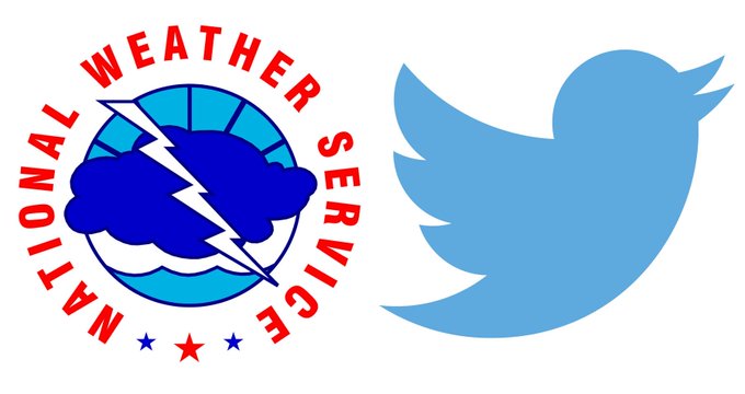
Everyone applaud Twitter for fixing a problem they literally created because the new owner doesn’t think before making decisions 👏 good job guys

NEWS: Twitter will allow the National Weather Service accounts to continue Tweeting weather alerts without limits.
Great Job
@TwitterDev
👏
350
1K
7K
4
27
185
Can you see the difference here? Between being a meteorologist and being a hack?


24
11
172
2 weeks ago: “I don’t understand the cone of uncertainty”
1 week ago: “I don’t understand the cone of uncertainty”
Today: WHAT BERYL HIT HOUSTON???

2 week ago: "oh, no worries, it's headed to the Yucatan."
1 week ago: "no worries, it'll hit South Texas."
Beryl: ***immediately makes a bee-line to Houston***

224
721
8K
2
5
163
New rule: if you hate the EF scale you have to propose a scientifically sound and equitable replacement. I’m tired of hearing “but we don’t rate hurricanes on damage!” OK FINE YOU DO IT THEN
18
7
149


This is what I mean when I say some of y’all have taken this too far

9
4
100
WFO Shreveport forecasters after 40+ straight hours of severe weather ops

2
1
95
Gov: the NWS did not predict 70 mph winds
NWS, 3 days before storm:
Why lie about something so easily fact checkable? Why shift blame to the agency who 1) already takes enough flack from idiots who don’t understand the weather, and 2) did an objectively good job?


The National Weather Service has issued a statement in response to comments made by Governor Janet Mills who has been publicly critical of their forecast leading up to the 12/18 storm that caused heavy damage and claimed four lives. Their statement is in this thread:


53
93
458
3
11
94


Me when I definitely understand how beam height impacts rainfall estimates:

4
4
79
Weather weenies have predicted 10 out of the last 4 high risk upgrades
4
2
75
“I hope we see an EF-5”
and
“I hope tornadoes stay in open fields”
ARE mutually exclusive. You cannot get both
5
2
75
Using the Iowa State Mesonet Site, I figured out a way to plot Weathergami charts for individual sites. Just like how the NFL Scorigami site!

Just renewed my AMS membership and checked BAMS... was nobody gonna tell me about Weathergami!?

7
5
63
7
8
74
PERiLS will be instrumental to understanding the evolution of the Rolling Forks tornado that occurred tonight. Through the day, showers across LA kept the air relatively cool, while MS continued to heat up. A noticeable, but subtle thermal gradient was present all day

1
12
70
Did I just get the Dodge City treatment by a Python package for trying to use the jet cmap?

5
7
68
I made it through orientation day, so as of today I’m officially a Pathways intern for NWS Topeka!
8
1
67


Finals at ULM are all wrapped up, and I wanted to share that I will be moving to Huntsville, AL in the fall to continue my education and work towards my Master's degree at UAH! I can't say thank you enough to all the faculty at ULM that helped me get here!
11
4
65
Just renewed my AMS membership and checked BAMS... was nobody gonna tell me about Weathergami!?
7
5
63


Yeah… the classic night before HRRR run becomes a supercell printer. Don’t buy it folks. Storm mode tomorrow is going to be messy —> linear but not too much in the discrete form. Tornado risk is elevated but let’s not be unrealistic

8
5
59
PSA for upcoming severe weather:
KULM slander is not allowed. Anyone who attacks our radar will be asked to come fix it

2
15
55
This is the final boss for bad and unscientific weather articles


6
4
54

And by the way, if you’re reaction to this is “people should be fired” and “the NWS in ____ is terrible”, then I do consider that to be hating. Issues like understaffing are way more serious than a lot of people realize. Just try and show grace every now and then
14
3
47
I’m a day late, but yesterday I got to work my first shift at the National Weather Service! Thanks SHV for hosting me! (Also my first NWS sounding)


1
0
47
It is sad to see that TORCON has just become some multiple of the SPC tornado outlook. At what point do you just stop using it

NEW: Tuesday’s severe weather threat has escalated with a TOR:CON up to 7 for most of Ohio, indicating the possibility of EF2 or stronger tornadoes.
We have more details on air and on our TV app:

40
549
2K
3
2
44
Central City. Mayfield. Dawson Springs. Earlington. Bremen. Bowling Green. This has to go down as one of the worst Kentucky tornado events of all time. I just can’t believe we all saw it. Incredibly lucky to have no damage here.
2
8
42
Wind is so strong on Tampa's radar that the velocity folded on itself twice and shows -18 kts. That means the actual velocity is -148 kts

2
13
42
Seeing some TV meteorologists (really just one) bash the NWS at every turn to their massive audience hurts. How does it benefit anyone at all?
3
0
42

Life update: I have (tentatively) accepted a pathways intern position at the NWS in Topeka, KS! I’m so excited to have this opportunity and can’t wait to get there!
1
1
41


AMS Baltimore 2024 is going to have 3 posters led by students from
@ULMWeather
@ULMAMS
! Come check all of the great work we’ve been doing!


1
8
38

@realDonaldTrump
Forcing low income families into segregated neighborhoods will *NOT* decrease crime overall. It may decrease crime in the more affluent suburbs, but instead of addressing the root problems of poverty and crime, the response is to move it somewhere that it won’t affect you.
3
1
36
Thank you
@NWSTopeka
for being such awesome hosts this summer! Time for me to pack up and head back home!

1
0
37

A pretty substantial (but shallow) debris signature crossing the river around Memphis. Just a "QLCS spinup" but appears to have been fairly long lived


2
7
32
First convection sampled by KULM in over a year🥳 she's still got it

2
2
32
Meteorologists who vote for Trump:


some rainy day reading: the project 2025 plan to break up NOAA, the federal government's weather & climate agency


41
362
673
0
3
32


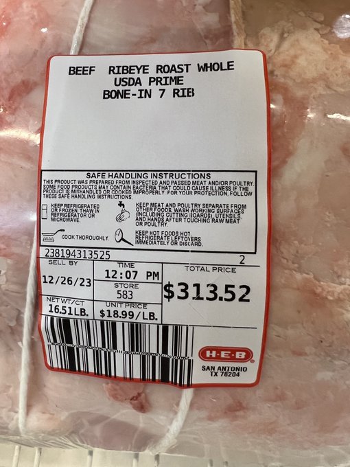
I’ve been a lifelong Democrat. But after buying a 17 pound USDA Prime Roast, I have no choice but to vote for Trump a 3rd time

5
1
31

Do people in the comments think that radars don’t cost any money to build and maintain?

Alabama– we’ve got you covered! We recently completed our 1st radar installation in the state and data will be flowing soon. For an area that experiences many dangerous storms each year, this additional coverage is key.
Read more about our Moulton radar:

9
14
46
8
1
31
It will always amaze me seeing these QLCS events go from 0 to 60 in such a short time. 4 radar confirmed tornadoes, plus damage in Norman makes 5, all in ~45 minutes
1
2
31
Very low confidence in storm coverage tomorrow. the HRRR is pretty much alone across Central OK. If this is what the models look like in the morning, that isn't going to be enough for a risk upgrade. Regardless, a few very powerful storms possible.

4
2
30
Wow, what a normal & mundane post by our local forecast office. I sure hope the comment section isn’t full of mentally ill conspiracy theorists

1
1
28
About to start riding out the eyewall in Jennings, and look who joined the party
@RadarOmega_WX
👋

1
1
25


@8899Logan
@US_Stormwatch
London is at a higher latitude than Vancouver and Toronto, and is surrounded by water, making it harder to reach extreme temperatures. This is a huge deal for them
1
1
23


First ULM PERiLS sounding of the day from 01:01Z. Launching from Shelby,
#mswx
.
@NWSJacksonMS
@NWSLittleRock
@NWSMemphis
@NWSSPC
@ULMweather

0
1
23

Are tornado warning verification statistics getting too good? Local weather expert weighs in


0
1
22


@JadeoradeWx
@USWeatherExpert
This is true by the way - I remember hearing from the 2021 tornado that at least some people in Mayfield took action as a result of getting the second WEA with the emergency tag
0
1
20

2nd sounding from Oak Grove
#lawx
at 18:25Z **not QC’d - surface based parcel is not representative. ML parcel should be better**
@NWSSPC
@NWSShreveport
@NWSJacksonMS
@ULMweather
@PERiLS_Project

0
3
21
The people of Salina, Kansas should begin their typical hurricane preparations

NEW: A level 4 out of 5 red zone risk of severe weather has been drawn across Kansas.
DERECHO possible with widespread 70-90 mph winds and a few swaths of 100+ mph damage.
Treat this like you would a Category 1 hurricane. Full AM briefing in
@MyRadarWX
.

12
69
248
0
2
20
1337Z ULM Sounding from Kewanee, MS
@ULMweather
@PERiLS_Project
@NWSJacksonMS
@NWSBirmingham
#mswx
#alwx

1
5
19
Insane how fast the environment changed. The second it crossed into the more unstable air in Mississippi this storm went off the charts. Meteorologically this is just fascinating

Full
#SRRadarLoop
of last nights long tracked supercell and tornadoes. Prime examples here of Non-occluding mesocyclone genesis, and upscale growth into an intense MCV. Perhaps 3 separate long tracked strong-violent tornadoes from this.
5
57
173
1
4
19

People who spend their mornings checking and freaking out about the DAT need to find a new hobby

We are aware of a point on the Damage Assessment Toolkit that showed an upgrade to the EF-4 Keota/Wellman tornado. This point has been fixed and there is NO change to the rating. The tornado remains rated at an EF-4 with peak winds estimated at 170 MPH.
#iawx
2
68
304
1
1
18


9 tweet long thread?


Can we order an EF-5 to the White House, please?
133
10
280
3
0
18
1758Z sounding from Kewanee, MS. We had super-adiabatic lapse rates in the lowest 20 m so a ML parcel would likely be more accurate
@NWSSPC
@NWSJacksonMS
@NWSBirmingham
@ULMweather
@PERiLS_Project

0
5
17
People who think AI is about to take over the world should ask AI to help format their plots

2
0
17
Velocity color table on the aurora forecast is crazy

AURORA FORECAST: A powerful G4 storm is expected to strike Earth. It will be so strong that the northern lights could be visible on the horizon as far south as the Gulf Coast late tonight! 🛰️⚠️

84
2K
10K
1
1
17

I have been so checked out from the weather since I graduated. I guess this is nature’s way of reminding me to keep up

2
0
17
@NOAABrauer
This town is DESTROYED!!! This is the worst damage I’ve ever seen! I’m rescuing people now!
*Email me to pay me for my heroic and brave drone footage*
1
0
15
Such an interesting event across the US. Northerly winds creating mesoscale lake effect snow across small parts of the DFW metroplex
0
1
16
My first AFD + update!

SHV issues Area Forecast Discussion (AFD) at Feb 25, 8:59 PM CST ...New UPDATE...
0
0
1
0
0
16

This might be the first time I’ve seen ground clutter on a model initialization

1
0
15
I was told after Jan 6 that the president isn’t responsible for actions taken by others just because of their words

NEW: Rep Lauren Boebert (R-CO) tells 9NEWS that "Joe Biden is responsible for the shooting."
#copolitics
3K
416
2K
0
0
15
The GFS has an insane hot bias in the medium range. Anyone who tries to sell you this is just fishing for likes and shares. So sad

0
3
15

