
Lisa Berry
@lisaberry_gis
Followers
2K
Following
3K
Statuses
1K
@Esri Senior GIS Engineer, Living Atlas Evangelist, cartographer, geogeek, race car driver, and Star Wars nerd. Posts are my own
Redlands, CA
Joined November 2014
RT @mapsdotcom: Despite accounting for only 0.025% of the mass of Earth’s crust, carbon is vital for life on our planet. @cmshintani and @…
0
4
0
RT @regridapp: Six months ago, we proudly announced our strategic partnership with @Esri, a global leader in GIS. Tomorrow, we're excited t…
0
2
0
RT @SpatialAce: The winter issue of the #Esri State & Local Government Newsletter is out. This quarterly publication highlights Esri users…
0
2
0
RT @ArcGISOnline: #ArcGISLivingAtlas provides foundation elevation layers and tools to support analysis and visualization across #ArcGISOnl…
0
4
0
RT @ArcGISOnline: Learn how the federal government uses #ArcGISOnline to promote a deeper understanding of complex issues for effective sol…
0
1
0
RT @Esri: Introducing the Global Wind Atlas.💨 Harness the power of wind potential worldwide with multidimensional imagery layers, a partner…
0
8
0
RT @GIS_Bandit: Color Schemes for the Global Wind #Atlas in #ArcGIS Living Atlas #data #dataviz #cartography #map…
0
1
0
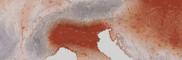
Understanding factors like drought can help us better understand how to mitigate risk and build resilient communities in the face of an ever-changing global climate 💡

The Los Angeles area was in severe drought when the Palisades Fire began. Drought conditions across the country, and going back to the year 2000, can be explored in @Esri's Drought Aware app:

0
1
4
Oh boy! We are already in the swing of planning for #EsriUC2025, so this is a good reminder to register and start planning! I always love seeing my @Esri, @spatialUCSB, and @UofRedlands friends!

0
0
6
Wind, wildfires, smoke, and drought are now impacting one of the most populated areas in the US. Stay up-to-date on the #PalisadesFire, #EatonFire, and #HurstFire with the @Esri Wildfire Aware App and the ready-to-use web maps from Living Atlas:


1
5
12
The newest 2019-2023 American Community Survey (ACS) estimates from @uscensusbureau are now live within ArcGIS Living Atlas! You will see the values in your new and existing maps automatically 🗺️

0
1
2
RT @BrilliantMaps: How Do People Heat Their Homes Across The United States? credit: @mapsdotcom Full data by state/county:
0
5
0
RT @OpenEnviroData: If you're at #AGU24, visit @Esri's Dan Pisut + @shrubberling at the ESRI booth in the demo theatre area (Booth #739) to…
0
4
0
RT @GIS_Bandit: #ArcGIS Instant #Apps: Introducing Streamflow Viewer #ArcGISOnline #water #hydrology #streams #GI…
0
1
0
Do you use @uscensusbureau American Community Survey data in your GIS workflows? The newest 2019-2023 estimates get released this week, meaning the Living Atlas collection of layers will be updated in the coming weeks. More info:

1
6
17
Stay up-to-date on the earthquakes and tsunami warnings along the Northern California/Oregon coast with various layers, maps, and apps from Living Atlas:


1
1
3
RT @mapsdotcom: Did you know Hawaii grows and sells more Christmas trees at tree farms than Alaska? Or that more than 25 million Christmas…
0
3
0
RT @josephkerski: This could be one of my favorite moments in all of #gis this year - when this was announced by @esri @GISEd
https://t.co…
0
4
0
@nettiequette @HarrisburgU @KeystoneGIS @PAGameComm @PennsylvaniaGov @gisday @Esri @ArcGISStoryMaps I used your drone work in my #GISDay2024 presentation! 😍🥺 Maybe we need to coordinate a matching outfit for this year’s #EsriUC! 🌎
1
0
2