

Esri
@Esri
Followers
192K
Following
13K
Media
9K
Statuses
21K
Esri builds #ArcGIS, the leading location intelligence and spatial analytics software for mapping, 3D GIS, imagery, and geospatial app development.
Joined September 2008
Let's look back at over 10,000 years of volcanic eruptions. This animated map groups eruptions using the Volcanic Explosivity Index (VEI) with indices from 0 to 8. Learn more here: #ArcGISPro #DataViz
13
512
11K
You're looking at earthquakes from inside the Earth. 🌏 Created by Raluca Nicola with the #ArcGIS API for #JavaScript. Explore the app here:
19
648
2K
Did you see the @USAA's incredible deep learning presentation at #EsriUC? Here's a walk through of each step in the Woolsey Fire damage assessment process: #DeepLearning
10
288
1K
ChatGPT but for maps.💡Here's a first look at our work on a Smart Mapping Assistant prototype that combines the power of GIS with generative AI. #AIinMapping #GeospatialAI
15
287
1K
From the bottom of our hearts, thank you for making our first virtual #EsriUC amazing. We look forward to seeing you virtually, or in person in 2021!. 🔹86,482 attendees from 180 countries .🔹153 exhibitors.🔹250 demos.🔹232 live & on demand workshops.🔹200 user videos.🔹39 SIGs

14
167
529
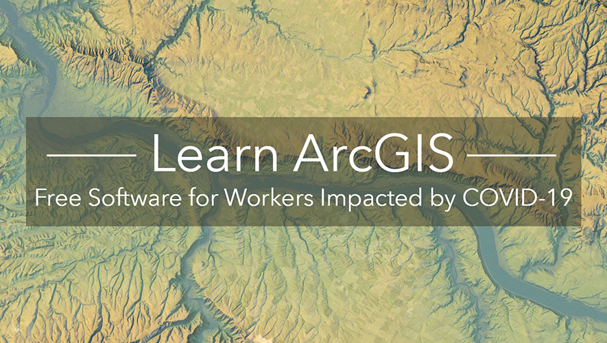
We’re excited to announce that now through August 31, 2020, university & college students ages 18 & over can have free access to ArcGIS for their continued #education during #coronavirus closures. Final day to join is June 30, 2020. Sign up: @LearnArcGIS

15
358
505

Learn how to create your own #3D globe app - it's easier than you think! Click here to get started: 🔸This app by Raluca Nicola (@nicolaraluk) visualizes earthquakes with exaggerated depth.
10
165
450

The latest release of #ArcGISOnline is now available! 🙌 This update introduces new and improved configurable apps, new and updated #LivingAtlas content, and lots more. Take a look:

7
106
393
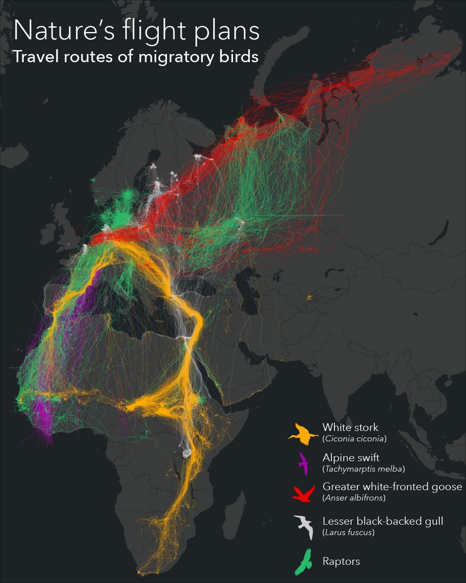
If your holiday travel plans feel hectic, consider the itineraries of migrating birds. 🦅 This map by @Esri_de shows five species who travel great distances to winter or breed. 🔹Data: Movebank . #cartography #birding
4
100
419
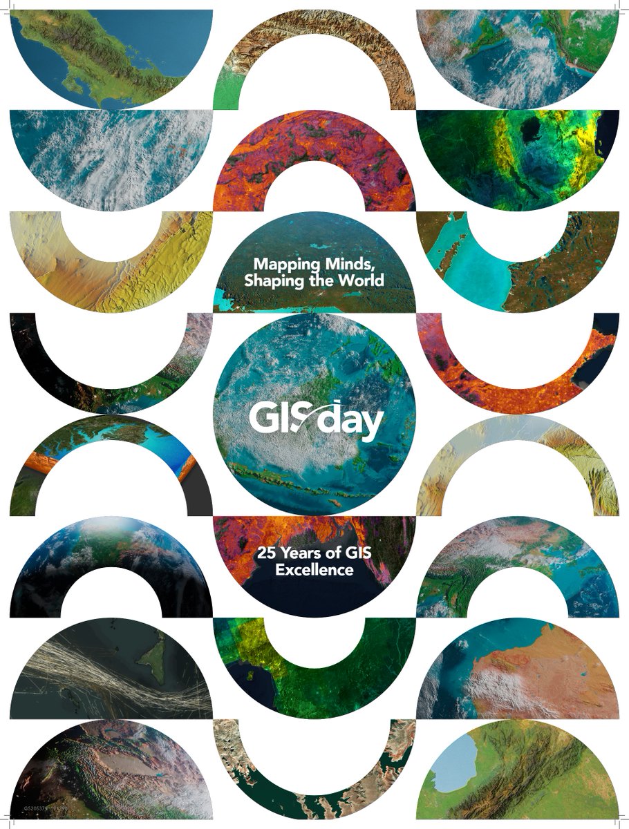
Happy 25 years of GIS Day! 🌎✨. Celebrate how GIS technology transforms our world, reveals hidden insights, and empowers us to make smarter decisions. Let's share the magic of location data for a better tomorrow! . Where are you celebrating?. #GISDay2024

15
149
411


"Every single one of us makes an impact on the world every day. It's in our choices - what we buy, what we eat, what we do. This community using #GIS is making a difference every day." - #JaneGoodall @JaneGoodallInst #EsriUC

0
128
349
UPDATE: US county-level data is now available on the @JohnsHopkins #COVID19 dashboard. This data is also available as a hosted service. See the updated dashboard here:

14
191
317
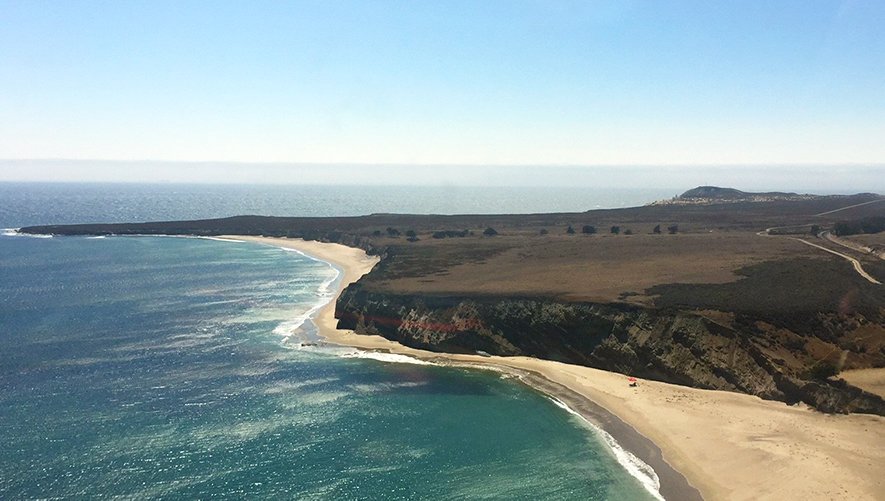
The Jack and Laura Dangermond Preserve will protect over 24,000 acres of coastal habitat, including over 8 miles of coastline, and will be managed by The Nature Conservancy. Learn more: @Conserve_CA #Nature #Ocean #Wildlife
6
125
315

This wonderful book tells the tales of how 23 women applied themselves and overcame obstacles, using maps, analysis, and #GIS to contribute to their professions and the world #WomenInGIS

4
35
287
The @audubonsociety Bird Migration Explorer is your guide to the heroic journeys made by over 450 bird species, and the challenges they face along the way. 🐦. 🔸Explore the map:

4
82
314

What's possible with #ArcGIS? How about mapping historic UFO sightings to make an out-of-this world visualization? Learn more here: #ArcGISPro
7
50
260
Happy #GISDay! We want to hear your amazing stories of how you're changing the world through the power of #GIS. Share your stories in the comments below! Don't forget to download and print your free 2018 posters here: #GeographyAwarenessWeek
11
154
277
We support the Black community and are committed to helping our users leverage the power of GIS for positive change. We're launching a Racial Equity initiative to create solutions for racial, social, economic, and health disparities impacting communities of color.


9
111
272
We're thrilled to bring you the first public release of the ArcGIS Maps SDK for @UnrealEngine. Create #3D immersive experiences with enhanced realism and the accuracy of GIS data:
6
65
260

The @relivecc app makes outdoor adventures come back to life with 3D maps, geotagged photos, and even music. Read how one cyclist used Relive to document his journey on the Pacific Coast bicycle route from Canada to Mexico. 🚴 #GetOutThere #GIS
1
69
246
With the #ArcGIS Maps SDKs for @unity3d and @UnrealEngine, you can use game engines to create cost-effective, immersive simulations and realistic urban scenarios. #GDC21. 🔹Join the beta program: .🔹See it in action:
4
53
237


The new voxel layer in #ArcGISPro 2.6 allows you to visualize and explore multidimensional phenomena in a completely new way! Explore data across #3D and time to uncover hidden patterns that provide additional insight and impact to your analysis. #EsriUC
2
87
220
A once in a lifetime moment! Jack Dangermond welcomes 2 of the greatest minds in conservation & biodiversity – #JaneGoodall & #EOWilson to share what they’ve learned over their legendary careers to help future generations protect our Earth. @JaneGoodallInst @EOWilsonFndtn #EsriUC

6
87
212

For the first time, we're releasing a high-resolution, global land cover map, built in partnership with @ImpactObserv and @Microsoft in ArcGIS #LivingAtlas. The map uses @esa #Sentinel2 satellite imagery, and leverages deep learning AI. Explore the map:
6
99
198
You're looking at earthquakes from inside the Earth. 🌏 Created by Raluca Nicola with the ArcGIS Maps SDK for JavaScript. 🔸Explore the app here: #ArcGIS #JavaScript
4
59
207

ArcGIS Platform helps #developers build powerful solutions with a comprehensive set of high-quality location services. Take a look at each of the location services that #ArcGISPlatform offers, and sign up for a free developer account today.

3
21
181
What if rivers stood straight up? Let’s look at 3D visualizations of some major rivers around the world. Try this app here: #WorldRiversDay
2
54
184

We're psyched to be a part of the @PokeVisionGo phenomenon -Thank you!Together we can truly "catch 'em all!"
8
61
183

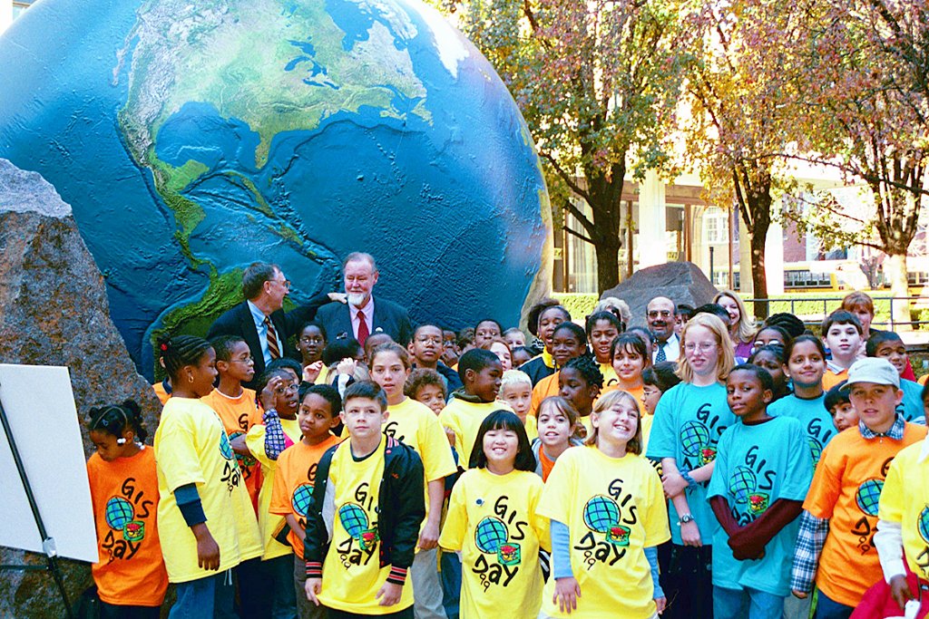
Happy #GISDay! Did you know the first GIS Day took place in 1999? This ArcNews article from that year gives you a look at some of the wonderful events that took place around the world #GIS #Geography
1
121
181


Full house at the #WeCan Share and Connect: Women’s Idea Exchange at #DevSummit! Thank you for sharing the great work you do for the world 🌎 #WomenInGIS


1
50
184

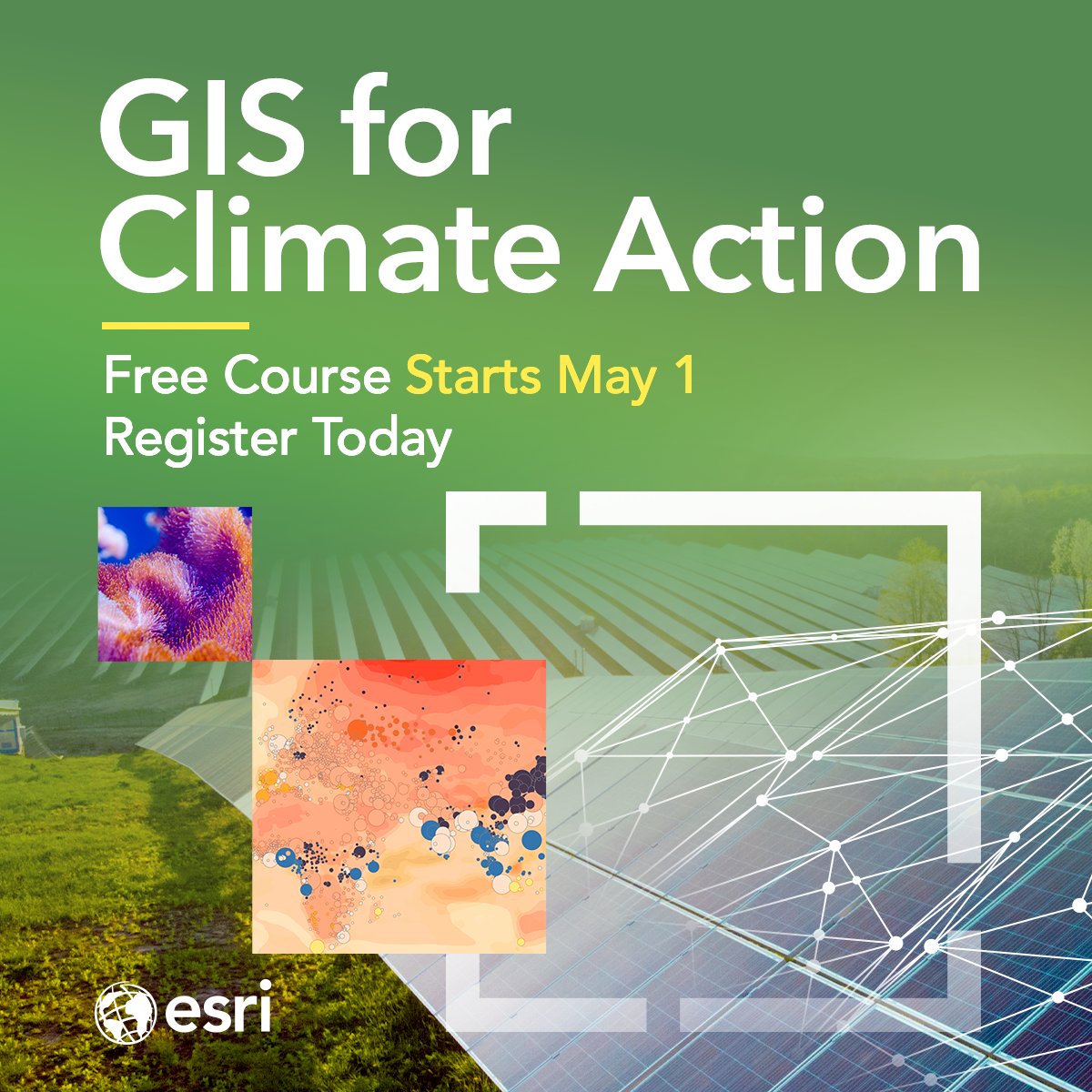
What can you do to turn climate change around? 🌱 Use GIS! Register for our free course and learn how. We'll provide all the ArcGIS software you need: #ClimateAction #GIS
0
52
180
Priceless! #JaneGoodall bestows the chimpanzee sign of friendship on Jack Dangermond and #EOWilson. #EsriUC @JaneGoodallInst @EOWilsonFndtn

3
33
165
Do you know what causes #ocean currents? Check out our new #storymap to find out #Maps @EsriStoryMaps
2
90
161
We're proud to announce that Jack Dangermond has been awarded the Planet and Humanity Medal by the International Geographical Union (IGU) for his contributions to global sustainability. Our sincere congratulations!
2
36
169
The total number of confirmed #Coronavirus cases worldwide has reached over 82,500 as of February 27th. This dashboard created by @JohnsHopkins University tracks the spread of the virus in real-time. #COVID19. Mobile: Desktop:

5
117
158
Developers! Put your coding skills to the test with Esri and @TechCrunch. Build world-changing apps to address our planet's most pressing challenges using #ArcGISPlatform. 🔹 Sign up here:
5
26
162
Swipe to view relationships between layers with the new Swipe widget, available in version 4.13 of the #ArcGIS API for #JavaScript
6
40
154
Cloud raster formats, mosaic datasets, and the ArcPy API, oh my! Learn all about multidimensional analysis in #ArcGISPro #Imagery
3
32
158
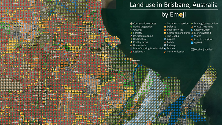
Want to know how land is used in #Australia? The Queensland Land Use Mapping Program used emojis to create a thematic map of how land is used in the Brisbane region. 🌳😃 See this wonderful map here: @QldGov #PoweredByEsri
2
28
138
Think you know everything about your neighborhood? Let's find out! Enter your ZIP code to learn more: #ArcGIS #Demographics

5
20
145
Update Regarding #COVID19 malware: please be aware of a downloadable Windows-based application containing malware that looks nearly identical to the @JohnsHopkins dashboard. Read this blog from our security team:


3
172
153
Mission accomplished! 🙌 Dr. Dawn Wright, Chief Scientist of Esri (@deepseadawn) made history as she dove to the deepest place on Earth, Challenger Deep. Here are 30 incredible photos from the mission.


4
23
148

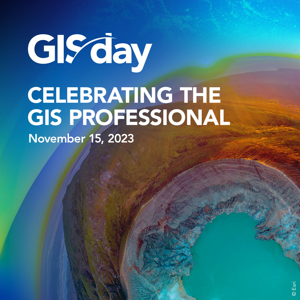
GIS Day is November 15! 🌍 A day to celebrate your accomplishments and incredible work using #GIS technology. Explore GIS Day events worldwide: 🔸Here's a special message from Jack. #GISDay2023
2
67
146
Happy GIS Day from all of us at Esri! 🌏 Today, we celebrate you, GIS professionals, and the important work you do each day. Show us and tell us how you're celebrating today in the comments below. #GISDay2023
2
56
143

Our most popular free online course returns: Cartography. 🗺️ Learn how to make beautiful maps using #ArcGISPro. Register here:

2
45
150
Our popular online course, “Cartography.” starts tomorrow. Save your spot and get ready to take your maps to the next level. Register here: #Cartography

5
67
141
The famous World Ocean Floor Panorama by Heinrich Berann, 1977, is based on the work of oceanographic cartographer and geologist Marie Tharp. Tharp’s work was fundamental to the plate tectonics revolution. Learn more in this #storymap: #Cartography

1
51
140

9
69
139

Students from Lurgan use Survey123 for ArcGIS to record data across certain sectarian lines. After analyzing their data, the students from conflicting backgrounds find that they aren’t that different after all. This is how change begins. #GISinSchools #EsriUC #TeamLurgan

0
44
133
Love LEGO? ❤️ Here's a fun Map of Wisconsin made with LEGOS and designed in @ArcGISPro (1 brick=10 sq mi). The terrain is represented at different levels in elevation, with lakes and cities displayed. Full map: 🗺️ 𝐴𝑢𝑡ℎ𝑜𝑟: 𝐴𝑡𝑙𝑎𝑠 𝐺𝑢𝑜

4
29
144
Tornado season in the U.S. is like a wave that forms in the gulf, crashes over the mid-west, then rolls back to the sea. Learn how to #map seasonal #tornado migration using data from the @NOAA Storm Prediction Center #DATAPALOOZA
2
80
129

This animated map uses @USGS data to map major earthquakes in 2019. Learn how to create a #3D globe of earthquakes with exaggerated depth using #ArcGIS API for #JavaScript.
2
67
129
The new swipe mode in World Imagery Wayback makes easier than ever before to view imagery over time! See what's new here: #LivingAtlas
3
15
123

3
133
134

The @audubonsociety's Bird Migration Explorer utilizes millions of geographic data points to visualize the incredible annual journeys made by over 450 bird species across the hemisphere. 🦅 . Learn more: #AudubonDay
2
36
133


GIS Day is five weeks away! Do you have plans to celebrate? 🥳 Register your event at and get 5 free ArcGIS for Personal Use licenses. #GISDay2024
3
44
135
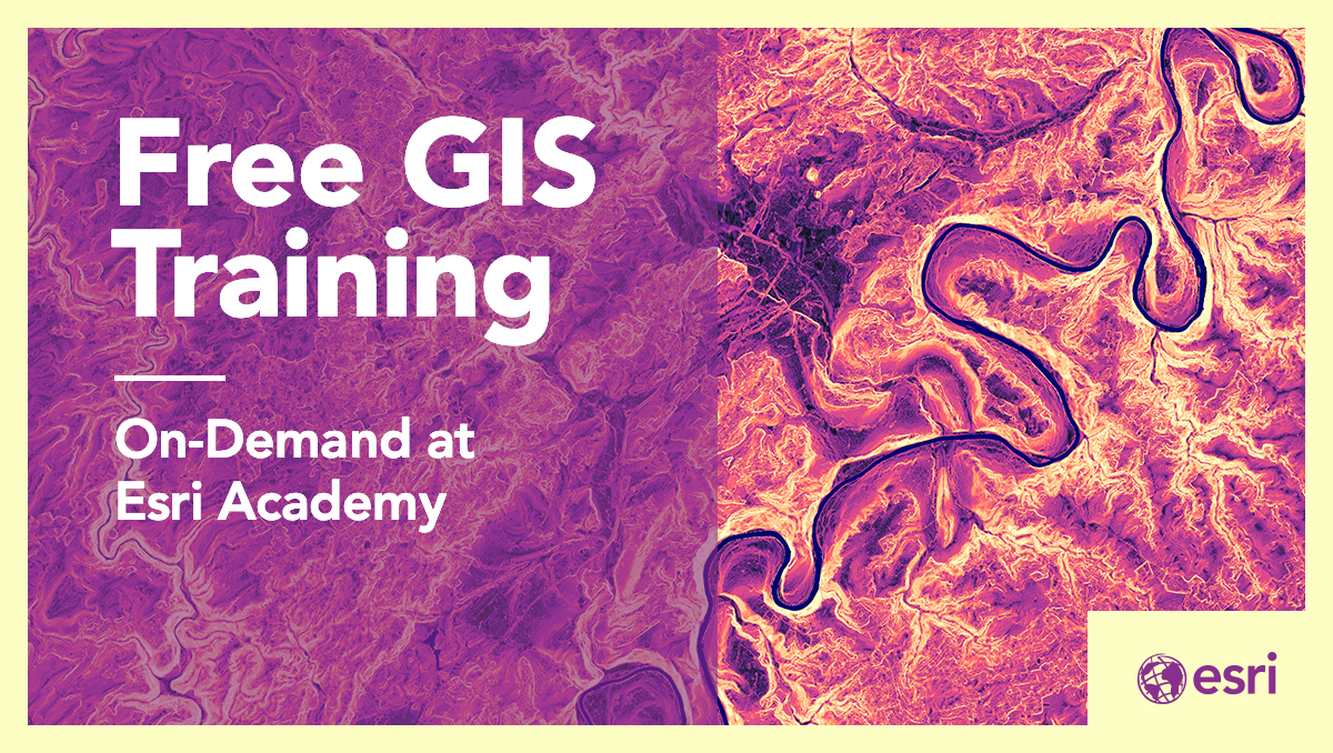
Happy to announce that we've extended our program. Furloughed professionals affected by #COVID19 can gain free access to @ArcGISOnline & 20+ apps until December 31, including @ArcGISPro & lessons through Learn ArcGIS & the Esri Academy. Learn more:
5
63
133

Turn up the volume! 🔊This set of 41 paleo-elevation models (DEM) represents the changing #paleogeography of the oceans and continents back to 540 million years ago. 🌏. Learn more about this map on our YouTube channel:
2
53
127
This wood-cut model of the Island of Hawai'i is amazing! 😍 @John_M_Nelson shows you how to use #ArcGISPro and Spatial Analyst to make a template for these charming little wooden terrain models.

0
25
128
Furloughed professionals affected by #COVID19 can now gain free access to @ArcGISOnline & 20+ apps until August 31, 2020, including @ArcGISPro & lessons through Learn ArcGIS & the Esri Academy. Sign up through June 30 for a Learn ArcGIS membership here:

3
73
124
GeoCards are a new kind of app created in #ArcGIS Experience Builder that bring together maps, StoryMaps, Dashboards, & Infographics as shareable containers of geographic data, to create customized web experiences. Try them here in the #livingatlas #EsriUC
1
50
121


You're looking at earthquakes from inside the Earth. 🌏 Created by Raluca Nicola with the #ArcGIS API for #JavaScript. Explore the app here:
1
71
119