
WVLT Weather
@WVLTWeather
Followers
11,969
Following
75
Media
33,097
Statuses
42,696
WVLT First Alert Weather - Keeping East Tennessee and Southeastern Kentucky prepared. Download the WVLT Weather app for your Apple or Android device.
Knoxville, TN
Joined April 2009
Don't wanna be here?
Send us removal request.
Explore trending content on Musk Viewer
FEMA
• 2297487 Tweets
Dolly
• 68454 Tweets
#SmackDown
• 61703 Tweets
Release Now
• 44610 Tweets
Lakers
• 23567 Tweets
#GiveAttentionToThisToo
• 21926 Tweets
Oregon
• 20026 Tweets
#ParmarthiDiwas
• 19504 Tweets
Aces
• 19463 Tweets
鶴丸国永
• 18886 Tweets
TEN FIREWORK IT
• 18005 Tweets
Saint Dr MSG Insan
• 17124 Tweets
Kinger
• 14795 Tweets
Purple Heart
• 12336 Tweets
Michigan State
• 11409 Tweets
琉球新報
• 10859 Tweets
Last Seen Profiles


Check out the fireball, as seen near Oak Ridge. DOZENS of folks reported the sight at 2:13 a.m. Wednesday. Chances are, your 'porch camera' would have captured it. Check your cameras and let us know if you saw it! We'd love to share the view with East Tennessee.
14
64
291
Following up on the last post, there's a CLEAR mesocyclone near Karns. Are you seeing this set of clouds? There's a ton of rotation here.

10
50
235
The National Weather Service in Morristown has confirmed an EF-2 tornado in Knox County from Monday's storm. This is the first August tornado in Knox County since 1950, crews are continuing to survey damage in this area as well as other locations in Knox, Jefferson and Loudon

1
20
63
Melissa Long, one of our talented Weather Vols, took this spectacular photo of the conjunction of Saturn and Jupiter Monday evening! Amazing!

0
13
57
This is a new fire, easily visible around Pigeon Forge, on the SSW side of the city. You can see the view from our Monster Monster camera. Thinking of all the brave firefighters.
4
20
56
Brandon Thompson shared this video of the tornado in Scott County.
1
28
51
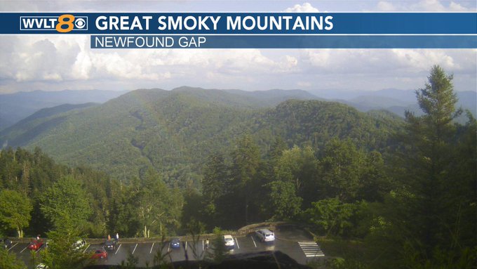
Check out the snowy Newfound Gap this morning, in the Great Smoky Mountains National Park!

0
8
40
Wow!! Check out the last of snow and ice on the trees in the Smokies before the sun melts it away.

0
12
41
Snow lovers, check this out! The 9 inches of snow makes the Newfound Gap brighter, even before the sun comes up.
#WVLTFirstAlert
#WinterStorm
#GSMNP
-
@WVLTHeather

0
6
35
On top of the Smoky Mountains, it has been cold enough to snow since late yesterday and it continues to pile up!

3
12
38
This is awesome! This is the first time I've seen a rainbow captured on the Newfound Gap webcam. Enjoy!
2
4
36
Snow mixed in the rain across the plateau. Not expecting much accumulation.

0
1
28
That's a lot of snow. When you add up what was already there, the caretaker (named PNut) said LeConte has a base of 16" of snow! Wow!

1
4
32

Making weekend plans? The good news is it's not a rainy weekend, just a rainy start! Join WVLT News for the latest track of your weekend rain.
2
2
30
A brush fire has sparked in Pigeon Forge. Remember, it is VERY dry outside. Do not burn ANYTHING right now. We have a crew on the way to get more information.
#FirstAlert
#tnwx
#wvltwx

0
12
32
This is downtown Middlesboro Sunday morning. Melinda sent us this. That flooding is horrible!
@nwsjacksonky

4
14
31
We just had an 87 mph gust at McGhee Tyson Airport! That's wicked! If you were around the airport, did you feel the wind?

2
6
31
This is some postcard-worthy stuff sent in by William. The
@usairforce
plane on the tarmac at
@FlyKnoxville
. Easter egg: notice the jet engine covers.
@wvlt
@AirNatlGuard

1
5
28
Models continue to suggest rain changes to snow Christmas Eve while highs remain below freezing as snow continues to fall Christmas Day. Stay tuned to WVLT Weather for updates throughout the week!
0
6
29
Where were you when? We would love to hear your stories from the Blizzard of '93, for most people in the region, the 'all timer' storm. Dozens had to be rescued from the Appalachian Trail, thousands were absolutely trapped, and everyone has a story!
7
6
29
Many secondary roads around Knoxville, Maryville, Seymour, and Pigeon Forge are snow-covered and slick. Generally totals have been under 1". That said, even Alcoa Highway is pretty slick at 6:14 p.m.

1
5
28
A really high-res view of the
#Rockwood
fire, in Roane County. Thanks to Christopher Barger for the photo.

1
6
28
Ellie S. sent us video of cars near Westland and Ebenezer that appeared to lose control. Ellie says several cars either went off the road or hit the guard rail. -
@bencatheywvlt
7
5
28

Breakfast on the porch? I'd try to quietly join these deer in Spring City! Thank you J.d. for sharing this stunning view from Watts Bar Lake.
#WVLTwxVols
-
@WVLTHeather
@WVLT

0
3
26
The folks running the Mount LeConte Lodge shared in their "High On LeConte" blog the overnight view of the fire in Wears Valley. We'll keep you updated on the latest on this developing news story in the
@WVLT
News app!
1
15
26
You've seen all those headlines about the Sahara and the dust from the desert, right? Well our computer models don't have much of the dust getting anywhere close to East Tennessee until the end of NEXT weekend... maybe
0
17
25
Talk about a real snowy view ... The sun just lit this up enough to see more than 7 inches of snow at Newfound Gap as of 7 AM.
#WVLTFirstAlert
Join
@WVLT
News for the current conditions and day ahead!

1
4
26
It was a cold but beautiful view at Mt LeConte this morning! It was 14° to start the day, with a new layer of snow and ice on top of ol' Smoky.

3
5
25
Snow is sticking in the mountains Saturday but it's been a quiet winter in most of East Tennessee. Since the 1.7" snow in November, we haven't seen much powder at all!
0
4
23

We have a rain and snow mix high above Gatlinburg. The mix is swirling around in high winds.
0
7
26
East TN is not in the path of totality, but next Saturday, you'll witness a partial eclipse. PLEASE do not look directly at the sun without eye protection. What's also compelling is that there will be at least six Power 5 FB games impacted by eclipse!
1
4
26
PLEASE STAY HOME: there are wrecks everywhere Thursday night, with total closures on 75 and 40. It's incredibly icy in Roane and Campbell Counties, even on the busiest highways.
#FirstAlertWeather
#tnwx
#kywx

1
9
25
Winter Storm Watch is posted for East Tennessee on Tuesday as we expect 2-4" of snow to accumulate. Plan for slippery road conditions during the morning and evening commutes.

0
11
24
The folks at LeConte Lodge say they now have 1" of snow on the ground! This is more than 6,000 feet up into the Smoky Mountains where it's cold enough for snow.

0
7
25
Another gorgeous sunset picture from Kathy! That is pretty close to Tennessee Orange if you ask me! -
@PaigeWVLT
#tnwx
#wvltwx

0
6
25
ANOTHER ONE! Did you catch the sunset? We had some very late light, cast on anvil clouds ~30,000-40,000 feet up. These were best seen from the Foothills, as the storms were over in NC.

2
3
24
It's a beautiful Tuesday morning! We hope you have a great day!!

2
3
22
Another couple of inches of snow in the Smokies this morning, with snow still falling.
#GSMNP
@WVLT
-
@WVLTHeather

1
8
24
Alright who did it!?! Who asked Santa for snow on Christmas? Because, he must be behind the models showing several inches of snow a week out! 😉
#NotAForecast
#WishCast
We will keep you updated on the actual forecast on
@WVLT
! -
@WVLTHeather
#WhiteChristmas

6
4
24
The views are beautiful in the mountains, where the Winter Storm Warning continues until Noon Tuesday. Join
@WVLTHeather
on
@WVLT
News for the latest on your forecast!!
1
2
19
The view of the Smoky Mountains in Sevierville looks more like a painting this morning! Thank you for sharing, David!

0
7
22
How sweet! Morgan Myers sent in this photo from Sevierville. It's the youngin's first snowman!

0
3
23
The ONLY substantial snow anywhere, still on the ground nine days after the big snow... is over Knox County. Just a few more hours until it is ALL gone!

3
2
23

0
5
21
Another small earthquake was registered in Blount County, just east of Maryville, this morning. It was a magnitude 2.2. According to the USGS, the Eastern Tennessee seismic zone is one of the most active earthquake areas in the Southeast.
@WVLT
1
6
18
Maybe I'm just partial to our area, but I think the Smokies look pretty in the fog and rain too. What do you think? -
@WVLTHeather

2
3
21
The Flood Watch was replaced by a Flash Flood Watch for most of East Tennessee due to the intensity of rainfall expected overnight through Tuesday morning.
0
7
20
Use caution this morning, on the tail end of the
#WVLTFirstAlert
Weather Day, as we all need to keep an eye out for any high water and patchy ice. Wakeup with
@WVLT
News for the latest on weather and traffic! -
@WVLTHeather
1
5
21
If DST became permanent, we wouldn't actually get 'more sunshine,' as it's just a way of well, keeping time. But we would pick up 85 more days with sunsets after 6 o'clock in Knoxville.
5
4
20
Meanwhile in Arkansas: traffic on I-40 is at a complete stop. It's snowing very heavy and 40 is totally covered!

1
14
20

1
2
21
Mother Nature is all confused! We're well into spring and it's snowing in the National Park. We expect some places WAY up to get 7" or more of snow by late Saturday. Don't expect that where people live!

1
9
19
We've got some ridiculously good photographers around East Tennessee. Thanks to Kevin Noble for this photo at Cades Cove. Unreal!

1
1
18

#NEVERFORGET
Check out this video of an American flag flying over Clingmans Dome this morning. Thank you Kenneth Creel, Jr. for sharing.
0
7
21
Wow, David captured a stunning sunrise over Sevier County this morning! Thank you for sharing in the
@WVLT
First Alert Weather app. -
@WVLTHeather

0
4
21
A few more snow showers overnight to this morning only add to the wintry beauty at the Smokies! If you're thinking about a hike today, know that wind chills are rough today. -
@WVLTHeather

1
3
19
Jim Knesek from Loudon sent us this photo of the Friday sunset! Did you snap a shot? Send us your view and check out the explainer video in the free WVLT Weather App.

2
1
18
We have low 90s back again, but the humidity makes it feel like it's closer to 100 degrees. Be careful in this heat, but you can look forward to relief in the 8-day forecast on WVLT News!
1
2
19
Here are the details on a small earthquake in East Tennessee Wednesday morning.
3
8
20
Did you feel it? A preliminary report of a magnitude 4.4 earthquake occurred early Wednesday morning in the Decatur area. We'll keep you updated on the latest on
@WVLT
News This Morning!

6
6
18
UPDATE -- The NWS updated the alerts for our area. We now have Winter Weather Advisories widespread, and a Winter Storm Warning in the Smoky Mountains. Join WVLT News for the latest forecast!
4
7
18
First light reveals a blanket of snow at the tops of the Smokies!

0
5
17
Listen, arctic air. We saw you eyeing East TN a week ago. Don’t you have enough folks shivering ... now you have to try dig further south next weekend!?! 🥶
-
@WVLTHeather
#WVLTFirstAlert
@wvlt

2
1
20
Love it or too soon? Check out the snowy trees in the Smokies this afternoon. Send in your views through the
@WVLT
Weather app!

1
3
19
Good news on severe chances. We're seeing winds weaken and lightning has dropped off big time (though lightning does not make a storm severe). Still expecting storms for much of the region thru 10 o'clock.

1
6
20
Here's the forecast for this week's
@RivalryThursday
high school football game of the week. You can also join from home by watching MyVLT.
@WVLT
@WVLTPacker
0
4
19
Some good news, the waves of rain are mostly reaching our area Monday and Tuesday. The flow looks to stay southeast of us on Wednesday, so that pulls back the WVLT Weather Alert from Wednesday and keeps it to part of Tuesday. Join
@WVLT
for the latest!
3
3
18
As expected, not everyone saw snow at all ... and the First Alert forecast for heavier snow on the Plateau and Smokies definitely verified. Newfound Gap had more than 3.5 inches of snow as of 7 AM. We always love to see your views!
0
6
19
While it snowed half the day at my house, we don't have any leftover. Now, the Smokies are showing off all the snow that just recently came to an end!
@WVLTHeather
#GSMNP
#ETNwx
#GSMNP
#SmokyMtns

1
3
19
CHECK THIS OUT - Here's the sunshine over Neyland on Game Day Saturday!

0
2
19
With a rain to snow event, the initial change to snow joins puddles for most of our area, but then surfaces cool and accumulations can really begin. Here's a look at the current trend for snowfall versus accumulations for Christmas Eve to Christmas Day.
1
4
19
Happy Thanksgiving from the WVLT Weather team! You can plan your day and look ahead with our
@WVLT
Weather app. -
@WVLTHeather
3
2
18

0
6
19
Here are all the alerts tied to the ice, and some snow. Big picture, this is still on track to start Sunday night and buildup late Monday. We will message you on the latest through the
@WVLT
Weather app.
#WVLTFirstAlert
-
@WVLTHeather

0
7
19
How is your view this morning? We have some passing clouds and fog for parts of our area to start your Thursday. -
@WVLTHeather
2
2
17
The supermoon, when the moon is a little closer, makes for a beautiful bright full moon, and a wonderful show of the Total Lunar Eclipse Sunday night.
2
6
19
I wanted to give you a heads up first thing that some storms this evening are now showing the potential for damaging wind. It's an isolated risk for stronger to severe storms, and we have the latest track on
@WVLT
News! -
@WVLTHeather
1
5
18
Here's the latest track of ice potential in our area. Notice the heaviest ice risk is further Northwest in our area. We're tracking freezing rain, rain, sleet, and snow on
@WVLT
News! -
@WVLTHeather
1
2
18
Our own Harry Sullivan got this stunning video at a snow-covered Third Creek. The Greenway looks totally different!
0
5
18
A 22° Halo sits over the Fields Of Honor in Crossville.
Jeannie Denk sent us this, just hours ahead of Veterans Day. You can also see 'sun dogs' on the sides of the sun. These clouds are from the outskirts of Nicole. The clouds mean rain is on the way for Friday.

1
3
18
Almost a full moon, and a beautiful site over the Smoky Mountains this morning!

0
3
19
Who wants to go for a picnic at that table right there!?! Well, the folks manning the lodge on top of Mt LeConte say it's 15 degrees and they have 8 inches of snow as of 9 AM, and of course it's still accumulating on top of ol' Smoky!
#GSMNP

0
6
19
Here's the forecast for this week's
@RivalryThursday
high school football game of the week. You can also join from home by watching MyVLT.
@WVLT
@WVLTPacker
0
6
19

Three local high school football teams are playing in the state championships this weekend! Here's a look at the forecast for Chattanooga at the start of each game. You can also cheer them on from home, while watching on MyVLT!
@WVLTRick
@WVLT
@WVLTPacker
0
10
18
The line of storms continues to move East towards our area. We'll continue to monitor the storms and keep you updated through the
@WVLT
Weather app! -
@WVLTHeather

0
7
17


The change to snow is possible Sunday night to Monday morning. The highest elevations of the mountains could get several inches of snow, which is why there is a Winter Storm Warning for the Smokies.
1
6
15
What's your favorite lake or river in our area?
What a sunset on Cherokee Lake tonight! Thank you for sharing, Donna!

6
3
17
What a great pic from Louisville, TN. Thanks to Kimberly Zizek for submitting in the weather app.

0
2
18