
Sequatchie wx
@SeqSevereWx
Followers
850
Following
8K
Statuses
7K
I cover severe and winter weather for the Southern Cumberland Plateau area. #Wx model nut.
Tennessee, USA
Joined January 2019

I'll never forget this post @TropicalSaiel Bobby nailed the setup of the snow band.

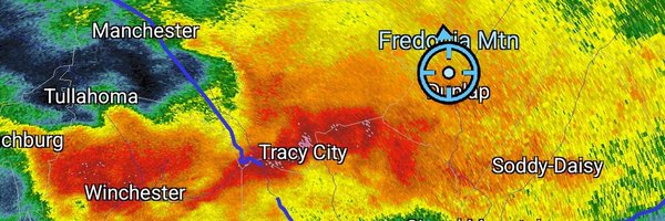
Hanging my hat on dynamical cooling over southeast Middle TN/plateau later tonight and early Sunday to lower temps in the boundary layer enough to deliver up to 1 inch of snow within circular outline.#tnwx#gawx#alwx#kywx

1
0
1
@TropicalSaiel Man it was a wild day. I had 2" but you could drive five miles in either direction and nothing.
0
0
2


@SCweather_wx Dang I'm so happy for you man that it feels like I accomplished something lol. 🐐
1
0
1
Amazing accomplishment. Congrats.

I officially hit 100,000 subscribers overnight. I started this journey 5 year ago on January 1 of 2020 with a pipe dream mentality. But somehow as I made videos that only got 10-20 views, I kept grinding. Soon those videos were getting 50-100 views. Then the standard was at least 100 views. I remember the video that hit 1000 views for the first time and how it felt. And I remember the first video that hit 10k views that got me eligible to get monetized. I almost gave up 2-3 times but something kept pushing me to continue. Somewhere in the process of that first year of trying to get 1000 subs, something clicked that this is possible & I took that then adopted a new mentality that I will make this happen... and it did. This is an awesome accomplishment that truly is God given. I want to encourage anyone out there to keep pushing towards your dreams. You will try to give yourself an excuse on why you can't do something, but it's a lie. We live in a time where the world will try to tell you to give up & sadly give you a reason on why it's ok to do so. With the social media driven world we live in, you have all the access in the world to show the world what you got. I have a YouTube Channel with 100k subscribers with a.. 510 dollar computer 90 dollar mic A hand me down keyboard worn down mouse I screen record off software that cost me 30 dollars a year I only just recently got photoshop to do my thumbnails, before I was using microsoft paint.. I don't have 2-10 computer monitors. I don't have flashy lights. And I don't have super fast internet. (not a knock on anyone that does) I'm literally just a dude that talks about the weather in his bedroom. Don't get so caught up in things you think you need, just start & get after it. What has separated me from others is my relentless approach & my consistency. I just don't stop. And if you think about it, that's how most really successful people reach their goals & are able to MAINTAIN it. The shortcut will not bring longevity to what you are working towards. The common phrase is work smarter not harder, but I would argue I have done the complete opposite in not just this Youtube journey but my entire life. You got a gift that is God given. You got to seek that gift & he will use you. But it takes work & I am still learning as I go. God can put the quarter in the gumball machine, but you gotta turn it to get it out. Thank you all for trusting me over the years & giving me this platform to talk about what I love!


0
0
4

@BiblicalRanger Happens all the time around here. Warm air above our heads and at the surface gives us a cold rain.
0
0
1

As we look into the 2nd half of February I see lots of backside snow event chances showing up.
0
0
3
@weathernerdga @joshuawx_ I like some of the new outlaw country but you won't hear any of it on radio.
0
0
1
@joshuawx_ But I listen to mostly podcast and documentaries so I'm not the best judge of what's hip.
0
0
0