

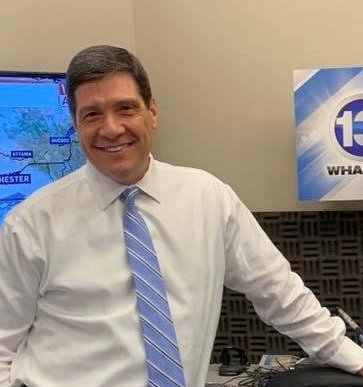
WHEC_Glenn Johnson
@Roc_wx_leader
Followers
9,362
Following
859
Media
6,958
Statuses
11,996
Meteorologist for First Alert 10 NBC forecasting the unique weather of WNY. SUNY Brockport grad. Former teacher Extreme Weather at Monroe Community College.
Rochester, New York
Joined October 2008
Don't wanna be here?
Send us removal request.
Explore trending content on Musk Viewer
Rosé
• 529795 Tweets
西田敏行さん
• 344228 Tweets
Sinwar
• 246142 Tweets
Bluesky
• 206331 Tweets
ブルスカ
• 193931 Tweets
スーパームーン
• 179640 Tweets
ブルースカイ
• 176888 Tweets
#わたしの宝物
• 176305 Tweets
ツイッター
• 142787 Tweets
JOURNEY CONCEPT PHOTO
• 114999 Tweets
タイッツー
• 87856 Tweets
インスタ
• 85280 Tweets
Kabir Is God
• 84879 Tweets
EFM X JACK AND JOKER
• 76993 Tweets
ILL BE THERE IN 7 DAYS
• 71922 Tweets
ログイン
• 62545 Tweets
#يحيي_السنوار
• 60240 Tweets
블루스카이
• 55705 Tweets
LINGLING MYCHERIE AMOUR EP9
• 38335 Tweets
ALRIGHT TPOP STAGE
• 27602 Tweets
#まふまふ誕生祭2024
• 21957 Tweets
غير مدبر
• 19794 Tweets
冬月くん
• 18627 Tweets
RADWIMPS
• 18246 Tweets
#TOBE緊急生配信
• 16831 Tweets
ミスキー
• 15196 Tweets
ふっかさん
• 14419 Tweets
個人サイト
• 13380 Tweets
mixi
• 11155 Tweets
ابو ابراهيم
• 10601 Tweets


36 years is a long time to be at one place & doing just one thing. It has been great fun to forecast our challenging weather. But I'm very fortunate that our weather has been calm & quiet as it would be rather difficult to focus on a difficult forecast.
62
30
519
Still in the "training mode" here at WHEC, but Meteorologist Stacey Pensgen is getting me up to speed!

26
4
439
Some cool video from John in Webster… Not seen very often in western New York, a dust devil!
9
46
170
The Mt. Morris Dam has been, and continues to be, one of the greatest investments for our community... Why? Flood mitigation! After yesterday's heavy rain the water level behind the dam has risen 36 feet in about 24 hours. Rochester again is saved by the dam...
#ROC

7
27
144

Snow owl pictured in Brockport today... Sign of winter storm to come? You bet! Thank you Kelly...

3
6
63

The track of the storm, so far, has been surprisingly consistent on most of the computer models. This fact continues to give us confidence that this storm will have a big impact on WNY. Join us at halftime during the game on News 10 NBC for a complete look at the timing.

9
7
44
First Alert Weather Team tracking rain. Do not anticipate severe storms - so damaging wind or tornadoes are not a real risk- but heavier rainfall MAY produce localized flooding. Greatest potential will be late this afternoon into the overnight. Yellow Alert Day continues...

5
2
41
Big 'ole snow flakes, the size of half dollars, falling at our the 13 WHAM Studios in Henrietta. You got to love spring in ROC?

5
7
39
This could be the scariest costume for Halloween in
#ROC
... Local kid named Ryker going as a meteorologist!

3
6
36
Jim Montanus took this amaznig picture from Sodus Point yesterday....

1
14
37
Nice shot from Jim Montanus show lake snow tonight

3
27
32
Clear skies, a 75° temperature, a 54° dew point and just some fair weather clouds today.... Some would say near perfect weather for Rochester! Enjoy...
#ROC

1
2
29
Frosty cold this morning in WNY... Pretty shot from Geneva this morning!

1
5
28
Hard to believe (and if it stands)... but the ROC Airport has measured a peak wind gust of 72 miles per hour at 1:21 PM this afternoon. That is the seventh highest wind gust in recorded history for ROC!
#ROC

5
8
28
Snow advancing through PA & into NY State in the next hour. Expect arrival time of 8-9 PM as it moves south to north with conditions going "downhill" before midnight. Looks like an easy 5-10" by Monday AM! Join us on News 10 NBC at 6 PM as we follow the full extent of the storm.

2
8
29
Severe t-storm watch is posted for all of WNY until 11 PM this tonight. Watch for strong storms to develop with the potential for heavy torrential rain, small hail, lightning and strong damaging winds.
#ROC

3
3
28
We got the rain starting and we can't seem to turn it off... Amazing rainfall totals with 1.5 to 3.7 inch measurements common across WNY during the last 24 hours. The ROC Airport set a record for the day & this was a record that has stood since 1873 (148 years of record keeping).

3
8
28
Due to the very chilly waters of Lake Ontario, it is spring lake effect for WNY... North Greece is now at 53 degrees, but Dansville is at 86 degrees. That is a difference of 33 degrees over a distance of 45 miles!
#ROC

7
5
25
One more day with higher humidity, but more comfortable mid-summer weather is on the way for the remainder of the week!
#ROC

1
3
25
What a comparison in temperature from this year to last year! On this date 2017 produced a high temp of 80°. Today we will struggle to get to the lower 40s. Find out when spring will arrive at

3
16
26
Pretty view from East Avenue of the full moon tonight... The hunters moon adding to the halloween "vibe" in WNY.
#ROC

1
2
27
Great for snow lovers! This map shows the extent of snow depth across the U.S. with 73.2% of the lower 48 covered in snow. By some estimates, this is the greatest daily amount of snow since 2003 (since this data was first measured).

0
6
26
Just a spectacular sunset this evening in ROC... Sunset was at 8:34 PM and civil twilight going until 9:08 PM. The length of the day now at 14 hours and 54 minutes.
#ROC

0
2
25
Red Alert.... News 10 NBC is tracking the winter storm. And the snow is already on our "knocking on the door" to WNY! Join us at 6 PM and I'll take you through the storm during the next 24 to 36 hours
#ROC
1
6
25
No, this is not a picture from the Caribbean... Beautiful shot from Jane in Sodus Bay this morning. Sunrise now at 5:44 AM!
#ROC

0
3
23

Weekend storm looking more and more likely for ROC... Now it really comes down to the exact storm track and with the additional lake snow, this appears to be a long duration event lasting more than 48 hours.

5
5
23
You never know what you're going to see in the Finger Lakes... Jarred send a nice picture from Keuka Lake this morning. It appears to be "tornado-like", but it is not. Lake fog and low level moisture being drawn into an updraft.
#ROC

1
6
22
You got to love it! Bennett is just 6 months old and plays in his walker at 5 PM and (according to his mother) the minute he hears my voice he will watch the entire weather segment. Thanks to his mother Mary for sending a picture that makes my day!

1
0
22
The good folks at Brookdale Senior Living sending us a cake for National Weatherperson’s Day

0
1
23
We had a good break from wet weather for most of the day.... But by judging by the 10 NBC First Alert Doppler Radar that may change for some of the northern towns during the next hour or so.

5
4
21
It COULD be argued that the high wind is the worst part of this storm.... But there is also poor visibility, sub zero wind chill and Lake Erie squalls. Here Highest wind speeds thus far for Western New York. NYS Thruway is now closed from exit 46 to the PA border.
#ROC

1
11
22
13 WHAM Weather Authority "hitting-the-road" again... I paid a visit to the Batavia Middle School today! We had a couple of hundred 6th and 8th graders gaining some knowledge about Western New York Weather.

1
5
22
WHAM Cam "showing-off" tonight! Good sign for tomorrow's weather in ROC.

1
1
21
It is truly amazing when it is the 7th warmest August in recorded history for ROC, yet we never reached 90° for any single day. So how did this happen? It was the huge amounts of humidity which kept the overnight low temps so warm.
#ROC

3
5
21
Warmth is coming... But it will take about 7 days for ROC. The temperature will begin to turn right around Halloween. Kind of ironic that most of the mild weather will arrive for early November!

0
4
21
You have heard of the color, "navy blue". Well, this is Rochester gray... The sun is trying, but just not making it again today.
#ROC

2
2
19
@wnywxguy
thanks Josh... I always had a great appreciation for your work as well. Thanks for the kind words!
1
1
17
Bright sunshine helps, but Canandaigua Lake looking pretty blue today.... Not too shabby for a late February day!

0
1
21
Remember that tornado warning yesterday? Well it was confirmed as a week tornado (EF 0) with winds of 75 mph. This touchdown was in rural area of Wheatland Center and lasted all of 4 minutes. Fortunately no injuries or structural damage reported..
#ROC

2
6
19
Two cloud to ground lightning strikes in the last ten minutes... One near Wheatland and the other near Livonia. A rare weather event for us in January!

2
5
19
Tale of two seasons in Western New York... Greece now at 46°, but Mt. Morris is at 70°! Just a difference of 35 miles means a difference of almost 25°. Try to forecast that!?!?

0
4
18


Snow has started, but the center of the storm is still over 800 miles away from ROC! Yes, we have a long way to go... Watch for my Facebook Live post coming by 11:15 AM.

0
5
19
That is one heck of a boundary across WNY!! It does not get much more extreme from one town to another. Right now just 30 miles will make the difference between June-like temps or March-like temps. Which side do you want to be on?

3
3
18
You know the lake squall is getting intense when lightning and thunder is showing up near Buffalo!
#ROC

1
3
18
It is a small, select group...

#ThrowbackThursday
A year ago today had a most enjoyable lunch with some of my weather buds.
@wnywxguy
@whec_rcaniglia
@spensgen
@MartySnyder13
@Wxandgardenguy
@scotthetsko
@Roc_wx_leader
#BlueSkies
#KeepLookingUp

13
1
86
0
0
19
The winter solstice (official start of winter season) begins at today 4:48 PM... Bristol Mountain is ready for the snow lovers!
#ROC

0
5
18
Great picture from last night's t-storm... Taken by Jim Montanus, Greece

0
6
19
Lake snow squalls coming in off the east end of Lake Ontario today... This is a picture of the scene between Parish and Mexico on I-81. Oswego County may end up with 1-2 feet of snow!

0
5
18
Can you guess Zach's halloween costume? I don't know if he'll get any candy looking like me.Thanks to Hilton School!

1
2
16
It may have been brutally cold this morning with sub-zero temps, but a beautiful view from David this morning. Looking east from Bristol towards Canandaigua Lake.
#ROC

1
4
17
Hard to watch the Bills game (for several reasons) but mainly because weather busy for Western New York... Tracking a line of t-storms in lower MI which eventually could impact us this evening. If the intensity is as strong as expected, it could be a rough night for folks.
#ROC

0
3
17
A little fuzzy on the clarity, but a nice picture of a waterspout over Lake Ontario near Wolcott in Wayne County.... Not unusual for this time of the year and typical they dissipate quickly as they approach land.
#ROC

1
5
18
Lake Erie snow squall is now getting closer to ROC (especially the western suburbs). The ROC Airport now reporting light snow with visibility down to 5 miles. Merry Christmas to all!
#ROC

1
3
18
Here is the look at latest expected snowfall totals by Saturday morning... Some good news! Latest data suggests snow may end sooner than expected (maybe by 9 AM Saturday). That will reduce overall snowfall totals...

4
8
18
Looks like it will be our first real heat wave of the season... ROC will string together multiple days of 90°+ along with significant amounts of humidity. Find out when it arrives on 13 WHAM @ 5 & 6

2
4
17

Latest snowfall reports since this all began on Friday... Amazing how these numbers can vary so widely. The Buffalo Airport now at 43 inches, while Newfane in Niagara County has only 3 inches (that's about 20 miles and a difference of 40 inches).
#ROC

0
3
16
As the Beatles sang many years ago, "here comes the sun (doo doo doo doo). Here comes the sun, and I say it's all right!". (1969 Abbey Road)... Warmth not here yet, but looking forward to the first step in that direction.

0
0
17
What does it matter if we get a few more downpours? ROC closing in on .50" of rain today & spots across the southern tier have seen over 2"! First Alert Doppler Radar STILL showing pockets of heavy rain. Find out why there is better news for Monday on 10 NBC after the Olympics.

4
1
14
This is what happens when viewers hear the forecast at 13 WHAM...

4
0
16
Latest fall foliage map form NYS... As expected, color change is minimal for ROC area, but this weekend the color change closer to 35-40% in the Adirondacks.

1
6
17
Here is the latest on snowfall - thus far.... Greatest amounts close to Rt. 104 with totals decreasing as you head south. We have a little more to go for this evening, but it appears our forecast came pretty close to what is being measured on the ground.

2
7
16
Major winter storm will have a direct impact on WNY... This is a look at the European computer model showing an estimate of accumulating snowfall in ROC, hour by hour, for Saturday evening into early Sunday...

2
7
17
A high temperature record that has stood for 64 years will likely be broken for today. The record is 61° set back in 1949 (Harry Truman was President for you history buffs).
#ROC

1
2
17
High Wind Watch posted for all of WNY starting Sunday morning and continuing through Monday.... Winds gusts may exceed 65 mph with the potential for tree and power line damage. It is the long duration of these strong winds that may be the biggest issue.

0
6
17
Right on schedule - the snow has arrived for all of WNY... let the fun begin! Time to get the snow shovel, the snowblower and the snowplow ready. Major winter storm will have an impact through Monday...
#ROC

3
5
15
Ten consecutive days of above normal temperatures for ROC.... How much longer can we keep this going?
#ROC
1
4
15
13 WHAM Weather made a visit to the Palmyra-Macedon Middle School today. We had 90 sixth graders ready to talk about summer weather... That's Jerry Scoppa, the tech guy at the school!

2
3
15
The recent snowfall (13.1" on February 3rd & 4th) now puts the ROC Airport almost exactly at the normal seasonal snowfall for this date. Amazing what a few moderate size winter storms can do...
#ROC

2
2
14
Lower humidity and comfortable temps .... Just a beautiful end to the holiday weekend! Heading back to work or school this week? How long can we keep this nice weather going for WNY? Tune to News 10 NBC at 5 and 6 for the answer.
#ROC

0
5
13
It is a weather pattern that extends summer-like weather.... We've had eight days in a row of above normal temps and we may only be about half way through this warm spell. Find out how high the temperature will go on News 10 NBC at 6.
#ROC

1
3
15
Made a visit to Northwood Elementary in Hilton talk about weather... Chevy Mobile Weather Authority strikes again!

0
4
16
As the saying goes, "everything, but the kitchen sink".... The weather will swing from one season to another with lots of strong wind in between.
#ROC
0
3
14
After today's rough and tumble weather in ROC, it's nice to see some pretty views! Lindsay in Bristol getting a nice shot of a rainbow this evening.

0
1
14
What a change in the temperature over the last 36 hours for WNY... And now that we have the relatively mild weather, we will keep it for most of this week.
#ROC
0
1
16
Beautiful sunset under way for ROC... Sun this evening sets 4:35 PM with civil twilight going until 5:07 PM. Actual daylight for this time of the year only lasts 9 hours and 10 minutes.
#ROC

0
2
15
Usually the start of spring (vernal equinox) begins on March 20th or 21st, but not this year. This is the earliest spring equinox in 124 year (since 1896). Remember, this is the point when sun crosses the equator on it's annual trek into the northern hemisphere.
#ROC

1
1
16
Here terrific photo from a 13 WHAM viewer! Kevin sharing a drone shot captured yesterday along side of Canandaigua Lake.

0
3
15
Don't worry they can correct that in editing (I think)...


1
0
14
This winter storm will have a one-two punch.... big time snowfall through Sunday, but also extreme cold for later Sunday into Monday. Wind chill is expected to go sub-zero with a wind chill of -20 by Monday Morning.

0
10
15

You could not ask for any better timing for improving weather.... Our little ghosts and goblins should have boo-tiful weather to trick or treat to many houses this evening!
#ROC

1
3
14

Tracking a storm for the middle of the week... but not so much for the snow, but rather a wintry mix of precipitation.
#ROC
0
2
15
Nothing like a lazy summer day in ROC... This picture is from Denise and is very high on the "cuteness scale".
#ROC

0
2
15
Latest trend on the First Alert Doppler Radar is a good one! Time lapse of the individual cells diminishing in coverage & intensity. Most of the severe weather including flash flooding has been in Niagara County, near Lockport. Reports show some street flooding there.

1
2
12
Going to miss this young lady... Norma Holland going on to bigger and better things. Wish her well on her last day at 13!

2
0
14