

Max Archer
@MaxArcherWX
Followers
2,624
Following
384
Media
2,672
Statuses
17,340
17 | Wannabe storm chaser | Documenting mother natures worst across the U.S | In search of the inflow notch | Licensing through @SevereStudios | 🌪️ =33 |
The inflow notch, TOR, Earth
Joined May 2022
Don't wanna be here?
Send us removal request.
Explore trending content on Musk Viewer
Lions
• 112130 Tweets
Ricardo
• 110905 Tweets
Karime
• 96189 Tweets
#TheStatement7
• 70269 Tweets
重陽の節句
• 67074 Tweets
Alice Guo
• 44513 Tweets
#LISAxVogueKorea
• 43365 Tweets
Rams
• 42917 Tweets
シーザリオ
• 40013 Tweets
昭和99年
• 37444 Tweets
Didi
• 27861 Tweets
高市さん
• 26139 Tweets
Stafford
• 22556 Tweets
MSSP
• 20415 Tweets
BTS IS SEVEN
• 19058 Tweets
Happy New Week
• 16686 Tweets
PRABOWOJKW TetapSELARAS
• 16673 Tweets
ADUdomba UdahGAKJAMAN
• 16003 Tweets
कारगिल युद्ध
• 15333 Tweets
UPICK ADD SUGA
• 12537 Tweets
落語心中
• 11726 Tweets
COSAVI
• 11267 Tweets


Pinned Tweet

Incredible chase yesterday with this shapeshifting violent tornado near Creta, Oklahoma.
This tornado took on multiple stages, starting with a wedge-shaped tornado, to a stovepipe, to a barrel tornado. Insane day!
#okwx
#wxx
#wxtwitter


1
9
48
Just got absolutely blasted by 60-80mph winds on Surfside Beach with a more intense cluster of storms associated with the outerbands of
#HurricaneBeryl
@NWSHouston
@ryanhallyall
33
280
1K
Getting absolutely rocked by 100+mph winds on the NE side of the outer eyewall associated with
#hurricaneberyl
here in Sargent, Texas
18
232
1K

Sustained 100+mph winds just barely out of the eyewall here in Sargent, Texas associated with
#HurricaneBeryl
@NWSHouston
@ryanhallyall
Just had wind gusts over 110 (peaked 119) while typing this
8
141
603
Had to go and abandon the chase temporarily yesterday to go rescue
@ReedTimmerUSA
,
@EdgarONealWX
and
@theScantman
after they had to put the Dominator 3 in the ditch incase of a worse case scenario of a violent wedge tornado occluding towards them!
9
41
552

Just lost power moments ago as 100+mph winds are absolutely rocking us in Sargent, Texas.
Had a 122mph wind gust associated with the outer eyewall with
#hurricaneberyl
@NWSHouston
@ryanhallyall
7
121
449
Extremely devastating damage footage coming out of Matador, Texas from
@valcastor
's live stream
#txwx
@NWSLubbock

14
118
412


18
131
391
Pictures of the giant wedge tornado earlier tonight by Hollister, Oklahoma, Absolutely incredible chase.
#okwx
@NWSNorman


6
61
358


Screengrab of anti-cyclonic tornado or satellite tornado NW of Grandfield, Oklahoma
@NWSNorman
#okwx

13
77
287
11
25
207
7
30
198
Haven't seen this much agreement between 4 long ranged models at hour 300 in awhile. Gonna have to keep an eye on this one.


21
16
183
Help needed at Lasea Road and Lee road off of I-65 on the ENE side of Columbia, TN, No EMT's can get through you can only access this area by walking, help needed badly via
@jameshannumWx
#tnwx
#wxx
#wxtwitter
11
100
169

Got to meet
@ReedTimmerAccu
today after the New Boston, Texas tornado. Great guy and amazing storm chaser. Wish everyone the best after these tragic tornados today.
#txwx
#wxtwitter
#okwx


5
8
154


Alright. You guys are gonna cancel someone, over his Christian beliefs and because he doesn’t like the LBGTQIA+ community, send him threats in his DM’s then make him deactivate? Call me crazy. But you guys are messed up.

33
6
106
I’ve chased many moderate risks, many enhanced risks, but this is the first time I’ve chased a high risk.
Today is the real deal, and it’s happening in my own backyard. Not sure how I feel about this.

15
3
105
This?
This is bonkers
This is an absolutely chonker of a chonky hodograph
Absolutely bonkers

14
5
106
This wildfire north of Wheeler, Tx is currently in the process of jumping county road E moving south at a very rapid pace. Not looking good.
#okwx
#txwx
#firewx
@NWSAmarillo
2
43
103


Massive shelf just came into Galveston! Winds have shifted and it’s starting to rain now.
@NWSHouston
#txwx
#stormhour


1
22
98
Conditions are rapidly deteriorating as power continues to flicker here in Sargent, Tx right after we measured a 95mph wind gust associated with the outer eyewall with
#HurricaneBeryl
4
31
94


@gravitykingtv
@NoContextHumans
This guy did NOT just circle out over half of the US and everything that provides a good majority of his food, gas and oil. L take
3
0
89
Nah, we’re ready for this again.


9
2
90

Conditions are worsening in Sargent, Texas as the eyewall of
#HurricaneBeryl
gets closer to my location.
Winds are gusting 70-85 at my location here.
#txwx
@NWSHouston
@ryanhallyall
2
27
85
Video of the possible multi vortex
#tornado
captured north of Wyneewood, Oklahoma between 10:10 and 10:15pm.
@ReedTimmerUSA
@NWSNorman
#okwx
3
21
84

Congo line of chasers following
@ReedTimmerUSA
@JordanHallWX
@Sierra_Lindsey3
@EdgarONealWX
@therealvanover
in the dom 3 and
@PappenheimWx
in the interceptor is hilarious.
Most exciting thing all day in Kansas 😂
#kswx
2
5
80


6
21
66

The Las Vegas raiders need to see a tornado today since they can never seem to get touchdowns in their own stadium

5
9
67
Rapidly organizing wall cloud with possible funnels west of Elk City, Oklahoma.
Starting to look really good.
#okwx
@NWSNorman
@N8_Snyder

7
21
66
Beefy wallcloud on this storm SW of Evansville, Indiana! Things are just now getting started, gonna have a long day today.
#kywx
#inwx
#wxx
#wxtwitter


3
9
65
Had a fun chase across SE Kansas today chasing a slow moving structured supercell. What a great way to start chase season 2024.
#okwx
#kswx
#wxx
#wxtwitter


5
5
66
Moment as this tornado hit Amory, Mississippi. Absolutely sickening. Pray for the best

2
8
60

Oh, balloons? Guess I’m old enough for a drivers license now.

19
3
61
Rotating wall cloud south of Wilcox Nebraska. Starting to get semi wrapped in rain now.
@NWSHastings
#newx
1
12
63


My video from the Hollister, Oklahoma wedge tornado and anti-cyclonic tornado has just been uploaded. Link in comments
3
3
59
What a crazy and unforgettable summit. Thank you to everyone I was able to meet and thanks to
@Simcoe12_Wx
for carrying us in the 9 hole.
Got to meet so many new people and learn so much from different people.
Now onto spring.
#NSC2024
#NSC

5
5
59


Strong tornado getting ready to move onto shore west of Dunedin, Florida! Take cover now!
#flwx

2
10
58
@225MPH_EF4
Johnson got moves like Jackson after nader chasing caught in 4k 1080p on
@ryanhallyall
’s stream 😂
3
13
58
Large wedge
#tornado
near Loveland, Oklahoma, images denoised to make the images clearer.
Still in awe of what I managed to capture on Tuesday, going to start working on the video today,
#okwx
@NWSNorman


1
4
57
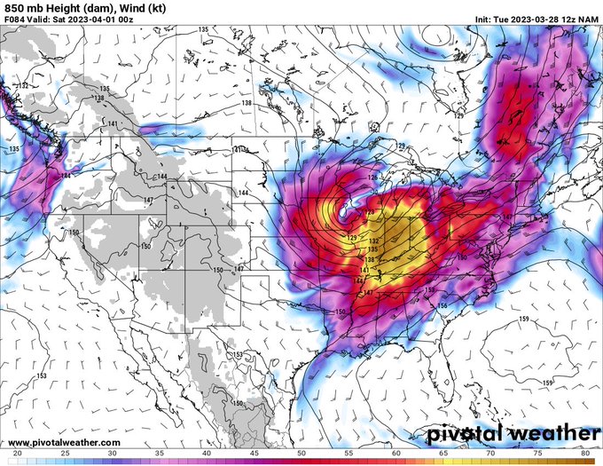
Quite the setups possible in the southern plains next week. My thoughts on the overall setups for Friday (9/22) and Saturday (9/23) are below with some deeper analysis in the graphics below as well. Models used for this is the 12z euro model.
#okwx
#kswx
#txwx
#iawx
#wxtwitter


5
13
55
Powerlines pulled down ahead of us near Randlett due to strong outflow winds. Unsure if these powerlines were down before but there were several power flashes.
@NWSNorman
#okwx
0
12
56
Lot's of intensification ongoing with
#Hurricane
#Idalia
. The Hurricane Hunters have measured a pressure of 968mb's and 125mph winds in the eye wall. Rapid intensification ongoing with
#Idalia
right now.
#HurricaneIdalia
#tropics
#flwx


8
16
56
Nothing better than an LP supercell roaming across the southern plains on a low risk day.
Taken at 5:48pm.
#txwx
#stormhour
Quanah, Texas.

1
7
56


0
17
53


Might have a tornado buried in this rain near Roll, Oklahoma. Had intermittent funnels within the rain along with a ton of sinking and rising motion within it.
#okwx
@NWSNorman

1
10
52
Had a great time seeing a lot of great people today! Finally got to see both dom 3 and dom 1 and talk to a lot of great people! Look forward to the next chase.
#txwx
@PappenheimWx

1
3
53

14
26
51


New tornado on the ground approaching Gaithersburg, Maryland. Take cover now if you live in the path of this tornado!
#mdwx


2
17
48
Thats a boundary ridin'
Tornado producin'
Vio tor existin'
Corn slabber
150 3cape wearin'
Son of a gun

5
6
49


Finally completed a dream I didn’t know I had from when I used to stay up late nights watching
@weatherchannel
tropics coverage and hurricane coverage with landfalls.
Such a surreal experience to intercept the eyewall in Sargent, Texas and record over 100+mph winds.


2
7
49

Alligator spotted on the side of the road enduring 100+mph winds north of Sargent, Texas!
Extremely cool to see!
@ryanhallyall
#HurricaneBeryl
#txwx
0
14
46
over 100mph winds being recorded between Catoosa and Owasso, Oklahoma. Destructive winds, power outages and damage should be expected from this!
#okwx

2
9
47