

Jeremy DeHart
@JeremyDeHart53d
Followers
16,334
Following
399
Media
555
Statuses
2,246
Meteorologist & @53rdWRS Hurricane Hunter. Alum of @NPS_Monterey (M.S.) | @NCState @ncstatemeas (B.S.) | Views do not represent those of the Air Force or DoD.
Joined October 2016
Don't wanna be here?
Send us removal request.
Explore trending content on Musk Viewer
Yankees
• 252294 Tweets
WANG YIBO IN THE GT FINALS
• 189302 Tweets
Presiden
• 140184 Tweets
HAPPY TWENTY FOURTH
• 73130 Tweets
期日前投票
• 59307 Tweets
ルメール
• 53288 Tweets
#菊花賞
• 44685 Tweets
アーバンシック
• 42231 Tweets
OFFROAD IN UBON
• 37581 Tweets
ダノンデサイル
• 34840 Tweets
#スパスタ3期
• 28385 Tweets
Happy Mashujaa
• 27686 Tweets
#虹7th_day2
• 25540 Tweets
gerard
• 23726 Tweets
Gowon
• 22113 Tweets
りんご飴
• 20657 Tweets
KAO WITH BAOJI
• 20213 Tweets
アドマイヤテラ
• 18176 Tweets
ねこあつめ2
• 16541 Tweets
メイショウタバル
• 15262 Tweets
コスモキュランダ
• 14079 Tweets
BINI JOINS IAM HIS7ORY
• 10601 Tweets


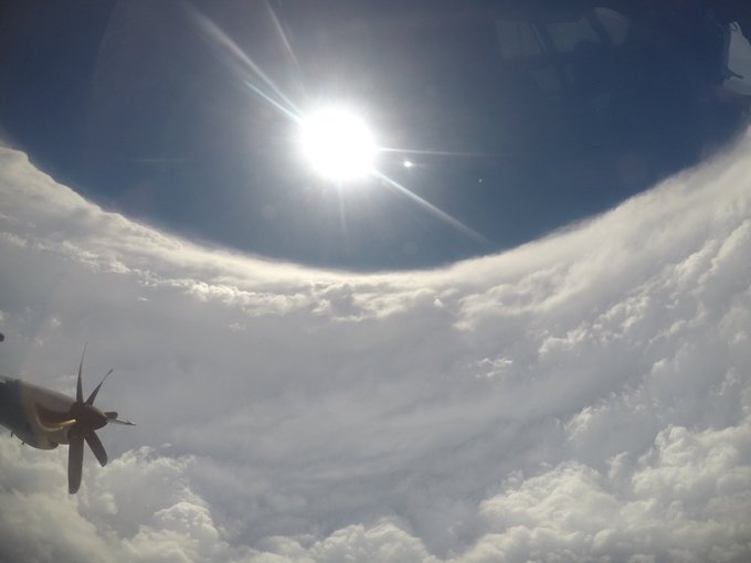
Blood is definitely pumping this morning. Going to watch the sun come up in a Category 5 hurricane.
#Lee


127
210
4K

(1/3)
#Michael
at landfall. The normal "stadium effect" was more like a cylinder, a straight vertical wall 50K ft high. Saw 175 mph flight level winds, ~155 mph at surface. Entered eyewall at 10K ft, ended up in eye down at 8K! Need another tweet to explain what that felt like…
41
529
2K
Can't emphasize enough what a serious situation this is. A category 4 or 5 hurricane with a near perpendicular angle of approach to the surge prone SW Florida coast. The wind and surge impacts are going to be catastrophic near and to the south of wherever
#Milton
makes landfall.


48
416
2K
My crew flew both of these missions. 16 hour day. Fought all kinds of gremlins on multiple aircraft. Traversed the Gulf of Mexico four times. Got the data.
#Helene
is steadily strengthening.


38
154
1K
My goodness. In the last inbound pass thru the SW eyewall, plane was jolted in what was a ~700 ft immediate change in altitude. Then they circle in the eye, probably to catch their breath. Behaving *exactly* like my Michael landfall mission (2018). Intensification likely ongoing.


(2/3) We got our clocks cleaned! On this our last fix, we entered from the S, and (eventually) exited SE. The white flashing in the eyewall is the severe turbulence we just flew thru. The chart tells the story. The wild gyrations in pitch & roll (over 30 deg bank!) were…NOT FUN.


20
120
491
33
431
1K
Don't think I've ever seen a tornado's fury captured on video like this. From lush woods to barren wasteland in 5 seconds. Just terrifying power.

New video - Inside the EF3 tornado next to the fire station at Breckenridge and N. Shackleford in west Little Rock. Mike Bennett and his friend were outside and ran for safety.
165
2K
8K
16
298
1K
Throwing everything but the kitchen sink at
#Idalia
w/10 missions planned over the next ~30 hrs (graphic c/o
@MikeAdcockWx
). Just in time as convection is exploding tonight. I'll be w/TEAL 71 Mon night. 3-hourly fixes begin Tue am…should = near continuous coverage thru landfall.


38
238
1K


Well the shear got to
#Lee
today, so no great eye pics. But, the most impressive seas I've ever seen. This was 1 min prior to entering the SW eyewall, to our 10 o’clock. Note the milky appearance/obscured sfc ✅. Confirmed the 85 kts we had just spiked to on the SFMR. Very cool.


20
136
979
10
153
850
#Milton
is on a path to Cat 5 today. But want to address the "it's supposed to weaken" talk before it even gets out the gate. Regardless of winds at landfall, this 10-12 ft surge is set in motion. Wall of water higher than a basketball hoop. If you're <12 ft of elevation, GET OUT

10/7 4am CDT: There is an increasing risk of life-threatening storm surge from
#Milton
for portions of the west coast of the Florida Peninsula beginning Tuesday night or early Wednesday. Residents should follow any advice given by local officials and evacuate if told to do so.


14
329
665
24
327
808
Tonight's recon plan for
#Idalia
. Tricky mission ahead w/Cuba land interaction & THREE aircraft scheduled to be on station around 00Z. Expecting to find a hurricane. The SFMR (under the well worn leading edge of the wing) will help determine if surface winds are hurricane force.


33
145
737

This is the turbulence I mentioned on Fri. We were outbound to the SW & I had just called the eyewall drop (you can hear the spring release & see the load mouth "sonde away" at start). Pilot said we lost 30-40 kts of airspeed instantly, stall warnings going off, & pulled a few Gs

Sometimes
#Hurricane
flights can get a little bumpy.
Video by Tech. Sgt Nate Calloway, Sept. 8, into hurricane
#Lee
61
519
3K
18
78
550
Onboard Teal 73 about to go check out
#Debby
, but been dealing with some storms on the ground for the last hour. Hopefully we'll be out there shortly.
21
58
515
(2/3) We got our clocks cleaned! On this our last fix, we entered from the S, and (eventually) exited SE. The white flashing in the eyewall is the severe turbulence we just flew thru. The chart tells the story. The wild gyrations in pitch & roll (over 30 deg bank!) were…NOT FUN.
20
120
491
(3/3) As the flight path shows, we made the fix then loitered in the eye for a bit to gather ourselves. The wx officer is usually busiest in the eye, so I had a rare opp to snap a pic and take in the moment.
#Michael
was every bit of the 919mb monster we measured. Unforgettable.


7
102
463
Holy cow it's happening.
@NOAA_HurrHunter
is officially replacing the two P-3s (Kermit & Miss Piggy) with WC-130Js that the
@53rdWRS
flies. Can confirm that it's a workhorse! 💪

Today,
@NOAA
announced that it has awarded a contract to Lockheed Martin Aeronautics, based in Georgia, for two specialized C-130J Hercules aircraft to become the next generation of NOAA Hurricane Hunters -
@NOAA_HurrHunter
Read more:
#flyNOAA

21
180
1K
11
48
450
We normally don't fly these until they get west of 52.5W. So *if* we get tasked,
#TD18
is forecast to be a major hurricane before we'd fly our first mission. Crazy 👀


12
61
424
Honestly shocked by how much I'm seeing this. Had to double check myself several times to make sure I'm not looking at an old cone. This disconnect is *seriously* underselling the direct threat to the Tallahassee metro IMO

I'm confused.
Television stations show the GRAF model making landfall almost 100 miles SE of the official NHC forecast outside the cone.
Is this what we're doing?


267
223
3K
26
43
430
Bermuda, on the way out to this morning's mission into Hurricane Lee. Not a spot we get to see everyday!

5
26
410
Been stuck on night crew flying Lee this week, so a few of us decided to just push through when we got back to St Croix this morning and hike out to some tide pools

10
6
405
It's always cool to get a
@53rdWRS
-
@NOAA_HurrHunter
fly-by in the storm environment. The timing today was impeccable however as TEAL 73 had multiple passes w/NOAA 42 in the eye of Hurricane
#Delta
. Check it out, I've never been able to see them from this close and for so long!
10
91
382

It's staggering to me how much spread there still is in the operational models at just 48 hrs out. I mean we are 2-3 days away & a landfall in either Apalachicola or Fort Myers (and everywhere between) is still on the table. NO ONE in this area should be letting their guard down.


15
78
350


This video was taken during the eyewall penetration in the thread. You can hear the "autopilot" warning repeating in the background meaning the plane is unable to hold heading/altitude and the pilots must fly it manual. Boy did they ever!

First person view of
#HurricaneMichael
and its southern eyewall as it made landfall. Turbulence was the worst the pilot had experienced and he flew through
#Ivan
,
#Katrina
,
#Rita
, and
#Sandy
.
#roughride
@53rdWRS
#eyewall
#michael
@DavidMuir
@ABC
@WGNOtv
@HankAllenWX
#landfall
31
469
986
14
96
335
The islands have beckoned us once again. And not a moment too soon. Missions into rapidly intensifying Hurricane
#Beryl
begin Sunday morning.

11
45
333


Early start from St Croix this a.m. for the
@53rdWRS
TEAL 73 crew. High-fiving
@GBlack22wx
& TEAL 71 crew on way out the door after their surprising upgrade of Hurricane
#Isaias
last night. Why we do what we do! We'll find out shortly if the strengthening trend has continued…

12
30
326


About to go for another run at
#Elsa
tonight. Possible re-upgrade to hurricane. Not excited about the recent convection wrapping around the center or the embedded mesovortices. Plan is for shorter legs than normal due to land proximity so should get plenty of good data tonight.


13
50
314
I grew up in Lenoir (Caldwell Co). I lived and worked in Asheville for years. Western NC is home. I am in shock at how bad the situation is right now. No power/water/sewer/comms. No way in or out. This is not even close to a recovery situation, this is a rescue operation…


#CaldwellCounty
#NC
I am sending this information from our church as a lot of People in Caldwell county have no power, and do not have access to food. Some don’t have access to water.
“CBC: We want to serve breakfast to ANYONE in our community/county that needs a meal. Please
13
529
919
8
74
319
Honestly, this was the first thing I thought of in regards to
#95L
. Florence was an outlier - I remember once it reached 25N, that no storm had ever made a U.S. landfall from that far east. Until it did. Bottom line…it is WAY too early to make assumptions about the track.

Hurricane Florence : a lesson in never assuming anything.
Full archive of the NHC 5 day cone. This was a “guaranteed fish storm” aka out to sea track.
Until it actually goes OTS, we watch them all.
#95L
66
381
2K
4
48
308
With full knowledge of the forecast, are we sure this is even a tropical storm right now? Dry air is just hollowing Beryl out. It is going to take one epic 180 for it to regain hurricane status let alone for the RI some of the hurricane models are starting about 12 hrs from now.
30
29
306
I just so happened to fly the landfall missions of Harvey, Irma, & Michael, as well as the late afternoon pre-landfall of Laura. Which means I am literally flying through the middle of each of these loops. What an absolutely surreal couple of years it has been.

In total, we've had four major Gulf canes in four years.
Though, Irma sticks out as it was weakening at this point.
14
104
338
6
34
290
Hard to understate this. The rate of rapid intensification explicitly forecast over the next few days by NHC ties their record maximum. This is exceptionally aggressive given it's still only a PTC, and shows how seriously they are taking the threat.


9
89
295
Beautiful morning in south MS. Heading out to investigate this little guy northeast of the Bahamas today.
#96L


4
28
281


Not sure where to start from today's
#Laura
recon msn & too exhausted to think about it. Haven't moved from this spot for an hr. Think I'll join the rest of you just taking in this sobering moment. Praying for SW LA & for my
@53rdWRS
@NOAA_HurrHunter
teammates still flying tonite

16
15
264
I know I said it would be more organized, but honestly wasn't expecting a tight 6-mile wide closed eye from a 55 kt tropical storm. 👀
#Lisa
seems poised to intensify rather quickly from this point forward


10
36
256

5
49
256
Wow. What a way to get your final penny.

Beautiful tribute from
@NOAA_HurrHunter
who earlier this evening honored longtime radar scientist and researcher Peter Dodge who passed away in March 2023.
His ashes were dropped in the eye of Category 5 Milton tonight –
PETER DODGE HX SCI (1950-2023) 387TH PENNY

146
2K
9K
5
16
257
What it's like flying across an
#AtmosphericRiver
. You can clearly see the boundaries on both sides…a literal river in the sky! We're continuing to fly ARs off the U.S. West Coast in support of winter season recon operations in the Pacific.
@53rdWRS
2
66
249
Down to 30% now. Worried there could be some complacency with this one due to recent headlines about the lack of tropical activity plus this wave's inability to develop thus far. But…never write-off a surface low in the Bay of Campeche. Don't like this look at all.


9
35
253
I knew I had a lot of flying hours this season, but not this many! This award, named after the squadron's all-time high flier, is presented to the member from each crew position with the most flying hours for the season. Duty, honor, country…and wx data 🫡

18
12
249
Latest VDM just reported an eyewall for the 1st time since
#Beryl
crossed the Yucatan. But…it is still open and is *40 MILES* wide. As has been apparent for the last 24 hrs, this is not a storm ripe for RI. Modest intensification - possibly to a Cat 1 hurricane- is the best bet.


8
50
246
Uh oh. Tonight's
@53rdWRS
mission has unfortunately confirmed this afternoon's satellite trends.
#Beryl
is intensifying again.

Leave it to
#Beryl
to come in way ahead of expectations. Extrapolated pressure is down to 962mb, a full 12mb (!) lower than earlier this afternoon. Could see it possibly rapidly intensify before running into land tomorrow morning

7
50
227
1
66
245
Down to 996mb already.
#Francine
is getting organized, and quickly. Looks really healthy on satellite. Has a very favorable environment for the next 24-36 hours. Have to think that the higher end intensity solutions (Cat 2-3) are on the table.
We got a dropsonde in
#Francine
's center just now supporting the extrapolated pressure. Francine certainly in a hurry to intensify already

6
20
119
7
62
242
Aerial view of
@iCyclone
's summer home of Bay St Louis, MS on a Gulf training flight this evening.

9
10
235


Still in awe of what the planes in the air saw at Ian's peak. Pic on right was SW eyewall after Garrett's crew got slammed down 1200 ft. Look at those eerie "fingers" sticking out into the eye. Just a wall of mesos. And impossible to see heading inbound bc of attenuation. Insane.

A couple of radar shots from the eye of
#Ian
on this mornings early flight (approx. 6-8am Eastern).Not the most photogenic eye, but it was quite the ride.Unfortunately another rapidly intensifying land falling hurricane.I hope everyone in Florida was prepared and is staying safe.


3
5
83
4
45
220
Rough ride today into now-Hurricane
#Sally
. "Pulsing" eyewall trying to wrap from E-W. Tough to fix w/the unexpected NE jog, crazy wind shifts & a LOT of clear air turb. All indicative of RI. ~50 kt increase in 4 hrs def qualifies. Keeps upper end intensity in play. Not good.😕


4
60
219
We just have to continue to grind and *fly this day-after-day 😅 Lee may not have the eye-popping Cat 5 structure anymore, but it is kicking our rear ends. The opposing forces of shear with all the other ingredients for intensification do not equal a pleasant flying experience.

Hurricane Lee has weakened significantly due to moderate wind shear. Latest forecast models still show the slow curve north next week. We just have to continue to grind and watch this day-after-day, especially for folks in Nova Scotia.

27
109
735
9
24
212


Heavy recon plan for
#Francine
for the next 48 hrs. With NOAA 49 already in the air and both NOAA 43 & TEAL 73 expected to takeoff in the next hr, should have 3 planes in the storm this evening. Then 3-hourly fix requirements starting Tue evening thru landfall.


8
59
215
Can't stop watching this. Imagine chasing a storm and this happens right on top of you. Listen to
@ReedTimmerAccu
frantically shout about deviant motion and rapidly changing wind direction. This is what he was contending with in real time.

Intense large
#tornado
Cole, Oklahoma. Deployed subsonic sensor for infrasound. 4 homes damaged
596
3K
12K
3
20
200
Took off at same time, flew 2000 miles apart, and back at the same time! TEAL 73 queued up behind TEAL 72 for the bird bath after a long day of flying

Busy day today! We currently have two crews flying. One is on its way to Hurricane
#Genevieve
and the other to
#TD14
in the Western Caribbean ✈️⛈🌪🌊
#WeatherReady
#ReserveReady
#ReserveResilient
#Coast2Coast
#wx


7
75
259
5
20
186
Shout-out from NHC on the value of aerial recon. I have arrived to a storm & been surprised by the intensity, but nothing like this. Expected a marginal hurricane, found a Cat 3! Reminiscent of the stories I've heard about flying into Patricia ('05), in the same part of the world


5
36
187
From today's
@53rdWRS
mission, you can clearly make out the northern and southern boundaries of the
#atmosphericriver
approaching CA as we transited across its core heading toward the SE. This is tonight's prelude to the larger AR expected to impact the West Coast Sun/Mon.


2
42
181
The Europeans know how to do hotel room coffee. Up and at 'em early this morning to fly the Puerto Rico landfall mission. Expectation is to find
#Fiona
as a hurricane at some point today


10
24
182
Just got the "go" call for today's
@53rdWRS
invest mission into
#90L
, so it's happening. Could become Wilfred today. No chill in the 2020 season

Special Outlook issued: A low pressure system over the southwestern Gulf of Mexico has become better organized and it is expected to become a tropical depression or tropical storm later today. For more information visit

15
294
626
4
37
177


I've been on invest missions that are more impressive than this. Despite satellite presentation, convective bursts, center reformations, etc.,
#Elsa
is not looking very healthy at all

6
26
169
@EthanClarkWX
Seen a lot of people sharing your FB weather page updates. Keep it up Ethan, you're doing life-saving work
2
7
171
Just realized that car was in the garage.


4
25
169
Other than a few extra clouds and showers on St Croix, you'd have no idea that a Category 5 hurricane was just over 200 miles away.
#Beryl
0
8
170
We were at 5000 ft and NOAA 42 was at 10000 ft, transiting through the center of
#Henri
at the exact same time on Friday evening. 2nd time I've seen this in the last two seasons! Appreciate
@TheAstroNick
for refraining from dropping a sonde on us. 👊
Fancy seeing you here 👋
One of our crews crossed paths with a
@NOAA_HurrHunter
yesterday in
#Henri
. Check it out. (c/o Maj. Jeremy DeHart)
#ReserveReady
7
68
437
2
18
166
Officially tagged to go investigate
#97L
tommorow. We always get amped up to fly the stronger storms, but my inner meteorologist actually favors invests. The surprise wind shifts, the constant streamline analysis…makes us ARWOs live up to our "mission director" role. I love it!
6
22
165
There will be one more fix mission tonight to determine if these satellite trends are translating to a strengthening (or no longer weakening) hurricane. Then a 12-hr down time while
#Beryl
is over the Yucatan (NHC has already canxd Fri am) with missions picking back up Fri night.


The satellite presentation of
#Beryl
has definitely continued to improve this afternoon, and MW imagery suggests the core has gotten better organized again. It will be interesting to see in recon data if that results in the weakening trend seen earlier today stopping/reversing.


4
27
186
5
30
162
Heading out for the third of 3
@53rdWRS
winter storm taskings. This one will go the furthest north of the 3. Dropsonde data will be fed into tonight's 00Z model runs, fine tuning output from the GFS, Euro, etc. One last round of sampling to help nail down that rain/snow line! ❄️


4
26
160
Wild stuff tonite from Hurricane
#Delta
. 1st fix: elliptical eyewall, confirmed hurricane force. 2nd fix: eyewall collapsing, psbl new tight eye forming, winds stronger but erratic. SLP dropped ~10mb! 1st time using Remarks section in VDM.
@EricBlake12
pics of what we discussed⬇️


1
29
159
Hurricane hunters look at their schedule & try to stay a little ahead of the game. Been looking for that glitch in the matrix since the ERC last night…when will that westerly shear start taking its toll? But cloud tops just keep on cooling and
#Beryl
just keeps on strengthening
2
21
159

Exact example of what you do NOT want to fly through when penetrating the eyewall.
I bet there is a wedge tornado with this supercell structure in the northeast eye wall of Hurricane Francine

20
60
926
2
12
157
Short vid from the eye of Hurricane
#Lane
today, SE of Hawaii. Only time for a quick peek before getting back to work to find that center fix, but incredible!
3
58
148


NE eyewall of
#Lee
: 148 kts at flight level, 144 kts at the surface via the SFMR. Basically a 1.0 reduction rate from the 10K ft flight level to the surface, a trend we have seen with basically every Category 5 hurricane in recent memory (e.g. Irma, Maria, Michael, Dorian).


6
29
148
#Ian
still looking rather healthy as it emerged offshore today, & is now explicitly forecast to regain hurricane strength before a 2nd U.S landfall in SC on Fri. 3 extra recon flights are sked next 24 hrs to catch it w/1st takeoff @ 5pm ET tonight (deleted prev post for clarity)


5
47
147
Plenty of weather action even between flights. Waterspout off of St Croix
4
10
149


#Grace
looked & felt like a hurricane today. Got a rare visual of the 65 kts (hurricane force) we saw on the SFMR. Chart is for 1500 ft so have to extrapolate for 5000 ft, but sea surface is consistent w/what we'd expect. So…here's what a hurricane looks like from the air! (1/2)


2
26
146
.
@ReedTimmerUSA
out here literally creating terms for the Glossary of Meteorology. "so-called 🦍 hail"
5
12
145
Found Hurricane
#Lidia
to be a tightly wound, surprisingly potent Category 3 (now Cat 4) hurricane. The NW eyewall was lit up like a Christmas tree with severe turbulence and mesovortex features. This is going to pack a major punch in western Mexico tonight.


1
31
140
Flew the landfall mission of Hurricane
#Harvey
exactly one year ago today. 938mb dropsonde found storm strengthened right up thru landfall. WC-130 also served as comm relay for mayday calls to Corpus harbormaster. Most humbling, memorable flight to date.
@TropicalTidbits


5
57
140