
Francisco Rowe ✌️
@Fcorowe
Followers
3K
Following
43K
Statuses
7K
Human Mobility & Migration • Geographic Data Science • Spatial Inequality l Lead @geodatascience/@livunigeog l @qmrg_rgs_ibg Chair | @REGION_ERSA Editor
🇨🇱Born🇦🇺Citizen🇬🇧Residnt
Joined January 2013

Exploring the travel-2-work origin-destination data at the LTLA level from the E&W 2021 Census. An intriguing pattern: 23% of all flows take the value of 1 (ie 1 person living and working a different LTLA). 48% of 1-3, but there is none 0 flows. Any ideas why? would expect zeros

0
0
1
RT @socarxivpapers: #SocArXiv: A Long Short-Term Memory Forecast of sub-National Population Change Across Europe
0
2
0
RT @geodatascience: 🌍 #30DayMapChallenge 🗺️ Day 25: Heat Giada Garofani has created a dashboard with a heatmap showing paramiltary attacks…
0
2
0
RT @geodatascience: 🌍 #30DayMapChallenge 🗺️ Day 22: 2 Colours Green 🟢 and blue 🔵 spaces within each of the cities that @jamesfmurphy95 has…
0
2
0
RT @geodatascience: 🌍 #30DayMapChallenge 🗺️ Day 16: Choropleth Women are leading international student mobility, yet gender gaps persist @r…
0
4
0
RT @geodatascience: 🌍 #30DayMapChallenge 🗺️ Day 15: My Data @mattgmasn uses @openstreetmap data to create a minimalist map of his home town…
0
3
0
Great opportunity 👇 working with a great team!

We are hiring a postdoc at my group (SUNLab) @NUnetsi. Interested in working on multidisciplinary problems like segregation, health, or economic growth from the perspective of Social Urban Networks? Contact me if you are interested. Please share it!

1
2
4
RT @MPIDRnews: Are you a #student who is interested in #Demography and #DataScience & you have no plans for ☀️#summer 2025 yet? Look no mor…
0
29
0

RT @Fcorowe: Want to know a bit more on how we use geography, data science & data at @geodatascience to study cities 🌆? Got you covered.…
0
4
0
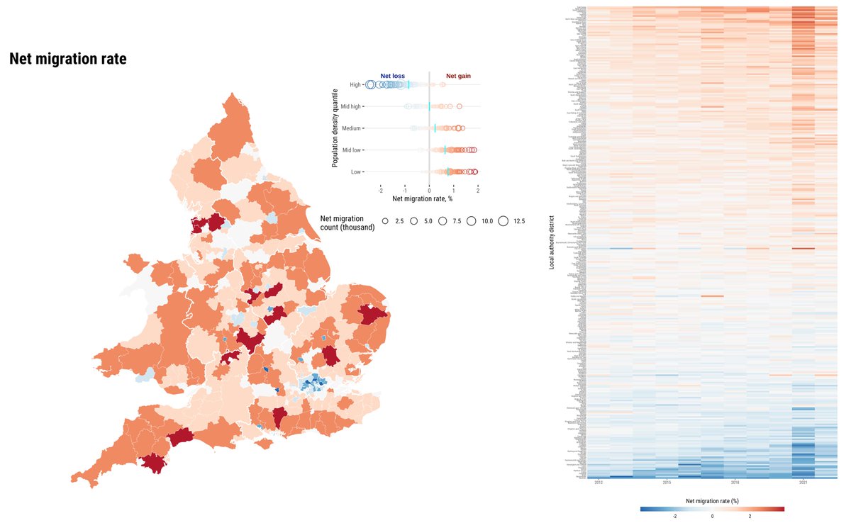
Analysing the spatial patterns of internal migration in the UK during the pandemic based on @ONS population estimates. We have done this using mobile phone data. These data combined offer a more complete picture of long-term & temporary moves:

🌍 #30DayMapChallenge 🗺️ Day 12: Time and Space @fcorowe maps changes in the net balance of internal migration flows within E&W. The map shows net balances in 2019-20 during COVID. The heatmap displays the long-term trajectory #migration
0
3
19
Want to know a bit more on how we use geography, data science & data at @geodatascience to study cities 🌆? Got you covered. We have a video for you 👇
0
4
11
The PDRA will be working with me, to develop a set of novel area-level indicators to characterise key dimensions of the social environment. What is important is to have experience and enjoy working with quantitative spatial data 🗺️
0
0
2
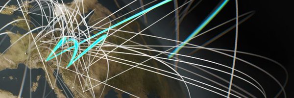
Today wis the day of an AI-assisted map. I had a play with Dall-e. Here the results 👇#30DayMapChallenge
🌍 #30DayMapChallenge 🗺️ Day 9: AI Only Two AI-generated maps using a prompt to create a flow map of people displaced by global disasters by @Fcorowe
#AI #DallE #AIMapping #AIGIS


0
0
4
RT @geodatascience: 🌍 #30DayMapChallenge 🗺️ Day 6: Raster Mapping the rural-urban hierarchy in Ukraine using data from the Global Human Set…
0
7
0
RT @Fcorowe: REMINDER: Last week! Apply for our Postdoctoral Research Associate to join @geodatascience. Apply Dea…
0
8
0
RT @an_panori: 📢@Tasos_Kitsos and I are guest editing a special issue in Region, @ERSA_org's free, open-access journal. ➡️#Digital disrupt…
0
12
0