

michael GOULD (@mgould.bsky.social)
@0mgould
Followers
11,469
Following
3,098
Media
8,154
Statuses
68,990
GIS professor and Global Education Manager at Esri (opinions my own). #travel #mountainbike #internationalDev #GIS #Spain #sarcasm
Back on the road
Joined June 2009
Don't wanna be here?
Send us removal request.
Explore trending content on Musk Viewer
برشلونة
• 789514 Tweets
John Kelly
• 299216 Tweets
Trump is Hitler
• 295711 Tweets
Bayern
• 291037 Tweets
Barcelona
• 255455 Tweets
Raphinha
• 213616 Tweets
Peñarol
• 78770 Tweets
Megan
• 77206 Tweets
Lamine
• 58948 Tweets
Casado
• 58818 Tweets
Pedri
• 50127 Tweets
Hansi Flick
• 36668 Tweets
Lewandowski
• 35803 Tweets
Fermin
• 35475 Tweets
Lille
• 33671 Tweets
Haaland
• 31060 Tweets
Neuer
• 27214 Tweets
$TSLA
• 26233 Tweets
Hatch Act
• 23943 Tweets
Nunez
• 22890 Tweets
Brest
• 22034 Tweets
Kompany
• 20147 Tweets
#ChampionsLeague
• 19878 Tweets
Xavi
• 19076 Tweets
Muller
• 17013 Tweets
Atleti
• 16694 Tweets
رافينها
• 16018 Tweets
Harry Kane
• 15279 Tweets
البايرن
• 15248 Tweets
Benfica
• 15246 Tweets
#FCBFCB
• 12972 Tweets
Feyenoord
• 12574 Tweets


My masters student Nnadozie gave a complete thesis defense and is now ready for employment or a PhD offer.

53
352
2K
@ianbremmer
there's just something special about "visiting California" rather than "the US"
13
12
696
Baby Siena dropped yesterday. You can call me abuelo. Just once though.

34
0
166
My wife in supermarket: that wine any good?
Geographer: don’t care

8
11
155

Have you tried the Sentinel-2 landcover explorer??

6
16
99

Now being added at no extra cost to University Institutional Agreements: ArcGIS Drone2Map Standard, ArcGIS Image for ArcGIS Online, ArcGIS Knowledge, and ArcGIS Workflow Manager Server - Advanced.
6
14
96
Our colleague Abbey published a fantastic tutorial outlining three types of machine learning, for downscaling
#climate
models. Check out the notebook.
0
23
95
My wife asked why did I choose those bottles but most of you know.

11
2
94
Educators: if you are not using (abundant) sports examples of applied Spatial Analysis, you are missing a big opportunity. Kids eat this stuff up.

2
32
91
Very sad news: the GIScience world lost another giant. He was my PhD advisor and a good friend of our family. RIP David. david mark buffalo - Google Search
16
9
91
Extending the Segment Anything Model for geoAI, including SAMLoRA.

0
16
91
Great job, Esri South Africa!! Just saw this.

0
11
87
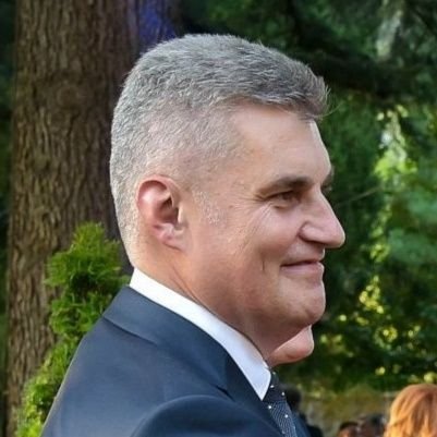
Ready for a new decade. Enjoying life and not taking things too seriously.

22
1
83
Run the trained model (SAM) in 3 minutes on desktop...

1
15
79
Free course: python libraries for spatial data science.
0
25
78
Message from the GIS community to high school students: take Geometry class seriously! It does have practical applications for solving important problems. (Oh, and start programming....)
6
12
75
Living with normal people is weird. Daughter saw my stickers and guessed it meant “shrimp”, wife guessed “shopping”.

6
18
74
Yesterday Siena turned 1 month. Grampa told her about FAIR data principles and she nodded right off.

4
1
71
Jack Dangermond interview from 30 years ago. What a hoot.

2
24
67
Spent the past 24 hrs on/off waiting outside ICU after wife’s lung operation. Keeps one thinking about life’s priorities.
28
1
61
So proud of all the Esri people working overtime to help 2800+ organizations that requested help with their response to the COVID-19 pandemic. 💯
1
7
61
When we said let’s take a group picture with jack that’s not what we meant.

3
4
63

Thanks (Shukran) to UAE University for hosting me and my colleague Kiran. Faculty and students (mostly female) had some good questions regarding modern GIS and geodata.

3
3
62
I had a Gaussian joke but only normal people liked it
4
1
58
End of an era: Charlie Fitzpatrick who started Esri's schools program 30 years ago...is retiring. That's him on the right, not wearing his Lake Wobegon hat for some reason. Thanks for developing capacity in a whole generation of educators.

4
4
57
Remote sensing yesterday: Jersey City and lower Manhattan.

0
3
53
ArcGIS for Microsoft Planetary Computer – FAQ
1
7
54
Big news if you study/map or just are interested in urban heat and its impacts.

1
17
55
Oh my, terrible news that
@jarlathond
suffered a fatal heart attack skiing. Big loss for our Geo community, VT friends, colleagues, students… RIP
15
7
51
Combine your R and ArcGIS skills using the R-Bridge. All the details here:

2
20
48
I thought he was on my Phoenix flight yesterday but it was just a similar looking 7-footer


3
2
43

My wife keeps telling me to stop buying map books. Oops.

9
2
45

Next week I'll be talking about this climate and agriculture (predicting crop yield) example by my colleagues. This is basically a masters thesis, done in a few days (when you know where to find data and which methods to use).
1
7
45

RT
@zanne2
: Massively inspired by
@iamwill
@nesta_uk
Be a leader of YOUR community
#grandchallenges
story about ESRI maps and kids -wow
0
7
34
Minister of presidency and environment in his welcome: “geeks might be antisocial, but they are socially conscious “
#foss4g2018

2
14
43
Oh my, GIS students: I was just made aware of a new $100 registration fee for attending the entire Esri User Conference in San Diego. Not a better bang for your career-buck.
3
14
41
Looking forward. Aimed at cities and their local universities!

Learn simple GIS workflows for identifying and analyzing urban extreme heat with Michael Gould and Joseph Kerski!
March 28 @ 11am PT
Part of URISA's Climate Change and Community Resilience webinar series:
More in the series:

1
17
67
1
11
43

Today is my 10th anniversary with Esri. Wow, what a ride so far !!!!
2
0
42
Siena is home and sleeps like… a baby.
#abuelophotos

Baby Siena dropped yesterday. You can call me abuelo. Just once though.
34
0
166
5
1
43


0
7
43
It was an intense morning in the office. Optimistic outcome (see the smiling faces)

2
0
41
Ok, first day out (in 46 days?) and up the mountain.

4
1
40
I am on duty for the next hour while mom is at Dr appointment.

0
0
40

Important new position announced today. Senior Climate GIS Engineer Job | Esri Career Opportunity
2
19
40
Today I started my intro GIS lecture with Simon Sinek’s “Start with why” TED talk. Why was GIS invented? Why do we work with GIS? Back to basics.
2
6
40
Mom’s 80th and parents’ 60th anniversary party in Mass.

3
0
37
did you know.. that to drive from Spain into Gibraltar you need to cross the airport's live runway? they lower barriers when a plane is landing/taking off :)

8
4
39

Remote sensing. San Diego harbor and Coronado.

3
2
39
Some of the Esri Young Scholar Award winners got a Jack pic (or was it other way round?) at the map gallery.
#esriUC2023


0
2
39

Archives: that day in 1998 when the Pope took in a small dose of GIS

3
12
35
The Institute for Geoinformatics (ifgi), University of Münster, is searching to fill the position of Professorship (W2) in
Geoinformatics for sustainable development. Application deadline Sept 30.
0
27
38
New free ArcGIS Pro lesson: Analyze COVID-19 risk.
0
17
37
The famous UC 18000 people in the hall for a 20-minute coffee break. Jack says be back in your seat in 20, hah ha.
1
0
37


I am working from on the East coast for a bit. Just did the 7:30 feeding (grand daughter turns 1 on Wednesday!) now back to the Teams calls.

4
1
37
Ha, guy just contacted me via LinkedIn to offer "my startup, Esri" financing advice. Good research, dude.
4
0
33
@SharonElizaDC
I remember once a college-age backpacker kid with white Rasta hair went ahead of me and the agent asked if he was traveling for business. The kid paused, but didn’t fall for it.
1
0
35
So, my mom was operated on yesterday for breast cancer. (She did super.) Sister last year (she had it tougher). Wife 12 yrs ago. Future is cloudy for our 2 daughters.
#cancersucks
8
0
36
2019 was another fascinating year as my Esri work took me to meet education officials, professors, students in India, Wash DC, Philippines, Hong Kong, Cyprus, Portugal, Mauritius, South Africa, Rwanda, Finland. So many great GIS people out there.
5
1
36
I am pleased to have been invited to join the editorial board of the journal Transactions in GIS.
3
0
35
Africa Parks is hiring a GIS lead.
2
14
32

Esri 2020 User Conference (13-16 July) already has > 32k registrants from 171 countries. Join the event here
1
13
35
Usual story: arrive to UC hotel, wow nice view. Then don’t see it again for 6 days… We’ve got a conference to run.

4
0
34
Looking for a GIS research topic? Try heat. Lots has been done but still, more GIS solutions, apps, datasets, best practice guides needed.
1
9
34
Nice to have been able to celebrate (early) Father’s Day with my dad. Yes, he finished all that cake.

1
0
33
you are highlighting a key distinction: not a map of trees, a map of where people decided to register trees.

OpenStreetMap has nearly 21 million individual trees mapped all throughout the world, but that data is highly localized and unevenly mapped.
I was curious to see which countries have mapped more trees than we might expect, so decided to try comparing trees to area.

10
21
117
4
2
34
Looking back on 2022, I was fortunate to have worked with
@esri
customers and colleagues from countries including Ghana, Chile, Lithuania, Israel, Sweden, Oman, Australia, Ethiopia, Kenya, Uganda, Tanzania, Morocco, Japan, Argentina, Netherlands, ...🥰
5
1
34
Virtual graduation ceremony and activities, ErasmusMundus Master in GeoSpatial Technologies. Congratulations to the grads. You are all stretched out now ;)

4
4
32
GitHub - opengeos/maxar-open-data: The Maxar Open Data STAC Catalog in CSV, GeoJSON, and MosaicJSON formats
0
10
32
Today's the day!! The launch of Esri's free Climate Action MOOC. Even if you don't plan to do all the lessons you should register to watch the inspirational videos. In week 1, a conversation between rockstars and Drs Katharine Hayhoe and Dawn Wright.
2
9
33
Birthday weekend starting. You only turn 40 once. In my case many years ago 🤪

4
0
33
Visit the Living Atlas to discover Landsat Level 2 data, then in Map Viewer zoom to location and use the Surface Temp processing template. Also filter by acquisition date, cloud cover.

0
10
33
It’s going to be a fantastic 2020 for both of my superstars

2
0
31
Mom had 2nd round of cancer surgery early today. Came home and had lunch, dessert first. hell yeah.
6
0
32
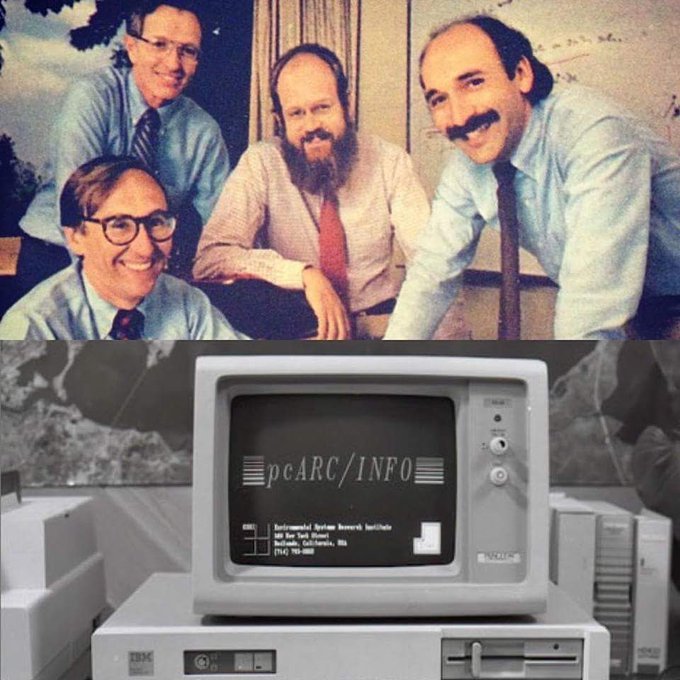
all four guys still work at Esri :)

1
1
32
Sunset views of the Danube, from the tallest building (and rooftop lounge) in Austria.

3
0
32
