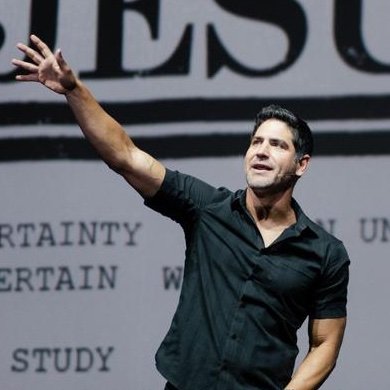
Phil Ferro Profile Banner
Phil Ferro Profile
Phil Ferro

@PhilFerro7

Followers
13,834
Following
728
Media
12,634
Statuses
33,924

2 x Emmy Award winner. Chief meteorologist for WSVN Fox 7. Keeping an eye on the sky, to keep you away from severe weather.

Miami / Fort Lauderdale
Joined June 2009
Don't wanna be here? Send us removal request.
Explore trending content on Musk Viewer
@PhilFerro7
Phil Ferro
1 month
Beryl is not only strong but also large. It's 502 miles long and 376 miles wide. Compare that with Jamaica that's only 146 miles wide... it may be difficult to find good shelter. Hoping for the best for our Jamaican friends.
Tweet media one
30
562
2K
@PhilFerro7
Phil Ferro
1 month
I am hoping this is wrong. I am hoping it's an error from the Recon data. Lets see what NHC says at 11 pm. Wishing only the best.
49
144
968
@PhilFerro7
Phil Ferro
4 years
The Erratic Path of #Eta . A look back at its path from development thru Wednesday the 11th.
15
250
575
@PhilFerro7
Phil Ferro
5 years
Dorian has now gone stationary. More misery for NW Bahamas.
Tweet media one
26
261
492
@PhilFerro7
Phil Ferro
7 months
Another view of Broward Tornado.
9
131
509
@PhilFerro7
Phil Ferro
5 years
I want to thank my team, the Miami Heat for their support during my surgery recovery. Without their encouragement, my comeback would be even harder. I return to wsvn today, first behind the scenes and hoping for on-air by March. Happy new year!!
Tweet media one
43
25
351
@PhilFerro7
Phil Ferro
4 years
I want to say thank you to the @wsvn family for encouraging me to stay home during this covid-19 threat. After all I’ve been through, we don’t need to add this bug. Now taking time to read & review all storm season material.
Tweet media one
31
10
355
@PhilFerro7
Phil Ferro
5 years
Hurricane Humberto reaches major hurricane status as of 8 pm advisory.
Tweet media one
38
211
326
@PhilFerro7
Phil Ferro
5 years
EXTREMELY DANGEROUS DORIAN REMAINS STATIONARY AND CONTINUES TO POUND GRAND BAHAMA ISLAND... Hazards: - Wind Gusts to 170 mph - Storm Surge 12 to 18 feet above normal tide levels with higher destructive waves These hazards will continue over Grand Bahama Island through tonight
Tweet media one
5
207
314
@PhilFerro7
Phil Ferro
4 years
I am so happy to tell you that I'll be back on-air starting Monday, March 2nd! At first with Belkys & Craig at the 10 & 11 pm newscasts then later w Jeff & Lynn. Thank you Brent, Vivian, Erika, & Jessica for all your support. Can't wait to return. I look forward to seeing you!
Tweet media one
Tweet media two
58
20
335
@PhilFerro7
Phil Ferro
5 years
What is that? I’ve got teenage kids, a wife, mortgage, an elderly parent, and this Storm. I sleep in the shower.
17
36
322
@PhilFerro7
Phil Ferro
5 years
What did I get for Christmas? Spending a wonderful time with my father. Thanks Santa!
Tweet media one
24
6
299
@PhilFerro7
Phil Ferro
2 months
Double rainbow at the Beach in Miami-Dade County!
Tweet media one
16
30
283
@PhilFerro7
Phil Ferro
5 years
Great view of Humberto's center spin. NW Bahamas may see heavy rain w gusty winds over 39 mph. For now the worst of the storm is in the Eastern Semicircle. Dry air & shear on western side keeping it in check for the moment. Bahamas keep monitoring. @7Weather
18
130
241
@PhilFerro7
Phil Ferro
4 years
Thank you so much for the article. I am excited to be back on air. Thanks to all the supporters who offered prayers, well wishes and good vibes... they all helped in my recovery.
@SunSentinel
South Florida Sun Sentinel
4 years
After overcoming second bout with cancer, WSVN chief meteorologist Phil Ferro returns to air
Tweet media one
2
19
146
22
23
260
@PhilFerro7
Phil Ferro
5 years
I hope this is a mistake-reading by hurricane hunters. Strongest winds detected as 8:30 pm now up to 167 mph. That would make it a category 5.
Tweet media one
17
137
235
@PhilFerro7
Phil Ferro
4 years
A friend is hanging up his mic after 4 decades in tv. He welcomed me with open arms when I arrived at wsvn & always pitched-in during hurricane coverage. Great sports anchor, wonderful sense of humor, & above all an incredible human being. I wish Steve Shapiro only the best.
Tweet media one
8
19
248
@PhilFerro7
Phil Ferro
4 years
My father in Cuba at age 17. He is my rock. Wishing him and yours a Happy Fathers Day.
Tweet media one
6
2
239
@PhilFerro7
Phil Ferro
5 years
So FL, you are NOT in the cone of concern. This means no direct strike is expected. We may still get some heavy rain at times, with moments of strong winds around 40 mph. Choppy seas, beach erosion and rip currents. An isolated tornado is possible.
Tweet media one
12
129
222
@PhilFerro7
Phil Ferro
5 years
I'm being asked. "Who named Humberto?" The World Meteorological Organization picks the names & should represent the languages in the Atlantic Basin. They're English, Spanish, French & Dutch. Names are repeated every 6 years unless its a destructive storm, then the name is retired
Tweet media one
7
57
213
@PhilFerro7
Phil Ferro
3 years
The moon and Jupiter. Side by side.
Tweet media one
6
45
211
@PhilFerro7
Phil Ferro
6 years
Hurricane Chris is now a category 2, and expected to remain this way until Wed. Night. This storm is a huge worry for the shipping lanes. It should stay away from all land masses. @7weather
Tweet media one
14
104
190
@PhilFerro7
Phil Ferro
1 month
Waves are starting to rise in Jamaica. By tomorrow they could be as high as 20 feet.
5
81
195
@PhilFerro7
Phil Ferro
2 years
Check this out. Classic #metroDade police vehicle spotted on my walk. Looks like a movie prop.
Tweet media one
10
11
191
@PhilFerro7
Phil Ferro
4 years
update Isaias is now a hurricane
Tweet media one
7
145
184
@PhilFerro7
Phil Ferro
1 month
This is not good news. Recon just reported 158 mph winds with Beryl. If it is confirmed, we may have a Cat 5 on our hands by 11 pm. NHC will tell us by then.
7
43
190
@PhilFerro7
Phil Ferro
1 year
Sign of the Times. Four half filled bags… 💵$75💵😳😳
Tweet media one
64
14
187
@PhilFerro7
Phil Ferro
2 months
Forgive me for diving into the sports realm but…. Panthers win! The Panthers win!!
Tweet media one
6
15
188
@PhilFerro7
Phil Ferro
5 years
This is why the @MiamiDolphins will always be my home team. Today I received all sorts of Fin’s gear supporting me in my fight against cancer. Thank you Dolphin’s communications team and @TackleCancer
Tweet media one
4
26
173
@PhilFerro7
Phil Ferro
7 years
Meet the newest meteorologist for SVN. Baby Emma. Born to Vivian Gonzalez & husband Jorge. All are doing fine.
Tweet media one
16
16
164
@PhilFerro7
Phil Ferro
7 years
#Irma is the strongest hurricane on record in the Atlantic Basin. Sustained winds near 180mph.
Tweet media one
7
163
155
@PhilFerro7
Phil Ferro
7 years
This is now the strongest hurricane on record in the Atlantic Ocean.
@PhilFerro7
Phil Ferro
7 years
Here is the latest forecast track on #Irma
Tweet media one
1
16
13
3
166
150
@PhilFerro7
Phil Ferro
3 years
Flooding on Biscayne Blvd & 23rd Street in Miami Dade. The area is under a Flash Flood Warning
15
108
158
@PhilFerro7
Phil Ferro
5 years
We need more of this.
4
34
153
@PhilFerro7
Phil Ferro
5 months
Brightline bound to cover the Hurricane Conference in Orlando. I’ll be posting stuff as I learn about it.
Tweet media one
17
2
156
@PhilFerro7
Phil Ferro
4 years
Not what you want to see. Two recon planes, USAF Hurricane Hunter & NOAA High Altitude. USAF has detected Cat 5 winds of 158 mph. We will see what NHC says at 11 pm
8
71
145
@PhilFerro7
Phil Ferro
7 months
Extended Broward tornado video.
8
45
153
@PhilFerro7
Phil Ferro
4 years
If you see the moon. Look further up and you will see what looks like an orange star. That’s Mars. It’s the closest it will get to earth in its orbit around the sun. Won’t happen again until 2035.
Tweet media one
7
40
150
@PhilFerro7
Phil Ferro
2 years
A Celestial Event will take place Sunday Morning. The moon & 5 planets will line up in the sky. Enjoy
Tweet media one
3
48
145
@PhilFerro7
Phil Ferro
4 years
1st #Supermoon of the year. So called because its 13% closer than normal & 30% brighter. Its also known as the #wormmoon . That because folktales say when this would happen, worms would come out of the ground signaling spring is near.
Tweet media one
4
43
136
@PhilFerro7
Phil Ferro
7 months
Possible Broward tornado
2
41
140
@PhilFerro7
Phil Ferro
3 years
Gorgeous sunset
Tweet media one
2
4
138
@PhilFerro7
Phil Ferro
4 years
11 pm Cone on new Tropical Depression 13
Tweet media one
12
64
129
@PhilFerro7
Phil Ferro
3 years
Thank you for the kind words
@BillyCorben
Billy Corben
3 years
I’m so sorry @PhilFerro7 . May their memory be for a blessing. #RIP
3
11
125
20
1
129
@PhilFerro7
Phil Ferro
5 years
Latest EURO models shows a cat 4 system anywhere across the NW Bahamas, & between Palm Beach, Broward & Miami-Dade counties. Not much difference now between GFS & EURO.
Tweet media one
13
93
128
@PhilFerro7
Phil Ferro
1 month
11 pm Tuesday Advisory: Thankfully, NHC keeps Beryl at 150 mph, a category 4. This is a very dangerous hurricane. All preps should be finished in Jamaica. Overnight the first squally weather will start to move in and winds to pick up.
4
75
130
@PhilFerro7
Phil Ferro
19 days
Hi folks. My apologies for not responding to posts but was out of town at my youngest’s graduation from Edinburg University in Scotland. Such a beautiful place. Now back to the weather on Thursday.
Tweet media one
Tweet media two
Tweet media three
28
4
128
@PhilFerro7
Phil Ferro
3 years
My almost 90 yr old dad got his first vaccine today. Thank you and all volunteers. In and out in under 90 min. So much gratitude.
Tweet media one
10
1
126
@PhilFerro7
Phil Ferro
7 years
Cone only forecasts where eye will be. Storm is 400 mi wide. Even if eye on west side. East coast to feel impacts.
Tweet media one
10
137
122
@PhilFerro7
Phil Ferro
4 years
What a beautiful sunset!!
Tweet media one
4
13
121
@PhilFerro7
Phil Ferro
4 years
11 pm Potential storm 9 cone. The path has slightly shifted a bit southward across the Islands. So FL still in the cone
Tweet media one
14
70
114
@PhilFerro7
Phil Ferro
9 months
Flash Flood Warnings extended in Broward & Miami-Dade thru 6 am Thursday!
4
52
123
@PhilFerro7
Phil Ferro
3 months
The Starliner Launch will take place this evening at 10:30 pm from Cape Canaveral. If the clouds cooperate, South Florida may see it about 4 minutes later, 6 minutes for the Keys
5
31
124
@PhilFerro7
Phil Ferro
5 years
Nothing is 100% perfect with Mother Nature. With a beast this strong we should monitor carefully.
@EdwardFrancoTV
Edward Franco
5 years
@PhilFerro7 @wsvn Why do forecasters expect this almost 90 degree turn north before the coast of Florida? Is there a chance for Dorian to not turn? #hurricanequestions
1
2
7
5
37
120
@PhilFerro7
Phil Ferro
3 years
Debuting today. New set of eyes.
Tweet media one
12
5
117
@PhilFerro7
Phil Ferro
5 years
Here is the satellite view with the track showing the turn north. Hoping this is the expected turn and not just a wobble.
Tweet media one
14
69
114
@PhilFerro7
Phil Ferro
4 years
It's 2020. You are not seeing things, Tropical Storm Paulette has returned from the Dead. The last time a system dissipated and the redeveloped was Ivan in 2004.
Tweet media one
6
41
109
@PhilFerro7
Phil Ferro
1 month
11 pm Tuesday Beryl Cone: Near the water view. It is not forecast to weaken that much. Winds should remain at cat 4 strength as it pushes over Jamaica. Dangerous winds and surge. Please complete preps now. Rain and wind will start to pick up East to West in about 60 - 90 minutes.
5
59
108
@PhilFerro7
Phil Ferro
3 years
Merry Christmas to all!!
Tweet media one
6
3
103
@PhilFerro7
Phil Ferro
3 years
My camera doesn’t do it justice, but a beautiful full moon tonight.
Tweet media one
3
5
108
@PhilFerro7
Phil Ferro
5 years
Yes. If the system does not turn early enough we could see a trop storm watch in Dade.
@NilsaYasmin
Nilsa
5 years
@PhilFerro7 Wouldn’t this mean that Dade “could” see tropical storm conditions?
0
0
3
5
36
102
@PhilFerro7
Phil Ferro
5 years
The cone shows this potential storm turning into Tropical Storm Humberto by Saturday morning. The cone starts by Dania Beach. Gusty winds and pockets of heavy rain are possible for South Florida.
Tweet media one
7
64
97
@PhilFerro7
Phil Ferro
5 years
I needed a good laugh, thank you so much!!
@LeslieA29
Leslie Marie
5 years
Tweet media one
2
15
27
5
19
103
@PhilFerro7
Phil Ferro
2 years
A tropical wave in the far eastern Atlantic has a high chance of becoming a tropical depression by next week. We'll keep monitoring its progress
18
37
100
@PhilFerro7
Phil Ferro
7 months
More Broward twister video.
2
30
95
@PhilFerro7
Phil Ferro
4 years
Clearer view now of forecast cone. More of an east coast system by the weekend.
Tweet media one
9
47
93
@PhilFerro7
Phil Ferro
2 years
Reports of a Solar storm arriving Friday. A storm is the term for impacts due to a Solar Flare or Coronal Mass Ejection. It's also known as a Geomagnetic storm. NO NEED to worry. it's a G1 storm, very weak. May see some auroras, a few minor blackouts & poor cell reception.
6
38
96
@PhilFerro7
Phil Ferro
2 months
If the rain and wind aren't enough...Over 2 thousand lightning strikes have struck over the last 30 minutes in Miami-Dade County
Tweet media one
5
31
99
@PhilFerro7
Phil Ferro
5 years
8 pm advisory. No changes. 185 mph winds. Moving west at 4. Still forecast to turn north by Monday.
Tweet media one
12
57
91
@PhilFerro7
Phil Ferro
4 years
A little Saharan Dust way up in the sky making for beautiful sunsets.
Tweet media one
2
11
98
@PhilFerro7
Phil Ferro
4 years
Beautiful sunset to kickoff Thanksgiving week.
Tweet media one
5
12
93
@PhilFerro7
Phil Ferro
6 years
Over the last 30 min over 250 lightning strikes have been recorded across the Western Suburbs of Broward.
Tweet media one
2
34
91
@PhilFerro7
Phil Ferro
5 years
How’s this for nerdy. I still have my Apollo 11 patch I got in 1969. I’m really enjoying all these 50 year tributes being televised.
Tweet media one
8
5
91
@PhilFerro7
Phil Ferro
6 years
The last update from the hurricane center just came in!! Uncork the bubbly.
Tweet media one
2
19
94
@PhilFerro7
Phil Ferro
5 years
Dorian's eye.
Tweet media one
10
32
87
@PhilFerro7
Phil Ferro
8 months
Merry Christmas to all.
Tweet media one
11
5
91
@PhilFerro7
Phil Ferro
2 years
South Florida is under a Flood Watch until Thursday morning. This means that conditions will be present for heavy rainfall. It could lead to street flooding. Please do not play in water as you may not see down electrical cables. Be alert driving, hazards may be hidden.
Tweet media one
6
47
88
@PhilFerro7
Phil Ferro
5 years
Unbelievable! At 11 am advisory DORIAN BECOMES THE STRONGEST HURRICANE IN MODERN RECORDS FOR THE NORTHWESTERN BAHAMAS. ...CATASTROPHIC CONDITIONS OCCURING IN THE ABACOS ISLANDS... 180 mph winds. @7weater
9
54
83
@PhilFerro7
Phil Ferro
4 years
Hoping for the best in Nicaragua & Honduras. The next 12 hours will be horrible. If Eta emerges back over water So FL should watch it.
Tweet media one
4
28
83
@PhilFerro7
Phil Ferro
4 years
The big so long to my friend Steve Shapiro after 4 decades of a tv career. Don’t miss our 6 pm newscast when he says good bye.
Tweet media one
Tweet media two
Tweet media three
Tweet media four
3
6
89
@PhilFerro7
Phil Ferro
4 months
What a beautiful day !!
Tweet media one
9
3
90
@PhilFerro7
Phil Ferro
4 years
New 5 pm Potential Storm 9 forecast cone. Still expected to become a tropical storm later tonight or tomorrow. It will be called Isaias
Tweet media one
6
56
85
@PhilFerro7
Phil Ferro
4 years
Some areas got rain today. Not me. Lawn is like a KFC special, extra crispy. How about you?
Tweet media one
Tweet media two
16
1
82
@PhilFerro7
Phil Ferro
5 years
I look like somebody told me I have to pay the dinner bill!!!
@MiamiGlitterGrl
Lauren Lococo
5 years
See...Phil’s number 1! @PhilFerro7
Tweet media one
0
0
7
8
3
80
@PhilFerro7
Phil Ferro
3 years
Oh my! What a great start to the Thanksgiving weekend.
Tweet media one
3
11
81
@PhilFerro7
Phil Ferro
1 year
Take a look at this stat. A more down to earth look than a "one in a thousand year event" event. On April 12th, FLL received in 7 hours about the same amount it got in all of last year's rainy season.
Tweet media one
3
23
82
@PhilFerro7
Phil Ferro
9 months
Very heavy rain across Mainland South Florida. NWS issues Flash Flood Warning for most of Metropolitan Broward & parts of Miami Dade thru 1:15 am. Cars are reported flooded and many roads impassable.
4
22
82
@PhilFerro7
Phil Ferro
4 years
5 pm Isaias Close Up Cone shows a possible category 1 over the NW Bahamas
Tweet media one
10
68
78
@PhilFerro7
Phil Ferro
4 years
Happy Noche buena and Merry Christmas.
Tweet media one
9
1
80
@PhilFerro7
Phil Ferro
4 years
Happy 4th. Stay safe everyone.
Tweet media one
7
4
79
@PhilFerro7
Phil Ferro
11 months
USAF Hurricane Hunters detecting Category 5 wind speeds this evening in Lee.
9
29
79
@PhilFerro7
Phil Ferro
4 years
A good reason to always monitor a storm's forecast path. The 4 systems shown here all struck the U.S. as category 5, the most destructive level of intensity. Three days prior they had only tropical storm force winds. It's amazing how quickly they can grow in strength. @7weather
Tweet media one
7
25
74
@PhilFerro7
Phil Ferro
5 years
Don’t know why this made me chuckle. -Did you know coconuts are mammals. They produce milk and have hair.
14
8
77
@PhilFerro7
Phil Ferro
4 years
Laura radar imagery shows the rain in the hurricane. Oranges & reds are torrential downpours, but notice the blue. It's the northern extent of the eye wall, the most dangerous part of the storm. Wherever it makes landfall it will be disastrous.
0
34
73
@PhilFerro7
Phil Ferro
5 years
A grave error has been corrected.
My Station Finally Followed Me❤️❤️❤️😜
Tweet media one
4
1
28
4
7
74
@PhilFerro7
Phil Ferro
3 years
11 pm Elsa Close Up Cone. Most of the Metro north of Downtown Miami thru Palm Beach is out of the cone. CAUTION, Mother Nature does not recognize man-made boundaries. Stay alert. Even if the center does not pass over the area, heavy rain & gusty winds are still possible.
Tweet media one
5
21
76
@PhilFerro7
Phil Ferro
5 years
11 pm advisory. Dorian weaker with winds down from 140 to 130, but still a category 4. Still spinning in place. Won't move until tomorrow afternoon. Strong upper wind will drag it father away from our area.
Tweet media one
5
48
73
@PhilFerro7
Phil Ferro
1 year
It looks and feels like a tropical system. Stay dry, drive carefully, and be alert for any flying debris from stronger winds
2
13
72
@PhilFerro7
Phil Ferro
5 years
Who’s ready for this tonight?
Tweet media one
14
3
73
@PhilFerro7
Phil Ferro
2 months
Between the sunset and the rainbow, one can only hope Mother Nature will dry us out more.
Tweet media one
4
17
75