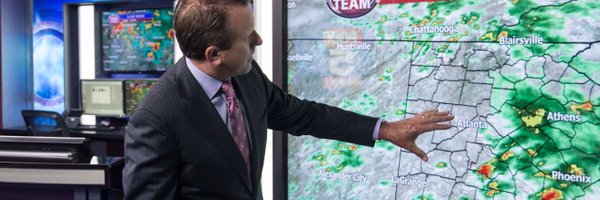
If this occurs early Friday morning we are in for serious damage here in north Georgia. Trees will be down all over the place resulting in long lasting power outages.
I've had insects and birds show up before on a webcam, but never a Masked Man! Be careful up there, but before you're done could you clean the lens please?
The Super Blood Wolf Moon total lunar eclipse will begin with the penumbra (outer shadow) at 9:39 pm. At 10:33 pm the moon will get darker as the umbra (inner shadow) passes over. Totality will occur at 11:41 pm. Best view will occur between 11:41 pm and 12:43 am. Happy viewing!
Crazy shelf clouds from yesterday's storms across north Georgia. First one is in Commerce from PJ Smith Rivera second in Jefferson from Tammy Schaefer. Thanks for sharing!
Full moon Saturday has lots going for it. It's the second blue moon of the year & the last until 2020. It's also the Paschal Moon: 1st full moon after the Equinox. Haven't had a Saturday Paschal Blue Moon followed by Easter Sunday since 1646 in N. America.
Winter Storm Watch for a large portion of north GA late Mon night through Tue evening. Up to 2" of snow is possible. Higher amounts mountains. Temperatures in the 20's Tue night/Wed morning will lead to ice on roadways that aren't cleared or treated.
Grateful to say: New Nielsen numbers show this May,
@FOX5Atlanta
News at Noon was once again Metro Atlanta’s top midday newscast among the key demo! Thank you—as always—for watching, whether on FOX Local, our news app or website
@jeffhillfox5
& I will see ya same time tomorrow!
The Rocky Mountains are known for their weather extremes and this one is no exception. Denver will go from sunny and 90's Monday to accumulating snow and 30's Tuesday!
While severe t-storms push out of NW now, the big show arrives midnight to 2am for a large area of metro Atlanta. I am concerned with storms capable of damaging winds to 70 mph and possible tornadoes. Stay with us.
Can’t believe that she is no longer with us. Remembering fondly my former colleague and dear friend Amanda Davis. Rest easy sweet lady. You left us way too soon.
I always advise to hold off planting your summer vegetable garden until after April 15th due to the risk of late freeze/frost. I jumped the gun this year & now looks like a cold blast by mid April. Do as I say not as I do!! 😳
UPDATE: All threat levels for severe weather tonight have been shifted slightly south. Most of metro Atlanta now under a level 1. Southern tip of Upson only county still in the level 4 for our viewing area. Cold air seems to be winning the battle.
Big flakes coming down across north Georgia. Over 3” so far in the mountains. Metro Atlanta could get up to an inch mainly on grassy areas as snow continues into early afternoon. Roads should be fine but could get icy later tonight.
Took these while heading home today just north of Atlanta. Looks like some scattered storms are in our future again this afternoon. Lots of rising air!!
Significant threat of tornadoes Sunday afternoon & then again at night into early Monday morning especially in areas just west of Atlanta. Timing will become clearer on Sunday, but until then download the free FOX 5 Storm Team App on your smartphone to get warnings.
Clear skies tomorrow evening to check out the great conjunction of Jupiter and Saturn. Just after sunset find an unobstructed view of the horizon and look to the southwest. Don't be late because it will only last about an hour before the planets themselves set below the horizon.
Mainly for novelty purposes here are two medium range models showing rain ending as snow or a wintry mix over north Georgia Christmas Day (7 days out). Many updates and many changes to come. Ho, Ho, Ho!!!
The Tropical Storm Watch has now been upgraded to a Tropical Storm Warning in effect through Thursday. Winds of 35-45 mph with gusts to 60 mph can be expected early Thursday morning. 2"-4" of rain is likely as well along with brief spin up tornadoes.
Beautiful sunset on a fantastic weather day here in Atlanta. The new week starts out wet Monday morning but will improve quickly during the afternoon with sunshine and highs near 60.
Still watching the possibility for snow showers to develop along a cold front that will pass through the region Tuesday afternoon through Wednesday morning. Snow should be limited to a dusting in the highlighted area with up to an inch in the mountains.
Heads up for Friday morning. Looking like patchy frost & freeze may happen. If you're thinking of planting the vegetable garden hold off. If you already planted be prepared to cover your plants. To be safe you should always wait until April 15th to plant to be on the safe side.