
Pratyush Tripathy
@i_pratyusht
Followers
555
Following
738
Statuses
240
Figuring out smarter ways to use satellite data & AI for environment ┋ PhD student @UCSBgeog┋Building @MapSolveAI Past: @PEAK_Urban @iihsin Views are personal
Santa Barbara, California
Joined July 2019
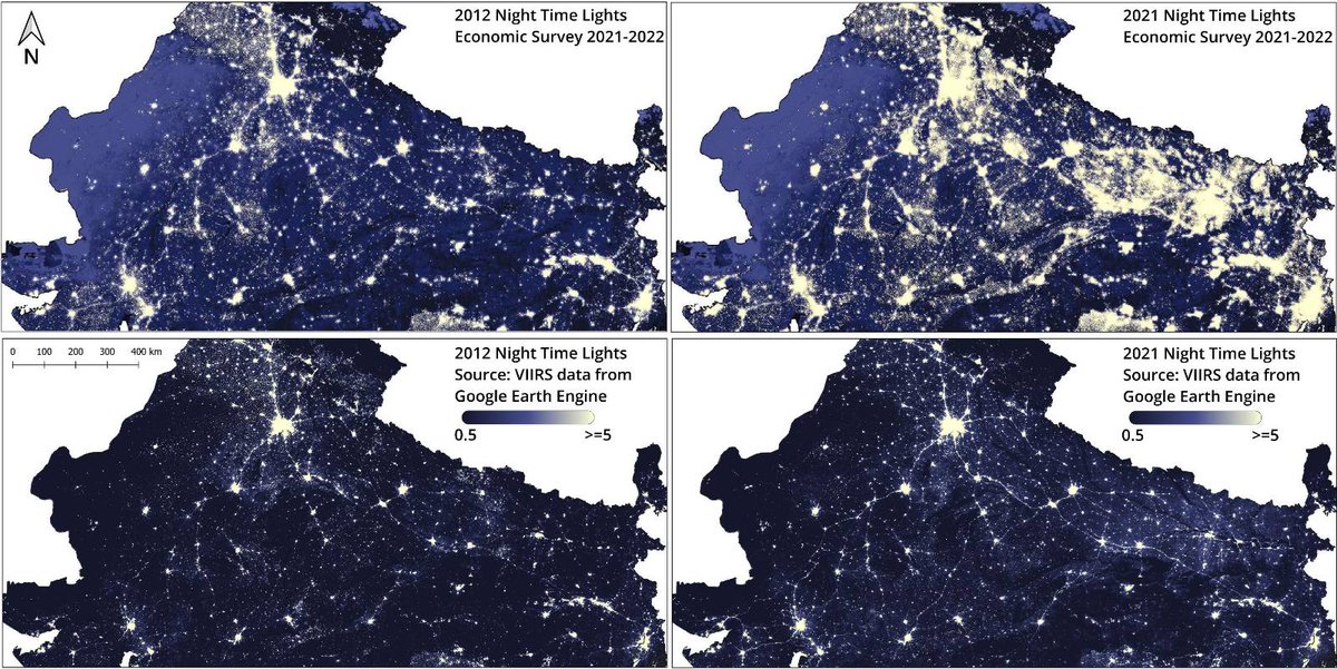
2021-2022 Economic Survey (ES) uses remote sensing and #geospatial data ‘to track, compare and represent longer term developments’. But when using remote sensing data, proper calibration, validation and visualisation are necessary. Else the data can be very misleading. 🧵 1/13
7
118
483
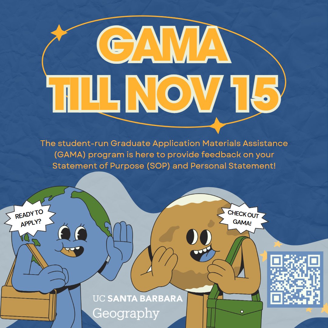
Considering applying to the UCSB Geography PhD program? You can now get feedback on your statements from current PhD students. Please share with potential applicants :)

📢GAMA is BACK🙌 Want to get feedback on your Statement of Purpose and Personal Statement for your graduate application? Check us out! Visit the “How to Apply” page on the Geography department website or scan the QR code to participate.
0
1
1
@passportsevamea should look into the incompetence and rude staff at @rpopatna Errors in passports have become a pattern, and their remedy to everything is a new passport application (incl. the fees) The most recent example is receiving a fresh passport with a "CANCELLED" stamp

1
0
0
@passportsevamea I received a new passport from @rpopatna with "PASSPORT CANCELLED" stamp on the last page. All other printed details are normal except for the stamp. RPO is unreachable. Could you please confirm that the passport is active? This is time-sensitive. @DrSJaishankar

1
0
0
Our session at #AGU24 on "Remote Sensing and Machine Learning for Flood Mapping and Impact Assessment" is now live! Glad to host this with @DrAmitK63389570 and @junrentschler. Consider submitting your work or share with a contact who may be interested.

0
1
10
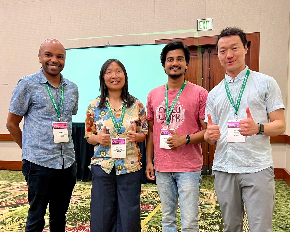
Always glad to run into people. This one’s from touching base with @DrKMwenda and @gissong at #AAG2024. Sharing our stories from @UCSBgeog :)
0
1
18
Also had a chance to interact with awesome alumni @UCSBgeog has produced over decades. The list is long but this one’s from an interesting conversation with Prof Sergio Rey. (2/2)

0
0
0
Introducing @MapSolveAI!🚨📢 We use state of the art AI with satellite imagery & other datasets to derive unique and actionable insights to help businesses, governments, and the development sector address critical challenges.🌏🚀🛰️ Explore more at

0
3
12

0
0
29


@gandhisahil @MTabarrok Segment Anything Model by Meta would be a good starting point. Paper and pre-trained Python models are available. Here's demo: I have success using SAM for satellite image segmentation. There are some other pre-trained automated segmentation models too.
0
0
2
RT @iihsresearch: 1/ The 2nd #fromtheiihsarchives this month looks at COINS, an open-source tool that generates street hierarchy informatio…
0
1
0
RT @UCSBgeog: The Department of Geography at UCSB is excited to announce a Tenure-track Assistant Professor position in Physical Oceanograp…
0
3
0
RT @Amruthkiran94: Come work with us! 🗺️The #Geospatial Lab at @iihsin is hiring for the position of "#GIS Assistant". 💡If you're interest…
0
12
0