
OntarioStormTracker
@Onstormtracker
Followers
10K
Following
511
Statuses
11K
Your source for severe weather updates across southern Ontario. @Northern_OST for Northern Ontario.
Ontario, Canada
Joined January 2016
RT @OPP_COMM_CR: UPDATE: ROAD CLOSURE: #Hwy11 remains CLOSED between West St in #Orillia and #Hwy60 in #Huntsville due to weather. Possible…
0
11
0
RT @tempesthunterph: What an absolutely amazing experience! #SolarEclipse2024 @LakeErieNorth @Onstormtracker @GirlsWhoChase
0
18
0
RT @Sharons_Shotz: @NorthFrontenac @Onstormtracker @weathernetwork @MurphTWN @ckws_weather And so the snow has started here in Plevna Ontar…
0
3
0
0
2
0
RT @tempesthunterph: Humble beginnings, I kept an eye on this seeing a small spout funnel. In this video it was beginning to suck up water…
0
4
0
RT @ICWR: 3 waterspout funnels seen over the middle of Lake Erie at 10:36 am, just on the Canadian side of the border, south of Erieau, Ont…
0
4
0
RT @tempesthunterph: Happy Thanksgiving everyone, on spout patrol for @ICWR lets go!! @Onstormtracker @LakeErieNorth
0
3
0
RT @alissabigelow: Approaching #Barrie 2:35-2:55pm. Two separate storms formed back to back & merged into one. Wind really picked up @ 2:45…
0
2
0
RT @tempesthunterph: Nice shelf about to hit Crystal Beach, I am on spout patrol @Onstormtracker @LakeErieNorth @GirlsWhoChase @icwr https:…
0
4
0
RT @lynnchidwick: Timelapse of thunderstorm passing by Guelph at 10:45pm @StormhunterTWN @weathernetwork @Onstormtracker https://t.co…
0
5
0
0
13
0
RT @BrandinCameron: Tornado warning Ottawa Ontario @Onstormtracker @Onstormtracker @weathernetwork @CBCOttawa
0
6
0
RT @tempesthunterph: Finnel cloud over Brigden, Ontario associated to this cell have video will post soon. @OntarioWedges @Onstormtracker…
0
6
0
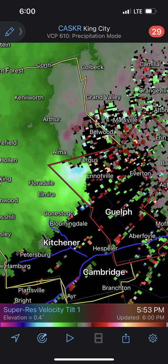
RT @tempesthunterph: Current situation near Strathroy, Ontario @weathernetwork @LakeErieNorth @IWeatherON @Onstormtracker @GirlsWhoChase #…
0
24
0
RT @09mazda6forsale: @AnthonyFarnell @Onstormtracker nickel sized hail hit Fonthill On at 6:32 pm.. I feel for all the soft fruit farmers…
0
1
0
0
17
0
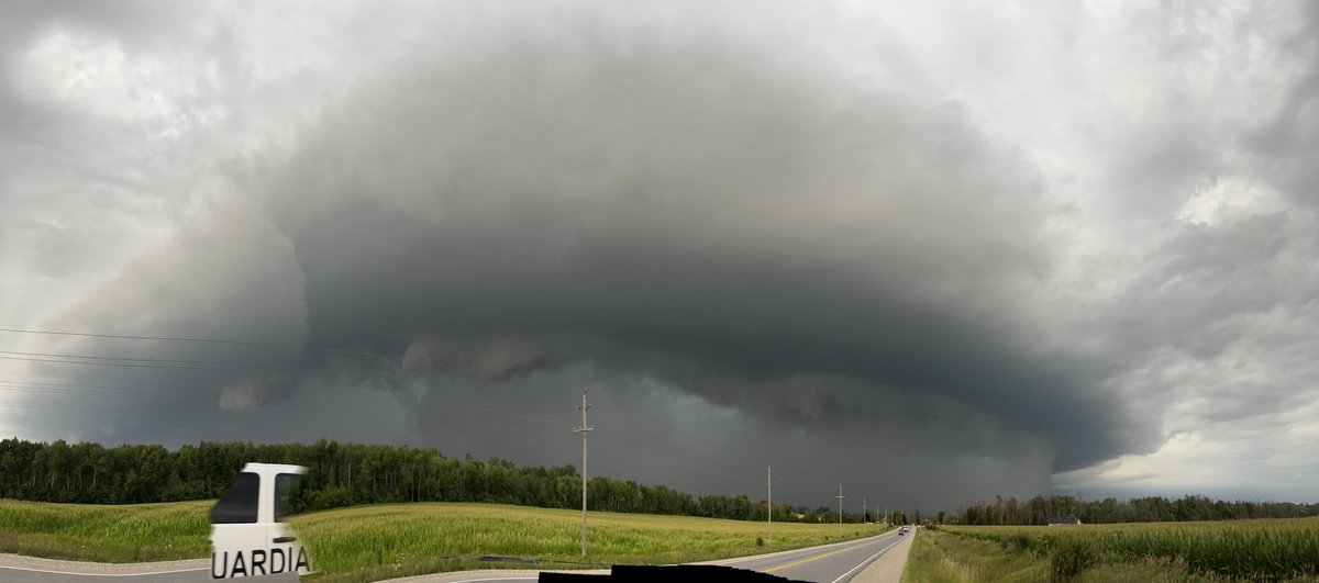
RT @tempesthunterph: Incredible shelf cloud off of Lake Huron, Highland Glen, Ontario @Onstormtracker @LakeErieNorth @weathernetwork #onsto…
0
23
0
RT @tempesthunterph: Wild day of very heavy rain and extreme winds at times zero visibility with the amount of rain coming down. On the way…
0
8
0
0
2
0
RT @SammiWakes: Watching the front roll in! Have no fear, players and parents vacated the diamonds 2 seconds after this photo @Onstormtrack…
0
1
0