NWSCNRFC Profile Banner
NWS California-Nevada RFC Profile
NWS California-Nevada RFC

@NWSCNRFC

Followers
7K
Following
60
Statuses
1K

Official Twitter account for the National Weather Service California Nevada River Forecast Center or CNRFC, https://t.co/wpdBnfYjSp.

Sacramento, CA
Joined July 2012
Don't wanna be here? Send us removal request.
@NWSCNRFC
NWS California-Nevada RFC
4 days
Wet week to start February over most of the region. Highest precipitation amounts are around 13-26 inches over the Nrn Sierra and 9-20 inches over the Shasta Basin since Feb 1. More widespread precip is expected mid-late next week. #cawx #cawater #nvwx
Tweet media one
1
20
30
@NWSCNRFC
NWS California-Nevada RFC
18 days
Areas of heavier rainfall over Srn CA could produce sharp rises on rivers. The Santa Margarita River at Ysidora (27% chance) and San Diego River at Fashion Valley (11% chance) have a greater than 10% chance of action/monitor stage in the next five days. #cawx #cawater
Tweet media one
0
0
5
@NWSCNRFC
NWS California-Nevada RFC
18 days
Showers & slight chance t-storms mainly ovr Central & Srn CA & most of NV into Monday. 1-3" fcst ovr transverse range to San Diego Cty Mtns & 0.75-1.5" Srn CA coast. Freezing levels drop to 3-5 kft Sun. Lingering showers Srn CA Tues-Wed. Precip in N late Thurs-Fri #CAwx #nvwx
Tweet media one
Tweet media two
0
1
15
@NWSCNRFC
NWS California-Nevada RFC
1 month
As we end the "1st Quarter" of the 2025 WY, total precip as % of avg shows those areas running "ahead of the game" (northern CA, especially Eel/Russian and Sacramento basins), and those that are not (central/southern CA and NV, especially southern CA and southern NV). #CAwx #NVwx
Tweet media one
3
52
185
@NWSCNRFC
NWS California-Nevada RFC
2 months
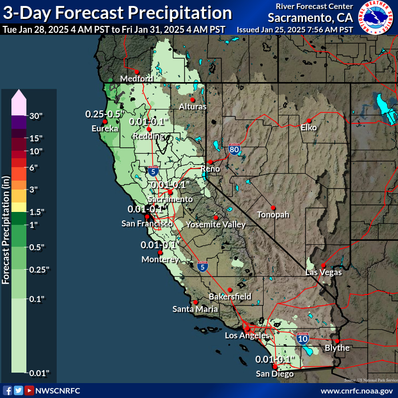
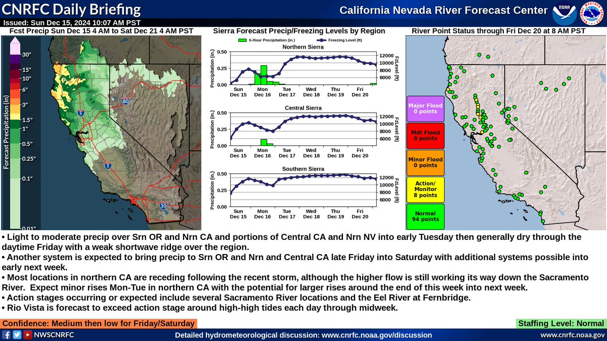
A weaker system bringing periods of light to moderate precip to Srn OR & Nrn CA & portions of Central CA & NV into early Tuesday. Generally dry later Tues-early Friday except showers possible NW CA & Srn OR Cascades Wednesday. A stronger system expected late Fri-Saturday. #cawx
Tweet media one
Tweet media two
0
3
12
@NWSCNRFC
NWS California-Nevada RFC
2 months
More precip, mainly light to moderate, is forecast over Srn OR & Nrn CA & portions of Central CA & Nrn NV tonight into early Tuesday. A few river locations remain above monitor stage and flow at Colusa and Fremont weirs. Additional precip expected next weekend! #cawx #Nvwx
Tweet media one
0
1
4
@NWSCNRFC
NWS California-Nevada RFC
2 months
How much precip fell over CA/NV in the last 48 hrs ending at 4 am today? Highest precip amounts were 3-6" with local amounts to ~8 inches along the Nrn CA coast & Shasta Basin. Rivers rose to monitor stage at several points & a few points to Minor flood stage. #cawx #cawater
Tweet media one
Tweet media two
Tweet media three
Tweet media four
0
5
19
@NWSCNRFC
NWS California-Nevada RFC
2 months
After a prolonged dry spell to start the month of December, we are finally seeing a pattern shift that will bring widespread precip back to the region starting later today, especially northern CA. Here are forecast precip amounts through next Tuesday morning. #CAwx #NVwx
Tweet media one
3
19
65
@NWSCNRFC
NWS California-Nevada RFC
3 months
@Dman1180 @UWCIMSS The 1991-2020 normal annual precipitation for Red Bluff is 23.12 inches.
2
0
0
@NWSCNRFC
NWS California-Nevada RFC
3 months
@sgrove @UWCIMSS Approximately 3.5 days.
0
0
1
@NWSCNRFC
NWS California-Nevada RFC
3 months
RT @NWSBayArea: Mark West Creek Thursday, Friday, Saturday
Tweet media one
Tweet media two
Tweet media three
0
8
0
@NWSCNRFC
NWS California-Nevada RFC
3 months
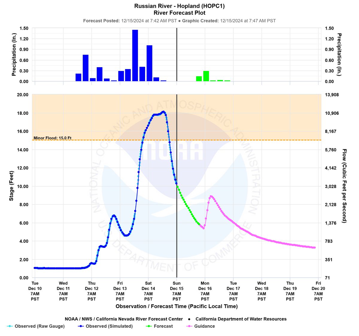
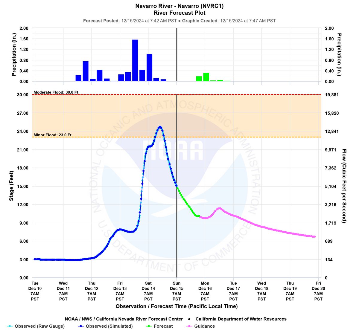
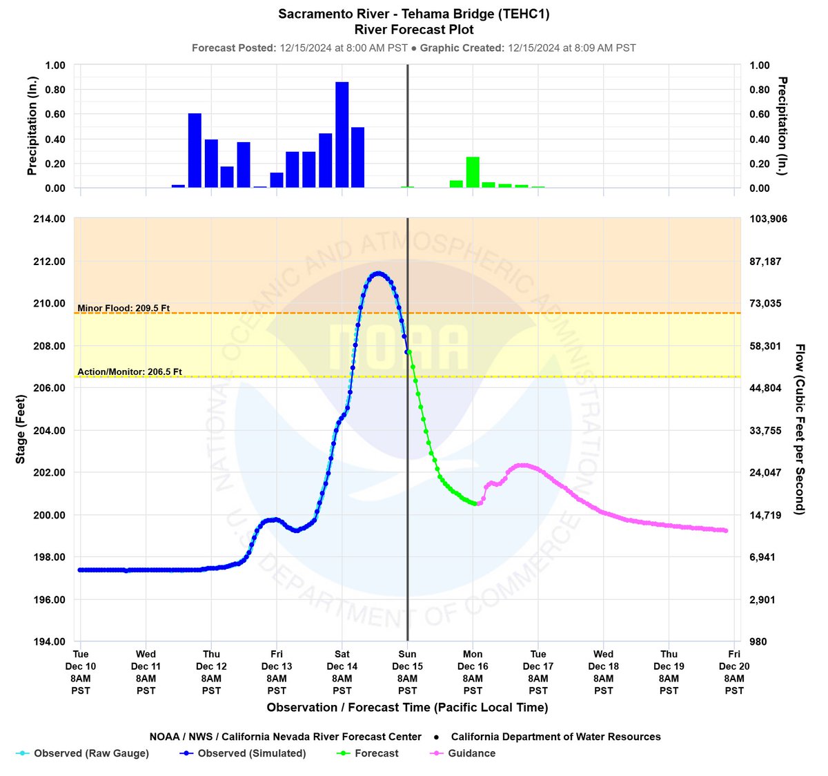
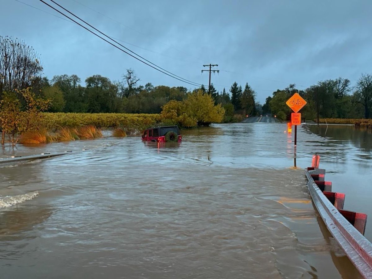
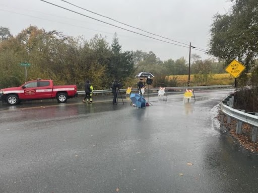
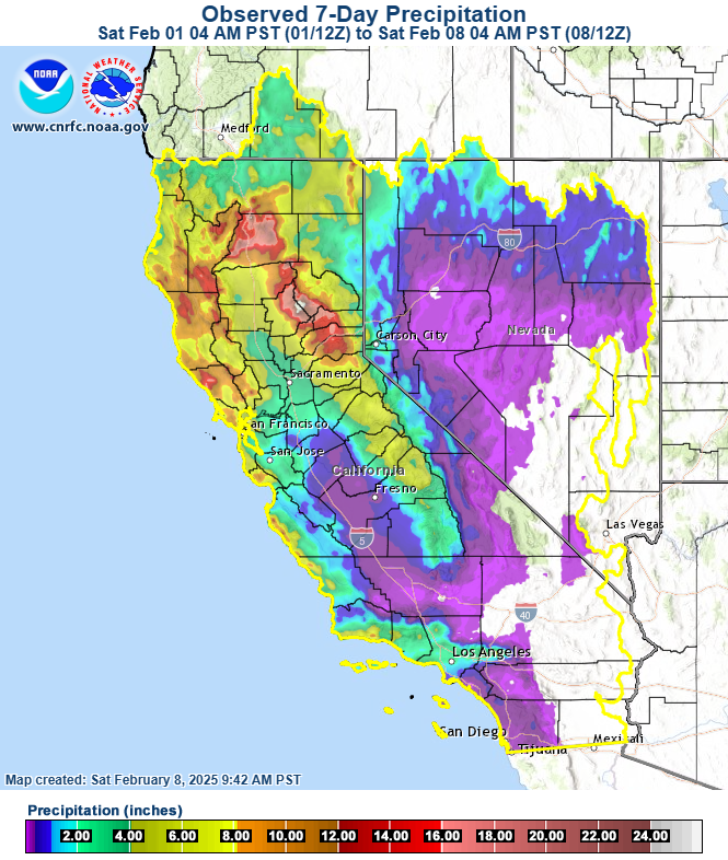
The #RussianRiver saw significant rises with the heavy precip that affected the basin over the past 3 days. The flood wave is currently moving past #Guerneville with the river cresting (34.68 feet) shy of the "Moderate Flood" stage (35 ft). River will recede this weekend. #CAwx
Tweet media one
0
0
6
@NWSCNRFC
NWS California-Nevada RFC
3 months
Impressive 3-Day totals across northern CA! Observed amounts of 7" to 14" (locally 15" to 22") from the Eel to Russian/Napa River basins along the coast, and Shasta Lake drainage to the Feather River basin over the southern Cascades/northern Sierra. #CAwx #CAwater #CAflood
Tweet media one
1
28
79
@NWSCNRFC
NWS California-Nevada RFC
3 months
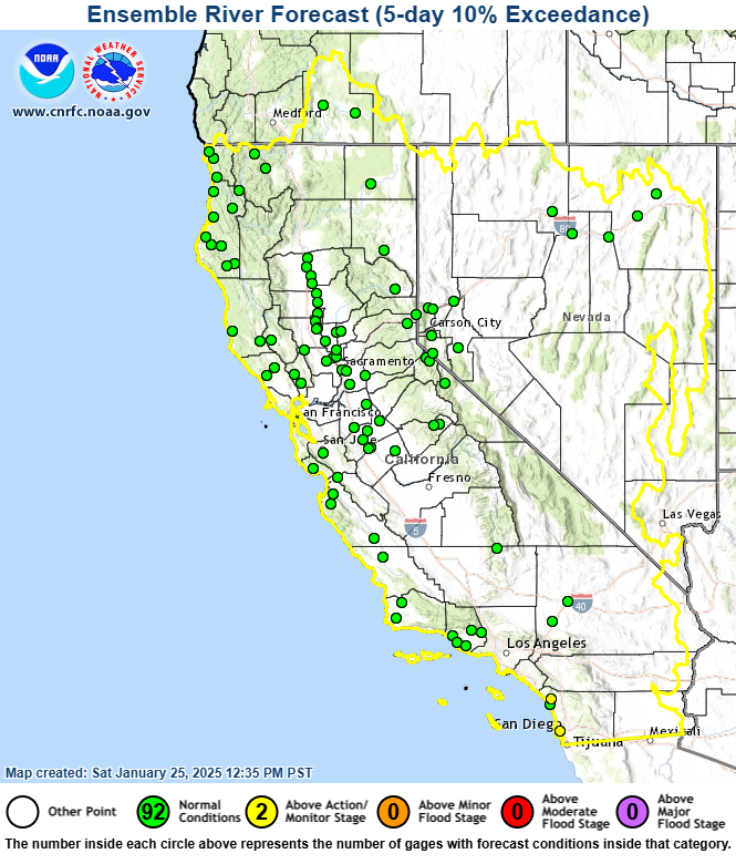
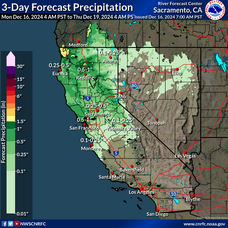
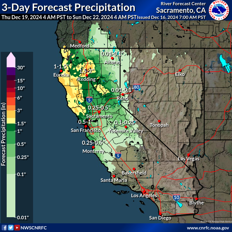
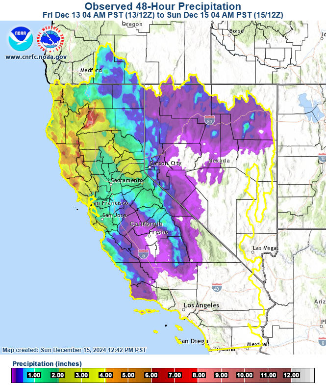
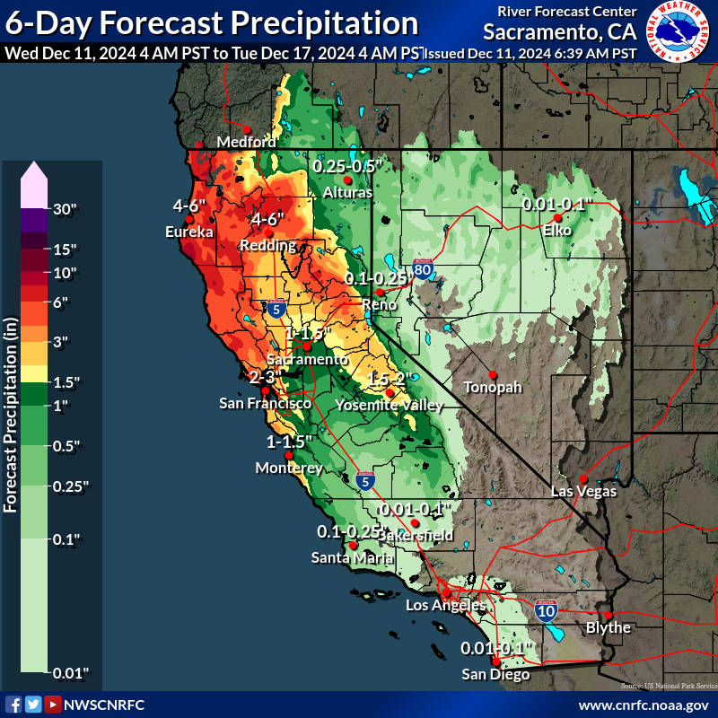
Wet Week ahead, especially for Nrn CA! Widespread moderate to locally heavy precip ovr Nrn CA tonight-Friday. The precip will bring sharp rises on rivers in Nrn CA & flow on the Colusa and Tisdale weirs. Some locations forecast to rise to minor to moderate flood stage #Cawx
Tweet media one
0
4
8
@NWSCNRFC
NWS California-Nevada RFC
3 months
Have you viewed the CNRFC web page, lately? The flood threshold terminology & corresponding colors on front map & individual plot thresholds are updated. Monitor stage now action stage (yellow) & flood stage broken into 3 levels- Minor Moderate & Major
0
2
3
@NWSCNRFC
NWS California-Nevada RFC
3 months
RT @NOAA: On this and every #VeteransDay, we pause to thank our veterans and all U.S. military members who serve in uniform. We are deeply…
0
55
0
@NWSCNRFC
NWS California-Nevada RFC
3 months
RT @NWS: Military Veterans help shape the backbone of the NWS, with 933 Veterans currently performing critical duties in our offices across…
0
204
0
@NWSCNRFC
NWS California-Nevada RFC
3 months
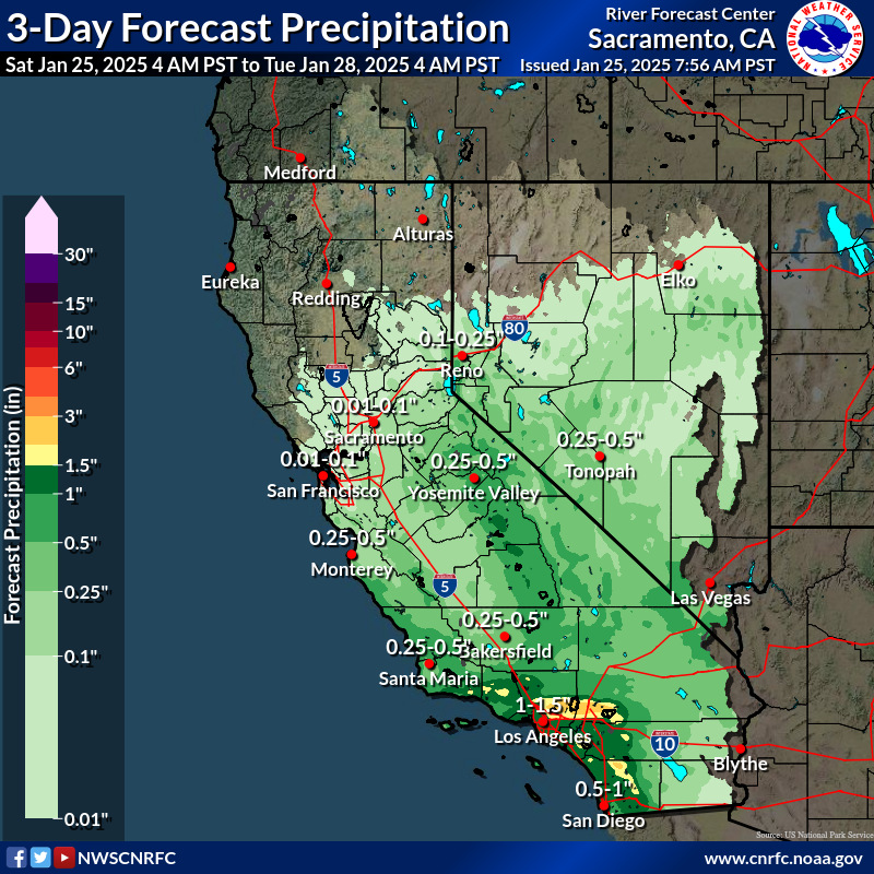
Periods of precip tonight and through the week mainly ovr Srn OR & Nrn and Central CA & Nrn NV & possibly into Srn CA Monday & Friday nights. First system moves through tonight-Monday. Minor or modest rises forecast on main stem rivers, especially along the N Coast #CAwx
Tweet media one
0
3
8
@NWSCNRFC
NWS California-Nevada RFC
4 months
Precip possible over NW CA coast Friday night-Sat & spreading south & east mainly ovr nrn portion of CA (especially along coast & higher terrain) & down the Sierra & over NV Sat night into Tues. Cooler temps expected early next week. #CAwx#Nvwx
Tweet media one
1
8
7