
NWS Anchorage
@NWSAnchorage
Followers
22K
Following
2K
Media
5K
Statuses
9K
Official Twitter account for the National Weather Service Anchorage. Details: https://t.co/pZTCFSLB54 #AKwx #Alaska #AK #Anchorage
Anchorage, AK
Joined August 2012
This pattern feels like early Spring, but our Forecaster saw his shadow this morning, so 6 more weeks of Winter? #akwx

0
3
17
Good afternoon Southcentral/Southwest Alaska! Here is a 3 day outlook of what is expected weather-wise. Cool and dry for most of the mainland apart from the Kuskokwim Delta coast and the Aleutians, which will see wet and windy weather.

0
0
7
Happy February, Alaska! Here is a monthly summary of weather in Anchorage for the month of January. It was an active month with periods of warm days, cold days, windy days, and rainy days. Perhaps we will have better luck this month for more snowfall! 🗓️

0
0
7
⚠️Heads up! Cold temps will cause creeks to begin freezing up across parts of the state, raising water levels and creating possible ice jams. As this occurs, water could spill out of channel and cause minor lowland flooding, impacting trails and low roads nearby. 🧊

0
0
4
Here is the weekend temperature outlook for select locations across Southwest AK. Tomorrow will see a rapid rise in temperatures with more moderated conditions through the weekend. Head to for more info! #akwx

0
0
1
Here is the weekend temperature outlook for select locations across Southcentral. Conditions will remain chilly, but moderate slightly through the weekend. Head to weather,gov/afc for more info! #akwx

0
0
9
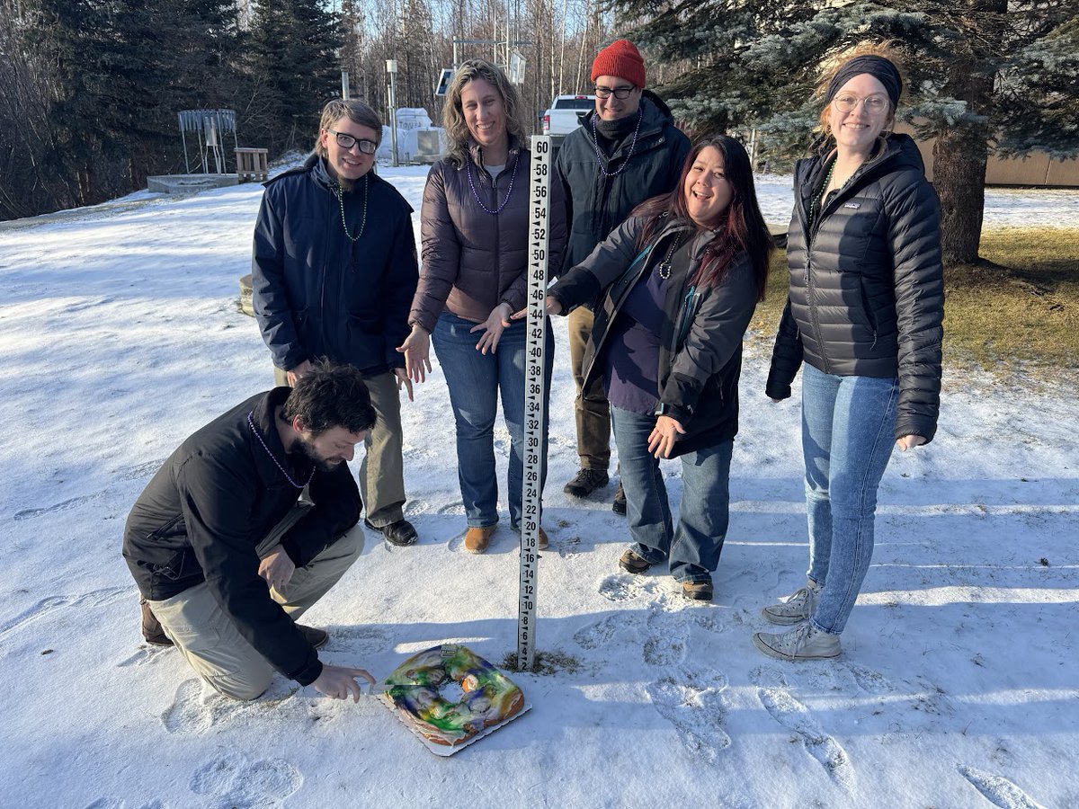
The forecast calls for calm & very cold conditions for Anchorage for at least the next few days. While there's no snow in the forecast, at least we received a small refresh, but that's not the only thing that showed up at our doorstep. Thanks for the king cake! @NWSNewOrleans

22
111
959

SWAK & Pribilof Islands Winter Weather UPDATE!. The Blizzard Watch has now been upgraded to a Blizzard Warning for the Kuskokwim Delta Coast (3 AM Thu-12 PM Fri) and the Western Capes (9 AM Thu-12 PM Fri). The Cold and Winter Weather Advisories remain unchanged from previous.

0
0
1
⚠Blizzard Warnings issued for Isabel Pass to Paxson, and Broad Pass from Midnight tonight to 9AM Thursday. Blizzard Warning issued for Thompson Pass and Keystone Canyon from 3AM Wednesday to 3PM Thursday. For the latest forecast, check #AKwx

0
0
2
‼⚠Cold air and Winter Storm in Southwest Alaska, multiple statements have been issued. See attached. Strong northerly flow across the area, bringing accumulating snowfall and areas of blowing snow Wednesday through Thursday. For more: #AKwx

0
0
3
✨New✨ land-based zones to be implemented March 18, 2025❗❗. 🤔 Why make these changes?! We believe this will provide a vast improvement in service & provide better service equity to those who live across Southern Alaska. 👉More info: #KnowBeforeYouGo

0
0
2
⚠️Heads up Eastern Aleutians & Southern AKPEN⚠️. Widespread snow showers will continue through this evening. Snow showers with gusty northwest winds could cause periods of blowing snow & significantly reduced visibilities at times today. Use caution if traveling!. #AKwx

0
0
3
Big changes are taking place this week in Southern Alaska! Temperatures drop substantially through the week into Thursday. Wind speeds similarly decrease, however, they will start increasing again by Thursday afternoon particularly in Southwest Alaska and gap regions.


1
1
3
❄️Snowfall at the office! Convective bands of snowfall have moved through Anchorage, allowing for short periods of moderate to heavy snowfall. Enjoy it while it lasts!❄️


0
2
25
❄ Kenai Peninsula, Anchorage, Mat Valley: Gusty southerly winds, snow showers, and reduced visibility through mid-morning. Intense snow showers with bursts of heavy snow/graupel and gusts to 40 mph may cause blowing snow & visibility <1/2 mile. Quick 1-2" possible in bands. ❄.
1
3
12
Gusty S to S to SSW winds work up the Cook Inlet today into tonight as a colder airmass works in from the south as well. Highest gusts are expected for Seward & the Western Kenai Coast. A High Surf Advisory is also in effect for the Homer Spit. See the graphic for more details!

0
1
8
While a meteorologist was out doing grass angels, we noticed our snow depth is the same as yours! @NWSLakeCharles, @NWSMobile, and @NWSNewOrleans: 0"🥚! . Now that the playing field is level, lets see who gets the most snow for the 2nd half of winter!. #AKwx

3
5
61
💨Gusty winds to linger across portions of Anchorage tonight through Monday morning. Winds around 50 mph expected to switch southerly after midnight through Monday morning, higher on the hillside. Stay tuned! #akwx.
0
1
8
Hello southern Alaska! Here's a quick teaser of what's to come this week: Day Snow-Fog satellite RGB shows a cooler and drier air mass moving across Southwest into Southcentral. This will promote clearer conditions and a break from widespread precipitation thru midweek. #akwx
0
1
6