

Mark Margavage
@MeteoMark
Followers
11K
Following
24K
Statuses
15K
Meteorologist, Winter Weather Specialist, and Snow Storm Chaser. Certified Airman 👨🏻✈️ PSU 2008. Wilkes U. 2016
Northeast PA
Joined February 2013
My 2024-25 Winter Forecast Issued to Patreon Subscribers on November 4th is now public. As mentioned in yesterday’s post, according to the latest ENSO update, we are locked in for an ENSO Neutral Winter, so while I did cover the possibility of a weak La Niña in this video, it has since become clear that the ENSO Neutral Package is more appropriate for the upcoming winter. Enjoy! ~Meteorologist Mark Margavage #WinterIsComing #wxtwitter #wxX
6
4
51
Idk what you’re talking about Andrew but a PV split at this time of year would mean that there’s potential for my area to see some absolutely HUGE snowstorms in March. 2 out of the top 3 biggest snowstorms ever in my area have happened in mid-March thanks to just such a PV disruption.

1
0
0
It’s Glorious! #wxtwitter #wxX

Mid-tropospheric polar cap geopotential heights are predicted to achieve a winter peak next week. Based on my latest paper ( around & following the peak is the best potential for severe winter weather including #snow for Europe, East Asia & the Eastern US.

1
0
4
@thaweatherclown I haven't changed my thoughts on that. A split is possible, but an extreme stretch is still the most likely solution until the predicted wave-2 pattern actually materializes.
0
0
3
@BrenArmitage92 Unless you are in along the southern tier of in the Laurel Highlands of PA, it doesn't mean anything because the storm will be south of you. For those other locations it's just a light snow.
0
0
0
@MikeTFox5 Ever since they got the option to call a "virtual day" at the schools around me, they've basically eliminated dismissals. If there's snow or ice in the forecast, they just go virtual. Not only that but they will call it at 4pm the day before.
0
0
0
I would say nearly 100% of storms would cut to the interior with that kind of set-up, if you assume this 500mb chart is 100% accurate. Sure there's a 50/50 low, but the Atlantic Ridge is way too far west and there is no Alaskan Ridge to amplify the trough. Just follow the height lines from Mississippi... Any storm that would form in the Mississippi Valley would have to ride along the SW flow. The only way you can get an East Coast snowstorm out of this pattern is if the Atlantic Ridge is further East and there's more ridging in Alaska. If neither of those things happen, this will not be snow at the coast.
1
0
2
@tornadopaigeyy I found myself thinking.... either this is terrible or I am completely out of touch with pop culture.
1
0
0

There’s a narrative floating around in my comments that the NAM did well on this storm… uhhh what!? 🤨 It was 100% wrong in the circled area. #wxtwitter #wxX


4
0
15
@weatherwilly That 540 line is awfully far north for a snowstorm. If the Alaskan Ridge were to amplify at the expense of the Atlantic Ridge, then perhaps... But as is, this would be a mess for anyone east of Michigan.
0
0
1
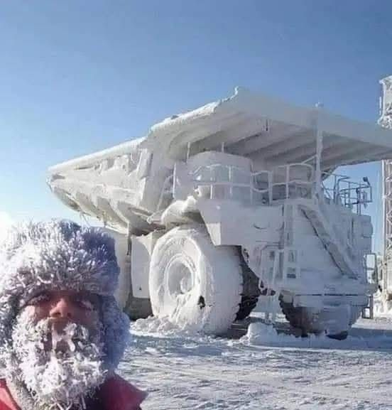
First Sign of Global Cooling following the 2021 Hunga-Tonga 🌋Eruption?? If confirmed, Krasnoyarsk Russia has reported what will become a new low temperature record for the Northern Hemisphere… -73°C (-99.4°F) The previous coldest temperature ever recorded in the Northern Hemisphere is -69.6°C (-93.3°F), which was measured on December 22, 1991, at a weather station near the summit of the Greenland Ice Sheet. Graph below from @_ClimateCraze 👇 #climate #wxtwitter #wxX


Krasnoyarsk Russia sets a new low-temperature record: Minus 73 degrees Celsius. Must be the CO2 ...
3
1
17