

Jonathan Yuhas
@JYuhasKSTP
Followers
10,510
Following
3,923
Media
8,927
Statuses
12,157
TV Meteorologist at KSTP-TV. Tornado Chaser. Pilot. Marathon Runner. Ex-Police Reserve. MN Native. Dad. Animal Lover. Always tracking the next storm.
Minneapolis/St.Paul, MN
Joined December 2010
Don't wanna be here?
Send us removal request.
Explore trending content on Musk Viewer
California
• 368231 Tweets
#मुहर्रमपर_अल्लाहकबीर_कासंदेश
• 280831 Tweets
Baakhabar Sant Rampal Ji
• 252056 Tweets
Corinthians
• 115766 Tweets
梅雨明け
• 77000 Tweets
オールスター
• 69011 Tweets
Olmedo
• 68485 Tweets
#TheAcolyte
• 58185 Tweets
#GranHermanoCHV
• 50254 Tweets
佐野海舟
• 44599 Tweets
Karnataka
• 44410 Tweets
Cacá
• 42910 Tweets
SAMSUNG X TOGETHER
• 42861 Tweets
Nasi
• 30603 Tweets
ENGFA WIMARNNAAM 1stMOVIE
• 21623 Tweets
#TrailerTheParadiseOfThorns
• 21088 Tweets
Big Sean
• 18380 Tweets
ブルアカ
• 18086 Tweets
Jarren Duran
• 17723 Tweets
Aces
• 15641 Tweets
ゴンチャ
• 15600 Tweets
Cruz Azul
• 14944 Tweets
ニィロウ
• 13742 Tweets
ランダム商法
• 13702 Tweets
マインツ
• 13510 Tweets
PRABOWOlanjutkan KerjaJOKOWI
• 11825 Tweets
KitaBANGSA BesarDISEGANI
• 11302 Tweets


Rosemount,MN this morning as second wave of Severe Tstorms rolled in just before 7am.
@KSTP
@NWSTwinCities


9
30
229

Cornbread Face said she will offer her services of being an Outdoor Warning Siren in Twin Cities during a Tornado.
@NWSTwinCities
@SafetyAlertsMN
@NWSSPC
@KSTP
12
10
181


The first 2 pics are me 26 years ago when I was a Meteorologist at KAAL in Austin/Rochester and the 3rd picture is me at KSTP TV. When I meet God I will tell him thank you for such a wonderful life!
@KSTP


10
2
104
My 17 year old daughter Maggie completed her 3rd Grandma’s Half Marathon this morning in 2 hours & 20 minutes.
@KSTP
@wdiowirt
#GrandmasMarathon

1
0
88

Check it out Northwest MN VS southwest MN. This is right now just before noon Mar 31-which one do you prefer?
#Snow
http://t.co/O6CGKz1msH

5
167
80
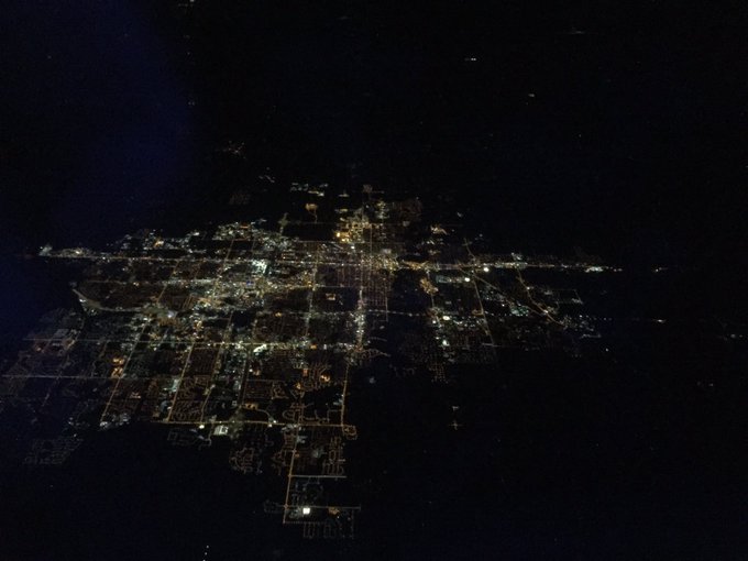
Flying over Fargo,ND/Moorhead,MN last night at 30,000 feet.
4
12
83


My Dad (John Yuhas) took this pic in Bloomington 32 years ago (Jul 24,1987) of 494 under water after Super Storm 87 that started Jul 23 with a Strong Tornado @ Maple Grove & Brooklyn Park then 10” to 12” of rain fell from Minnetonka thru Edina,Bloomington & Richfield
@KSTP

7
6
79

In 4 weeks we go back on Daylight Saving Time and Spring ahead 1 hour bringing back later sunsets.
@KSTP

7
12
73
Thinking about parking downtown Mpls today? This is no joke. $240 cash! Photo courtsey KSTP Justin Jensen.
@KSTP

25
102
71
My Son Max Yuhas took this picture of a Young Buck in ST.Paul at Sunset last night (Tue Jan 30) - Sunset tonight is 5:19pm. Sunny & Mild Today in Twin Cities with highs in the mid 50s ( Record High 46 in 2009 & Average High 24 ).
@KSTP


1
3
73
It is early to put this map out there but storm Wed-AM Fri will have 1” to 3” of moisture which means 12” to 16” of snow due to the cold temps Thunder at times will enhance snowfall. Thursday looks to be worst day with heavy snow & wind
@KSTP


28
35
66
6” to 8” of Rain overnight in the Mankato area made for loud and fast flowing Minneopa Waterfall this Sunday at Minneopa State Park southwest of Mankato. If you have not been there I highly recommend.
@kstc45
@KSTP
@ABC
@ks95
@KS95MorningShow
1
13
68
My son Max @ college in Ely,MN (Vermilion CC for Wildlife Management Law Enforcement) & he saw a wolf tonight
@KSTP
3
3
65
Chasing Union Pacific Big Boy today (biggest Locomotive in World). Here Is Big Boy in a light rain north of Owatonna at Medford,MN this afternoon as Train heads for St.Paul Union Depot arriving about 4pm.
@KSTP
4
16
67
Drove 850 miles roundtrip to Olathe,Kansas and Paola,KS to pick up some Yuengling Beer & visit with my Uncle Bill. Go KC Chiefs and Cheers and would love to see Vikings in Super Bowl 2025!
@KSTP

3
1
64
Road Conditions changing fast. On the left at 1130am is US Highway 169 in Mankato and on the right at 1130am 20 miles west of Mankato is the Snow on Highway 15 in Madelia.
@KSTP

2
27
62

We hit 77 today in MSP and to our north it was more like Winter with a 3pm temp of 36 at the Duluth Harbor while Austin was close to 90 with a temp of 86.
@KSTP

5
11
56

Close to 8" of snow between Jamestown,ND & Grand Forks,ND & 14" near Hope,ND. Pic is i-94 near Jamestown & travel not advised west of Fargo to Jamestown tonight.
@KSTP

8
22
54
OK Winter you won today but Spring is in training and ready soon! Winter the brat in Rosnowmount (Rosemount)
@KSTP
3
17
58
Rain is over for now in MSP but up north heavy snow is falling in Grand Marais with 8” expected overnight.
@KSTP

5
13
53
My son Max Yuhas recorded this video at MN State Fair after the Saturday night 9pm Severe T-Storms & this scene could be a repeat tonight with Severe T—Storms possible Twin Cities 9pm-11pm. Tornado Watch this evening until 12am.
@KSTP
1
5
58
I grabbed some stills of video I shot looking northwest from Rosemount toward Eagan and Inver Grove Heights at 8:48pm as area with Rotation (possible Tornado) was moving rapidly northeast. Calmer after 10pm but more T-Storms possible Sunday night.
@KSTP


2
6
55
Burlington Northern Santa Fe Train blasting northeast today in Tornado Warned Storm about 5pm near Cottonwood,MN ( 140 miles southwest of Twin Cities)
@KSTP
@ToddRaaen
@WrenClair5
3
11
55
Minnesota Highway 23 Snowstorm!Has been seen numerous times over Minnesota in which I call the “MN Highway 23 Snowball” meaning Heaviest Snow in MN falls 30 miles either side of MN 23 along 343 miles Pipestone to Duluth. Upcoming Sun/Mon Storm appears taking this path.
@KSTP

3
13
56
2" of snow in Ely,MN but snow melted by Noon & my son Max Yuhas took this photos around Ely this afternoon
@KSTP


1
1
52

Cornbread Face is very happy this morning the T-Storms did not happen overnight and now she is making sure the birds don’t land in her yard (Rosemount,MN). Hot and Humid today in Twin Cities with haze and 90 degrees.
@KSTP
@ABC
#DogsofTwittter

1
2
50
Missed step in Florida & fell eloquently 🙂 catching all my weight on left index finger while falling onto concrete. Tying shoes since then has been impossible so I gave in & had X-Rays confirming bone fracture in left index finger (bone piece like crescent moon on X-Ray).
@KSTP


13
1
53
Oops walked in front of a Live Camera Today during KSTP Traffic Reporter Hanna Conway
@HannaConwayTV
🤣 Report.
@KSTP
6
3
50

Kevin Klitzke captured the Saturday night Tornado as it was crossing the Minnesota/Wisconsin border just north of Hastings,MN & Prescott,WI. The Tornado was only visible during lightning flashes as the Tornado occurred well after sunset around 9:50 p.m.
@KSTP
@ABC
@NWSTwinCities

1
7
50
The old Cedar Ave Bridge in Bloomington on the Minnesota River is nothing but an Island today.
@KSTP
@ABC
#Flood2019
2
9
48
High winds rolling thru Rosemount,MN
at 5pm - this actually area under Tornado Warning but cloud bases too high for a Tornado here and temp has dropped about 20
Degrees.
@KSTP
0
22
47
Cherry Tomato size Hail @ 440am this AM in Rosemount,MN. Many areas of Twin Cities have seen Hail,Heavy Rains,Lightning & Gusty Winds as TStorms have been moving thru since midnight. TStorms are over and rest of day is Humid, Breezy and low to mid 80s
@KSTP
@NWSTwinCities
@ABC

3
11
50
Flying the Cirrus SR 20 out of Lakeville Airlake (KLVN) over Cold Twin Cities Today. Temp 3 degrees at 1pm at surface quickly fell to -4 below 1,500 feet above ground. Pic 1 is Cirrus SR 20. Pic 2 Me. Pic 3 flying over Flying Cloud/Eden Prairie. Pic 3 downtown Chaska.
@KSTP


4
1
49
We have an Arrest Warrant out for Old Man Winter in Minnesota. If you see him don't approach him and he is considered cold and icy.
@KSTP

4
11
47
Peanutmobile north of Rosemount,MN good thing there was not a jelly car or I would have been in a traffic jam!
@KSTP

3
4
45

Potent Winter Storm will bring Freezing Rain and Snow to Twin Cities with Snow/Freezing Rain moving into Twin Cities tonight after 8pm. Roads will be combo of Snow Covered & Ice by AM Tue. - Thunder possible. Northwest Metro will see Heavier Snowfall & more Ice south Metro.
@KSTP


2
10
45
Today great day to fly Cirrus SR 20 in Lakeville,MN (Airlake Airport).Wish I could say upcoming week (Mon Feb 20-Fri Feb 24) was more great weather. Heavy Snow in 2 waves (Wed & Thu) expected with Snow Amounts Twin Cities & within 200 miles radius of 12” to 18” of Snow.
@KSTP


3
2
46


Can't be at MN State Fair in person but there in spirit as my daughter Maggie stopped by KSTP to say hello.
@KSTP

4
2
45
Last year on this date April 8,2017 it was 73 degrees in the Twin Cities and the grass was turning green.
@KSTP

3
13
43
I shot this video in Rosemount just now and my face felt like it was getting blasted with cold sand.
@KSTP
3
4
44
Keep pets cool & don't walk them on blacktop as temps can be +130 & severely burn paw pads. Grass much cooler.
@KSTP

1
32
45
MSP 7 Day: today will b 1st time with above average temps in MSP since Mar 28 - expected high 63 (average 61).
@KSTP

3
7
42

KSTP/Twin Cities Live Emily Engberg took photo of leading edge of a Severe Tstorm near Mille Lacs Lake tonight.
@KSTP
http://t.co/TbORqh14bc

0
19
41
Last 9 days of July 2018 will bring no +90 days to MSP instead temps mostly in the 70s.
@KSTP

3
11
40
3"-6" of snow has fallen in MSP so far with another 1"-3" before it ends at 1am Mon. Next snow Sun night - Mon
@KSTP

3
14
42
Northern Lights to make an Encore over Minnesota tonight into Sunday morning anytime between 10pm & 4am Sunday.
@KSTP


2
6
42
Summer the Golden enjoying the golden sunshine in the Twin Cities and record high 63 degrees 2 years ago today February 17, 2017
@KSTP

4
2
39
Flew over St.Olaf College in Northfield,MN Today in the Piper Warrior in honor of Ricky Bobby from Tallagada Nights:The Ballard of Ricky Bobby. Great Flying weather this weekend in Twin Cities with Sub Saturday & Partly Cloudy Skies Sunday & highs both days near 40 deg.
@KSTP


3
1
41
Winds will decrease late this afternoon in Twin Cities then after a Cold night real Spring begins.
@KSTP

1
9
40


Surfing Squirrel Cloud over Rosemount,MN last night. Tstorms with gusty winds & heavy rain in MSP 4am-11am Wed
@KSTP

1
8
39
Former retired
@KSTP
Meteorologist Dave Dahl was Storm Chasing yesterday in Iowa & caught this WallCloud & Funnel Cloud west of Des Moines,IA - I did Nowcasting from home on laptop (watching radar & updating Dave place to go for best storm pics & keeping safe distance from storm.


4
4
41
Chased Storms in Iowa today and caught this Quick Tornado just after sunset off County 146 south of Searsboto, Iowa about 60 miles east of Des Moines.
@KSTP

1
4
39

Last Sunday in MSP on the left and MSP this Sunday on the right. Close to 70 deg tomorrow
@KSTP


2
12
39

I am wondering if this is the Wall Cloud (White Cloud) that produced a Tornado 5 miles north of Hastings and east into River Falls,WI. I took the photo from my Rosemount backyard at 9:40pm looking northeast toward Cottage Grove (5 miles north of Hastings).
@KSTP
@NWSTwinCities

2
4
36
Twin Cities has seen daylight increase of 1 hour & 6 minutes since 1 month ago & daylight will increase 1 hour & 24 minutes 1 month from Today. The Sun Angle is now the same as late October. The Higher Sun Angle leads to faster melting snow exposed to the Sun.
@KSTP


1
5
38


0
1
37
My 15 year old daughter Maggie captured this sunset 105 miles northeast of the Twin Cities in Shell Lake,WI
@KSTP

2
2
37
Cornbread Face putting on the Thunder Shirt and getting ready for a Stormy night in Twin Cities,southern MInnesota and western Wisconsin. T-Storms will start developing around Twin Cities after 4pm and some could be Severe this evening especially just south of MN River.
@KSTP

3
1
36
Daylight in Twin Cities has Increased 15 minutes since start of Winter back on Dec- 21 & Daylight will Increase 1 hour & 9 minutes over the next month. Daylight Saving Time (Spring ahead 1 hour) is 62 Days away beginning Mar- 12,2023 which will push the Sunset out to 7:14pm
@KSTP


1
3
38
Very Icy in south Metro - Airbus 320 has slid off runway at MSP Intl - not sure if any injuries but Airport now closed.
@KSTP
0
14
36

If you are in town & wondering how can you live in this cold it's because Summers are perfect.
@KSTP

2
9
36

1
3
36
KSTP viewer Kathy Sell sent me this photo today of Lake Agnes near Lutsen,MN today of the fall colors!
@KSTP
@Ginger_Zee
#FallFriday

0
13
37
My Dog Cornbread Face (actual pic 4/4/2021) was enjoying the temperature in Twin Cities 1 year ago Today (4/4/2021) when it was 77 degrees and 85 degrees the next day. The 1”of Snow that fell early this morning melts away quickly Today with Partly Cloudy Skies & 48 degrees.
@KSTP

2
3
34
More record highs for the Twin Cities Sunday thru Tuesday but remember who really controls our weather :)
@KSTP

2
15
33
Up in Tower,MN (temp -21 below & wind-chill -50 below) so thought I better pick up a block of Ice.
@KSTP

3
7
35
Radar Data of Hurricane IDA from New Orleans as IDA was making landfall. Overlaying New Orleans Radar hypothetically IDA would look like over MInnesota & western Wisconsin. Eye would stretch from Lake Minnetonka to downtown Mpls & Highest Wind Andover to MN/WI border.
@KSTP

3
4
36
Photo from Manitoba Canada Government shows one of Large Wildfires burning 600 miles north of Twin Cities that is causing Thick Smoke all across MN Today (7/31/2021). Skies Today Very Smoky across Twin Cities & MN then Less Smoky Sunday.
@KSTP
@BrandiPowellTV
@BrettHoffland

0
16
35
Sign of Spring in MSP as daylight gained 17 minutes since Dec 21 & in 2 months back on Daylight Saving Time
@KSTP

2
6
35
Happy Mother’s Day to all the Mom’s Today and especially to my Mom who has been behind me 100% from day 1.
@KSTP
#MotherDay

1
0
35

Enhanced Severe T-Storm Risk for MSP Area Today from 4pm-11pm but mainly 5pm-8pm in MSP area. Rapid T-Storm development northwest of MSP moves into MSP after 4pm then Heat/Humidity will increase Severe Threat with Tornado/High Wind/Hail & Flood Threat 5pm-8pm.
@KSTP


3
7
35