

Global Land Use Patterns
@GlobalLandUse
Followers
2K
Following
525
Statuses
2K
People change the land. What does that look like from space? Not a bot. Tweeting: @bordergroves Images via @GoogleEarth
🌍
Joined April 2020
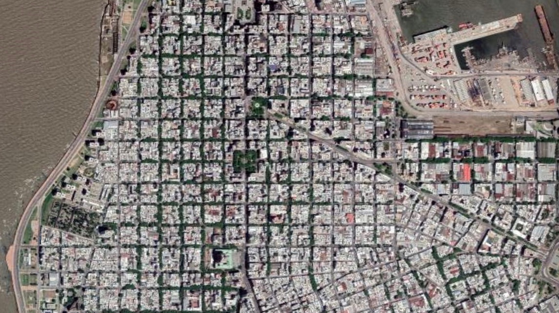
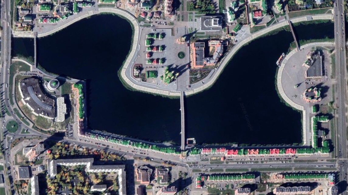
Connaught Place & central New Delhi, NCT, India 🇮🇳 28°37'10"N 77°12'37"E

1
5
49
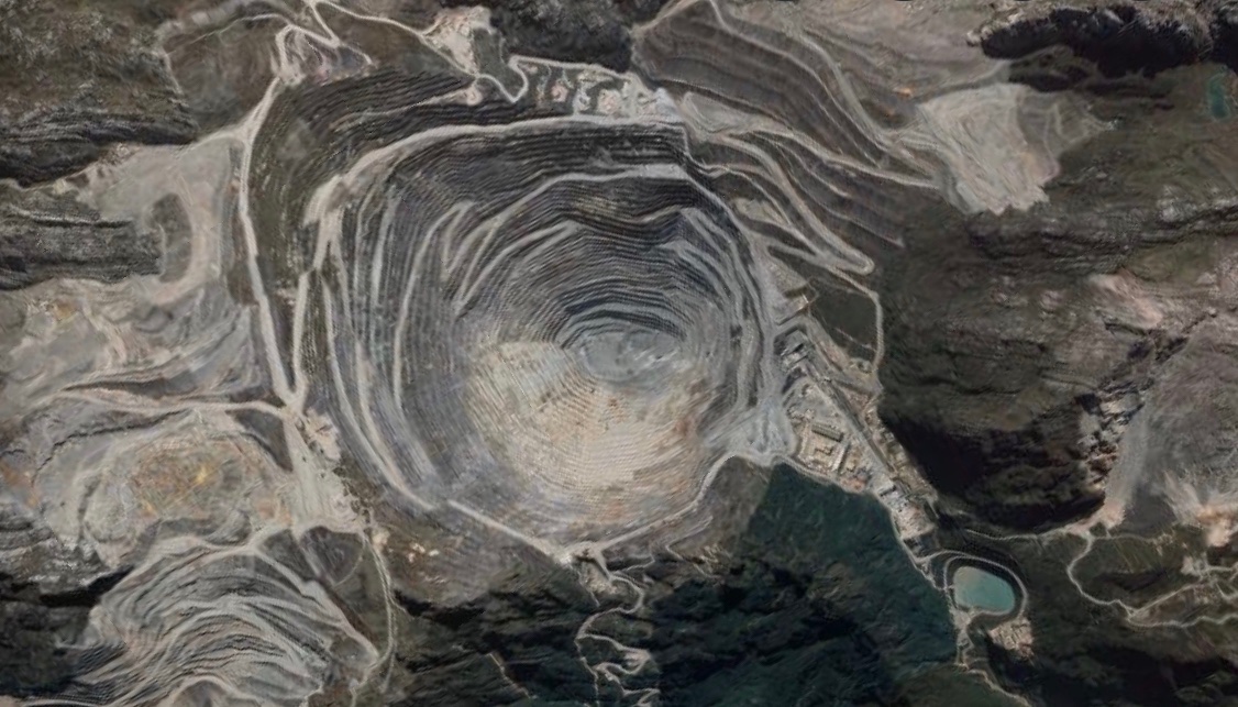
This mine. Right here.
Tenke Fungurume copper & cobalt mine, Lualaba, Democratic Republic of the Congo 🇨🇩 10°33'58"S 26°11'34"E Request by @ReubenLoffman

0
1
2
RT @GlobalLandUse: Kaloko’eli fishpond, Molokai, Hawaii, United States 🇺🇸 21°04'43"N 157°00'01"W

0
3
0

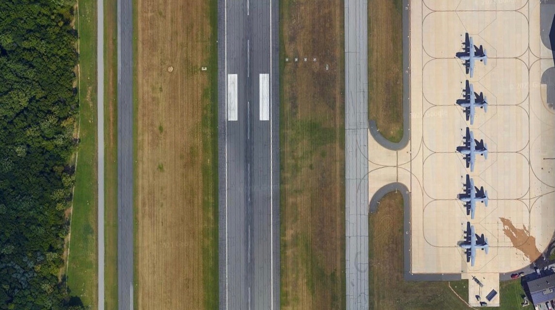
RT @GlobalLandUse: Delaware Air National Guard Base, New Castle, Delaware, United States 🇺🇸 39°41'06"N 75°36'07"W
0
1
0
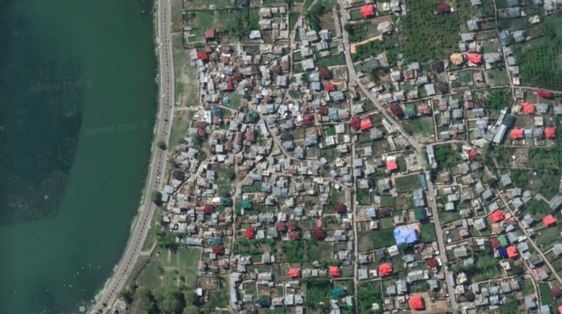
RT @GlobalLandUse: Dal Lake & Habak, Srinagar, Jammu & Kashmir, India 🇮🇳 34°08'37"N 74°50'23"E
0
2
0
RT @GlobalLandUse: Atlantic Ocean & Candeias, Jaboatão dos Guararapes, Pernambuco, Brazil 🇧🇷 8°11'53"S 34°55'03"W

0
2
0
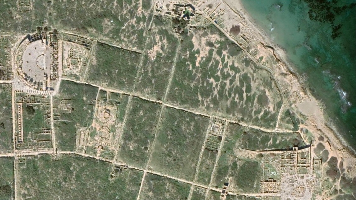
RT @GlobalLandUse: Leptis Magna archaeological site, Khoms, Murqub, Libya 🇱🇾 32°38'17"N 14°17'25"E
0
1
0
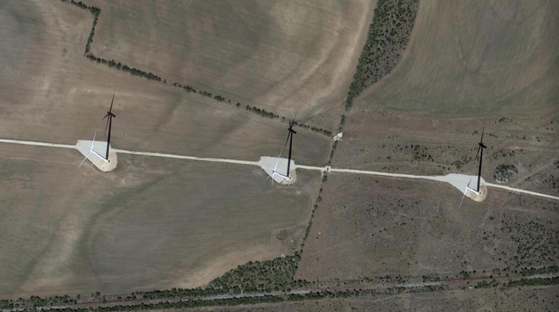
RT @GlobalLandUse: Roscoe wind farm, Maryneal, Nolan, Texas, United States 🇺🇸 32°13'15"N 100°28'43"W
0
3
0
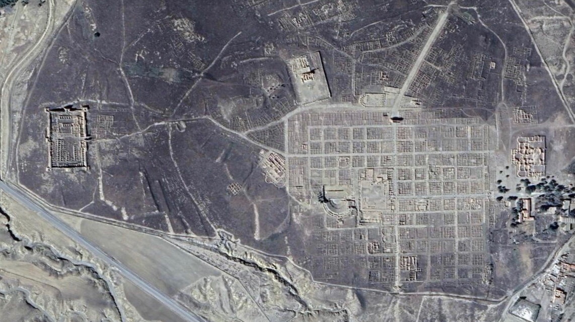
Colonia Marciana Ulpia Traiana Thamugadi or Roman Timgad, Batna, Algeria 🇩🇿 35°29'06"N 6°28'05"E
0
1
8
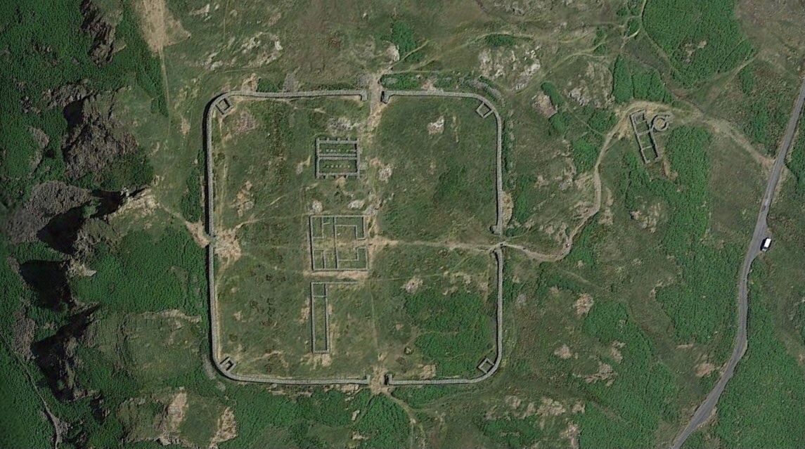
Mediobogdum or Hardknott Roman Fort, Holmrook, Cumbria, England 🏴, United Kingdom 🇬🇧
0
17
148
RT @GlobalLandUse: Poreporena Villages, Port Moresby, National Capital District, Papua New Guinea 🇵🇬 9°27'20"S 147°08'59"E
0
3
0