
Andrew Griffiths
@Central_IL_Wx
Followers
5K
Following
123K
Statuses
42K
ISU Meteorology '29 | Christian | Midwest Storm Chaser |@NWSLincolnIL Spotter| #ILwx| 🐻⬇️/ #Illini | Owner @IL_WX_Updates | Part of @Overcast_YT
Woodford County, IL
Joined September 2020
5
21
94

RT @NWSLincolnIL: We continue to monitor a system that is forecast to produce accumulating snow for much of central IL Wednesday. A narrow…
0
10
0
RT @NWSLincolnIL: A winter storm will take aim on the Midwest Wednesday. This brings the potential for impactful winter weather to central…
0
9
0
RT @StormAnalysis_: Experience the brand new storm visuals, enhanced accuracy in parameters, smoother risk areas, and much more! Play here:…
0
8
0
Both of these storms thankfully trended down last second. Current model guidance does suggest enough ice to cause travel problems tomorrow though. Heaviest rain will occur midday tomorrow with the chances at a rumble of thunder around and south of I-72. #ilwx


Becoming increasingly likely that two ice storms will affect parts of IL. The first one has a board zone with 40%+ probs of a 0.1", and the second one with 20-40% zone of 0.1". Placement will shift, but id pay attention with this one (tues evn-thurs morn, and fri evn-sun morn).


0
1
5
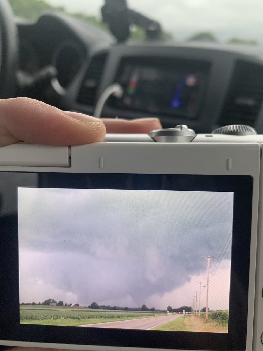
Two tornadic supercells ongoing One with a strong tornado near Bean Station, TN another southeast of Knoxville, TN. Another one gearing up to produce near Marbledale, TN


0
3
10
tds around ~15 kft


1
4
15

starting to really try and wrap up could be producing soon near Clarksville, TN


Watching this supercell developing in Northern TN. This storm will likely be more of a hailer at first, but could turn tornadic in a couple of hours once wind shear profiles become more clockwise and stronger. HRRR has this storm becoming much stronger and likely tornadic +3 hrs.


0
4
12
Main thing for this storm is if it stay AHEAD of the cold front. If not, then probably only a marginal wind/hail threat. If this storm does stay ahead of the front a couple tornadoes will be possible.
0
0
4
RT @joejacksonCBB: Below are Illinois transfers over the last 5 years This shows transfers 3P% before Illinois and while at Illinois. Only…
0
30
0