
🇧🇿 Belize GEO 🛰️
@BzGEO
Followers
10K
Following
128K
Statuses
75K
Belize GEO: Belize Group on #EarthObservation & GIS. #SciComm re: EO, GIS relevant to #Belize, the #Caribbean. Administered by a real live Belizean scientist.
Belize
Joined May 2016
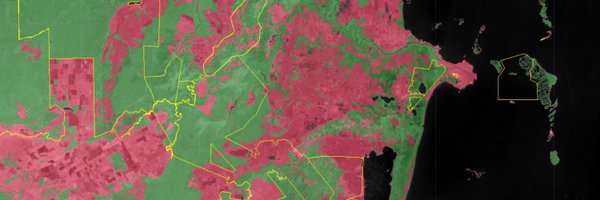
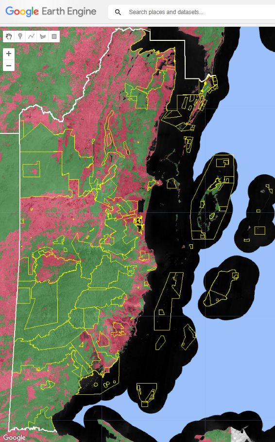
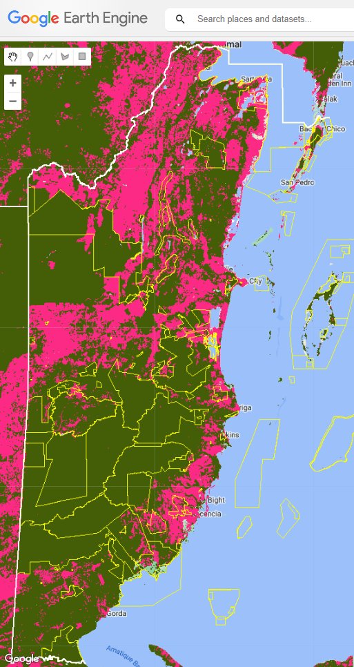
Can the @NICFISatData be used for wall-to-wall #LandCover mapping of tropical countries? 🤔We think so.😉 Here's a preliminary #EarthEngine #ML-based map of #Belize 🇧🇿's #forest cover using the recently released April 2024 @Planet mosaic data.
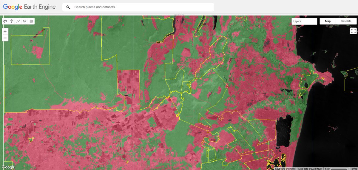
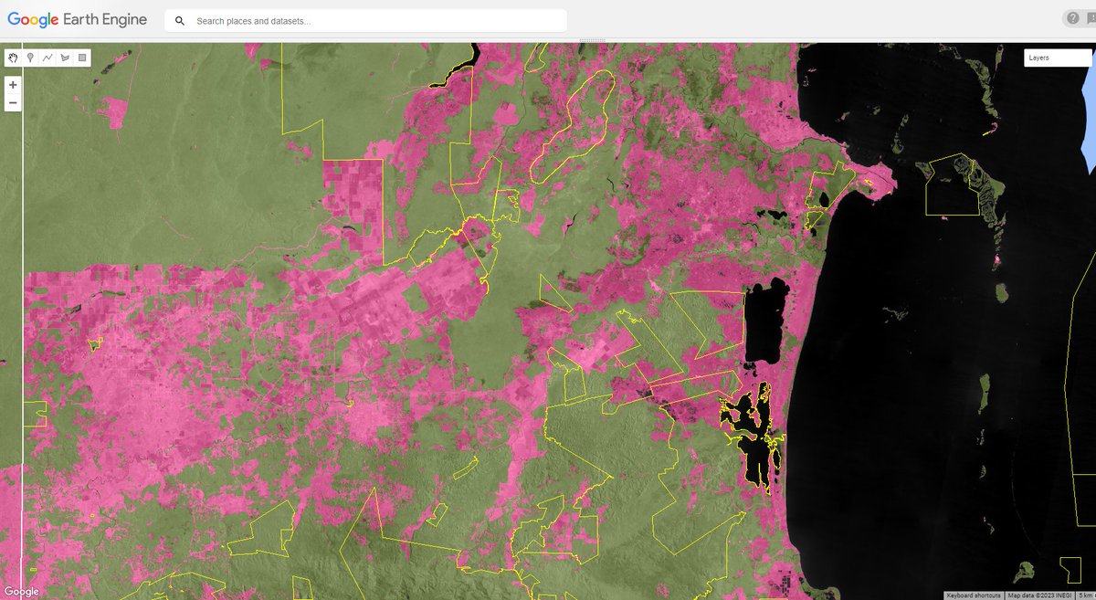
Asking again: Can @NICFISatData be used for wall-to-wall #forest cover mapping of tropical countries? 🤔YES! 😉 Here's preliminary #EarthEngine #ML-based mapping of #Belize 🇧🇿's forest cover using June 2023 @Planet mosaic data just released TODAY.

1
8
33
RT @WEkEO_dias: 🎉 The wait is over! WEkEO is proud to introduce its brand-new website, designed for experienced and new users alike. 🔎Tak…
0
7
0
RT @CopernicusLAC: 🚨¡Más de 200 personas ya se han inscrito en la 2a capacitación online de #CopernicusLAC! 🔒 Inscríbete a las sesiones so…
0
3
0
RT @GEOSEC2025: 🌍 Planet Earth is in peril. How should we respond? Today at @wef #WEF25, @YanaGevorgyan1 shared a powerful call to action…
0
7
0
RT @ALDroughtReach: #AL Drought Update‼️ North Central & South AL continue to see drought removal in many counties, but more rain is needed…
0
1
0
RT @jstnbraaten: Congratulations, Amirhossein! So well deserved – your #EarthEngine video tutorial series is a great resource for learning…
0
4
0
RT @USGSLandsat: The @USGS, in partnership with @NASA, is calling for applications from federal and international partners to serve on the…
0
22
0
RT @CEOSdotORG: In 2024, CEOS celebrated its 40th Anniversary. The Newsletter team at @JAXA_en summarised the achievements and highlights o…
0
2
0
RT @hannah_kerner: #ICML2025 includes a new track on Application-Driven Machine Learning (innovative ML techniques, problems, and datasets…
0
36
0
RT @HarvestProgram: The @GEOCropMonitor for Early Warning (CM4EW) has released its 100th report! For the past 9 years, @G20_GEOGLAM's Crop…
0
6
0
RT @AerosolWatch: VIIIRS aerosol optical depth (AOD) from @JPSSProgram NOAA-20 & NOAA-21 satellites observed thick wintertime haze & smoke…
0
4
0
RT @yangdi1031: Exciting NASA-funded postdoc opportunity at UF Geography! Join my research team investigating historical land use and fire…
0
22
0
RT @googleearth: Satellite imagery in Google Earth shows the Palisades, Eaton, and Sunset fires in Los Angeles. See traffic data, road clos…
0
30
0
RT @HarvestProgram: "NASA does a ton of space for ag tours, and the NASA leadership comes. They're trying to make sure that the farmers kno…
0
6
0
RT @lucychepkosgei: Pioneer Kenya 🇰🇪 Cartographers, Geospatials (photo) who pioneered most mapping activities & revolutionised the Cartogr…
0
7
0